Hurricane Debby North of Puerto Rico
02:32 PM EDT - 22 August 2000
11PM Update:
Debby continues its just slightly north of due west motion, and the longer this holds the worse this means for South Florida. The Gulf of Mexico track can't be ruled out yet either. More or less my previous thinking remains the same. The intensity of Debby when it approaches is conservatively estimated around a Category 3 storm -- * the potential is there for stronger *.
Tomorrow I would not be surprised to see the Florida Keys start to take some action (like suggesting tourists leave), not because they think it will go there, but rather because of the long time it would take to evacuate if it did.
Highest Risk Zone still lies between Miami and West Palm Beach, FL. Very subject to change, see you tomorrow.
PLEASE FOLLOW the advice from local authorities. Folks in Florida will have time to prepare between now and Friday. So have a plan ready if the storm decides to head your way. Use official sources and local media for more information.
9PM Update:
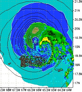
Debby has gone from a West NW motion to more of a general westward motion at this hour, which is plain to see on the Puerto Rico radar image. (Debby is beginning to move out of range of this radar) It's maintaining the 75MPH windspeed and probably will until tomorrow. The forward motion has slowed a bit to 18MPH.
Jim Williams over at Hurricane City is doing an audio broadcast now until 11PM tonight.
Original Update:
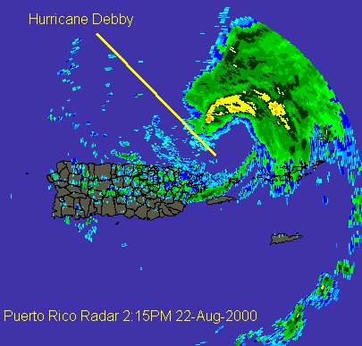
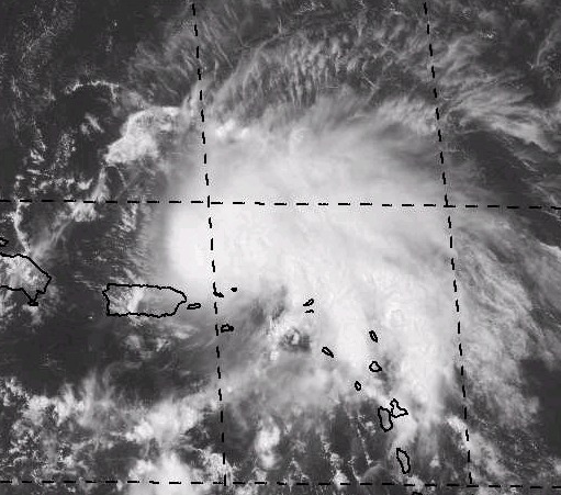
As these series of images show, Hurricane Debby is now skirting along the northern coast of Puerto Rico. Luckilly for them, most all of the convection is on the Northeast side. It is starting to wrap around, though, which would indicate it trying to become better organized.
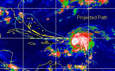
The future track is leaning away from the Gulf scenario (can't count it out yet, though) and more toward the South Florida northward scenario. Basically what was said earlier today on the page. We will continue to watch it.
There will be no organized chat event tonight, but we hope to do one tomorrow night. Jim Williams over at
Comments or Questions? Everyone is invited to use it. Use the comment button by the story Headline.