adam s
Verified CFHC User
Reged: Tue
Posts: 20
|
|
If Emily remains stationary for a 12 hour period the less confidence I have with the models of this storm. None of the models ever called for a stationary movement of Emily.
Edited by adam s (Tue Aug 02 2011 11:18 AM)
|
tpratch
Moderator

Reged: Fri
Posts: 339
Loc: Maryland
|
|
Models that don't have solid (recon dropsonde) data upon initialization generally do poorly with storm forecasting.
As the recons occur, and data becomes more frequent, the models generally do a much better job.
Give them time - it's not as simple as looking at satellite images and saying "oh yeah, it's going to do this".
|
weathernet
Storm Tracker
Reged: Sat
Posts: 296
Loc: Elsewhere
|
|
Contrary to what is indicating , satellite presentation of the IR JSL floater would make me think that I'm looking at a warm spot forming. It would not shock me, if we were to witness the mid level center to suddenly work itself to the surface, and show a 10-12 mb drop in pressure by this evening.
|
scottsvb
Weather Master
Reged: Mon
Posts: 1184
Loc: fl
|
|
Latest fix from 1 hour ago shows it went from 10 to 5 miles 1,500 ft center to surface center with 1 mile accuracy. Winds are near 45-50mph.. but pressure supports 35-40mph system.. I would then compromise on a 40-45mph storm with gust near 50.
Latest out to 48hrs has landfall near DR-Haiti boarder... it does another blow up of convection tonight and pressure down to 1005mb by Weds morning and maybe even lower by landfall later Weds night.(GFS maps usually do show a higher pressure then what a system really is)...
We will see what happens to the system tonight. I think what is more important though than the models is the near term pressure of the system. Lets see if it gets its act together and pressure drops.. once and if that does occur..we can determine what this might do and where it may go. Right now.. any decrease in convection could weaken this to a LLT with a midlevel dying circulation.
|
Ed Dunham
Former Meteorologist & CFHC Forum Moderator (Ed Passed Away on May 14, 2017)
Reged: Sun
Posts: 2565
Loc: Melbourne, FL
|
|
Note that the latest Recon at 1505Z had a position fix at 15.3N 64.0W. Emily is still moving slowly westward.
ED
|
LoisCane
Veteran Storm Chaser

Reged: Fri
Posts: 1236
Loc: South Florida
|
|
Thanks Ed... appreciate that statement on reality because local media is sending out texts to everyone in Miami that Emily has stalled.... giving people jitters 1,000 miles away.
Just have to wait it out...
--------------------
http://hurricaneharbor.blogspot.com/
|
scottsvb
Weather Master
Reged: Mon
Posts: 1184
Loc: fl
|
|
Not making a forecast here.. just a statement.. but if this gets past 72deg W when making landfall.. it could be a determining factor of how much it holds together. I feel it if makes landfall around 70-71W (aka 12z run) it will go over the highest mountains of Hispaniola and weaken the system more to then push more Westerly over more landmass compared to it holding together more as the indicates. Further west like past 72W will interact with less land and be just NE of CUBA Thurs evening and making its way WNW more so.
|
LoisCane
Veteran Storm Chaser
Reged: Fri
Posts: 1236
Loc: South Florida
|
|
a lot of factors.... for one.... if it gets further west and stays south of the track or even within the southwestern most edge of the cone the water temps could influence emily and she could strengthen deeper than she is
she currently has a green dot directly in the middle of what looks like her center moving west
with or w/o a pressure drop she is impressive for now
--------------------
http://hurricaneharbor.blogspot.com/
|
WeatherNut
Weather Master
Reged: Wed
Posts: 412
Loc: Atlanta, GA
|
|
Another Recon has left St Croix, and this one is reporting pressure data on the route which will be helpful
--------------------
Born into Cleo (64)...been stuck on em ever since
|
Joeyfl
Weather Guru
Reged: Mon
Posts: 133
Loc: St.Pete,FL
|
|
I think its little to soon to say this is going to fish north away from land. This storm really needs to be watched. I think we will have a better idea 24-48hrs where this will go. Unless this thing really ramps up and gains some latitude in next 24 hrs I really don't think its going as quickly pole ward as some models suggest. I also find it a little hard to believe that the lowest pressure is 1007mb. Buoy 42059 a good 150-200 miles west and is reporting 1008mb and falling. I feel we will see pressure drop on next recon and up tick in winds too.
|
JoshuaK
Weather Guru
Reged: Mon
Posts: 159
Loc: Lakeland, FL
|
|
Latest Satellite shows convection and outflow expanding overall, but with some dry air entrainment still going on in the SW quadrant I'd say, although WV Loops show the dry air being pushed back over P-Rico and Haiti.
EDIT: 2 AM Advisory has winds up to 45 MPH, Pressure down to 1006 MB, and a westward motion at 12 mph.
Edited by JoshuaK (Tue Aug 02 2011 02:10 PM)
|
danielw
Moderator

Reged: Wed
Posts: 3525
Loc: Hattiesburg,MS (31.3N 89.3W)
|
|
Product: Air Force Vortex Message (URNT12 KNHC)
Transmitted: 2nd day of the month at 18:13Z
Aircraft: Air Force Aircraft (Last 3 digits of the tail number are 309)
Storm Number & Year: 05L in 2011
Storm Name: Emily (flight in the North Atlantic basin)
Mission Number: 6
Observation Number: 02
A. Time of Center Fix: 2nd day of the month at 17:48:50Z
B. Center Fix Coordinates: 15°38'N 64°47'W (15.6333N 64.7833W)
B. Center Fix Location: 210 miles (338 km) to the SSE (156°) from San Juan, Puerto Rico (USA).
C. Minimum Height at Standard Level: Not Available
D. Estimated (by SFMR or visually) Maximum Surface Wind: 49kts (~ 56.4mph)
E. Location of the Estimated Maximum Surface Wind: 42 nautical miles (48 statute miles) to the NE (52°) of center fix
F. Maximum Flight Level Wind Inbound: From 113° at 51kts (From the ESE at ~ 58.7mph)
G. Location of Maximum Flight Level Wind Inbound: 41 nautical miles (47 statute miles) to the NE (52°) of center fix
H. Minimum Sea Level Pressure: 1006mb (29.71 inHg) - Extrapolated
I. Maximum Flight Level Temp & Pressure Altitude Outside Eye: 24°C (75°F) at a pressure alt. of 305m (1,001ft)
J. Maximum Flight Level Temp & Pressure Altitude Inside Eye: 23°C (73°F) at a pressure alt. of 307m (1,007ft)
K. Dewpoint Temp (collected at same location as temp inside eye): 18°C (64°F)
K. Sea Surface Temp (collected at same location as temp inside eye): Not Available
L. Eye Character: Not Available
M. Eye Shape: Not Available
N. Fix Determined By: Penetration, Wind, Pressure and Temperature
N. Fix Levels (sfc and flt lvl centers are within 5nm of each other): Surface and 1,500 feet
O. Navigation Fix Accuracy: 0.02 nautical miles
O. Meteorological Accuracy: 2 nautical miles
Remarks Section:
Maximum Flight Level Wind: 51kts (~ 58.7mph) in the northeast quadrant at 17:35:10Z
Sea Level Pressure Extrapolation From: Below 1,500 feet
Notes:
The Inside Eye/ Center Temp and the Outside Eye/Center Temps are opposite what they should be. Inside Eye/ Center Temp should be equal to or Higher than the outside Eye/ Center Temp. This gives some indication that the system isn't fully functioning as a vacuum.
The dry air entrainment on the SW side could be causing this.
Centers are within 5 miles of each other now.
Observation is from 1000 feet above sea level so the Maximum Flight Level Wind: 51kts (~ 58.7mph) should equate to a surface wind speed of 53 to 54 mph. Using a 90% reduction factor. After checking. The 54 mph is what the SFMR surface wind speed estimate is at the 58.7 mph spot wind location.
Edited by danielw (Tue Aug 02 2011 02:33 PM)
|
WeatherNut
Weather Master
Reged: Wed
Posts: 412
Loc: Atlanta, GA
|
|
I noticed that about the temps as well in/out, but the other thing that is strange is that the pressure barely rose 1mb as the plane flew SW. It has now turned due E and the pressure is starting to go down well south of where the last vortex was located. I think we might have the center trying to relocate to where the first plane today found a center south of the others
--------------------
Born into Cleo (64)...been stuck on em ever since
|
adam s
Verified CFHC User
Reged: Tue
Posts: 20
|
|
Emily is now getting organized and winds are at 45 mph with a west movement of 12mph. How strong do you think Emily will get before getting near the island of Hispaniola?
|
danielw
Moderator
Reged: Wed
Posts: 3525
Loc: Hattiesburg,MS (31.3N 89.3W)
|
|
I'm seeing fairly rapid pressure falls at the buoys over the last 3 hours. I almost looks like someone threw a switch and turned on a vacuum.
I'm still not sure the storm will pass over Hispaniola. Possibly the western tip of Haiti and Eastern Cuba. Winds, based on the latest SHIPS model. Should be in the 55 mph range. But homes in Haiti aren't necessarily built for those winds. And quite a large number of people are still without decent shelter since the Earthquake.
Latest SHIPS model indicates the shear and most of the other inhibiting factors should decrease or drop in 6 hours. I believe this will coincide with Dmin, or the diurnal minimum in a storm cycle. Weaker or fewer thunderstorms.
We will have to wait and see what happens then.
See Clark's answer to the definaition of D max and D min.
http://flhurricane.com/cyclone/showflat.php?Cat=0&Number=25541&an=0&page=1#25541
If you live on the Florida Peninsula you may want to go over your Hurricane Plan. And check the fuel, water and grocery supplies. Just in case.
Edited by danielw (Tue Aug 02 2011 03:13 PM)
|
JMII
Weather Master

Reged: Thu
Posts: 489
Loc: Margate, Florida
|
|
While still weak the outflow is impressive for a storm that has yet to find a true center to wrap around. She's got a small window to gain some strength before running into plenty of obstacles in the form of dry air, plus mountains. Looks 50/50 to me... I still think she has much chance as falling completely apart as she does spinning up into a stronger TS. The factors for intensification are there, just too sloppy near the core to make it happen right now.
--------------------
South FL Native... experienced many tropical systems, put up the panels for:
David 79 - Floyd 87 - Andrew 92 - Georges 98 - Frances 04 - Wilma 05 - Matthew 16 - Irma 17
Lost our St James City rental property to Ian 22
|
danielw
Moderator
Reged: Wed
Posts: 3525
Loc: Hattiesburg,MS (31.3N 89.3W)
|
|
5:00 PM AST Tue Aug 2
Location: 15.8°N 65.4°W
Max sustained: 50 mph
Moving: WNW at 12 mph
Min pressure: 1005 mb
BULLETIN
TROPICAL STORM EMILY ADVISORY NUMBER 5
NWS National Hurricane Center MIAMI FL AL052011
500 PM AST TUE AUG 02 2011
...EMILY A LITTLE STRONGER...BUT STILL NOT WELL ORGANIZED...
SUMMARY OF 500 PM AST...2100 UTC...INFORMATION
----------------------------------------------
LOCATION...15.8N 65.4W
ABOUT 185 MI...300 KM SSE OF SAN JUAN PUERTO RICO
MAXIMUM SUSTAINED WINDS...50 MPH...85 KM/H
PRESENT MOVEMENT...WNW OR 295 DEGREES AT 12 MPH...19 KM/H
MINIMUM CENTRAL PRESSURE...1005 MB...29.68 INCHES
WATCHES AND WARNINGS
--------------------
CHANGES WITH THIS ADVISORY...
THE GOVERNMENT OF THE BAHAMAS HAS ISSUED A TROPICAL STORM WATCH FOR
THE SOUTHEAST BAHAMAS AND FOR THE TURKS AND CAICOS ISLANDS.
SUMMARY OF WATCHES AND WARNINGS IN EFFECT...
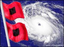
A TROPICAL STORM WARNING IS IN EFFECT FOR...
* PUERTO RICO...VIEQUES AND CULEBRA
* THE DOMINICAN REPUBLIC
* HAITI
A TROPICAL STORM WATCH IS IN EFFECT FOR...
* U.S. VIRGIN ISLANDS
* SOUTHEAST BAHAMAS AND TURKS AND CAICOS ISLANDS
|
Joeyfl
Weather Guru
Reged: Mon
Posts: 133
Loc: St.Pete,FL
|
|
I cant stress enough that southeast coast/FL needs to watch this closely. Interesting models coming in much closer to FL this evening. Of coarse this is one of many runs and models will continue to flip flop but a lot of obstacles in the way of this one. I would expect maybe a slight shift west in track at 11 just to be closer to consensus.
|
Lamar-Plant City
Storm Tracker

Reged: Mon
Posts: 383
Loc: Plant City, Florida
|
|
Was looking at the model loop from the past day or so. It nicely shows the models flipping back and forth a bit from east to west. If I have the general idea correct, a stronger Emily is more likely to recurve up the east coast and miss everything but the Bahamas, while a weaker storm may hedge more to the west, keeping Florida in the game. So if Hispanola weakens her, does the track shift back west and why don't the models predict this? Or do I have it all wrong? 
--------------------
If you don't like the weather, wait 5 minutes...
2023 Season Prediction: 17/6/2
|
MikeC
Admin
Reged: Sun
Posts: 4543
Loc: Orlando, FL
|
|
The official forecast didn't change much at 11, just extended out further another point, but following the curve, it's going to be close, but odds still favor the east of US landfall side, but it will be dangerously close and must be watched closely. It may be close enough for Tropical Storm watches to be put up in part of East Central, or South Florida Late Thursday or Friday. Luckily the western side of the storm in a northward traveling system is usually the weaker side.
This advisory now places Georgia, North and South Carolina, and Southeast Virginia inside the cone of uncertainty. Anyone in the cone should be keeping up with developments on Emily.
However, for those in the Bahamas, as there are now Tropical Storm Warnings up for the Southeast Bahamas, and Turks and Caicos Islands.
New Full Update tomorrow morning.
|
 Threaded

 [Re:
[Re: 


