Archives 2010s >> 2019 News Talkbacks

Jump to first unread post. Pages: 1 | 2 | >> (show all)
MikeCAdministrator
Admin


Reged: Sun
Posts: 4543
Loc: Orlando, FL
Category 5 Hurricane Dorian Grand Bahama Island
      #100406 - Sun Sep 01 2019 09:46 AM

11:00 AM EDT Update 2 September 2019

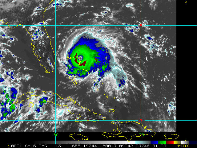
Hurricane Dorian is still sitting over Grand Bahamas island barely moving, and an eyewall replacement and land interaction has reduced it to 155mph winds (High end Cat 4). It's expected to remain a Major hurricane through Wednesday and the tropical storm force wind field likely will expand as it does.

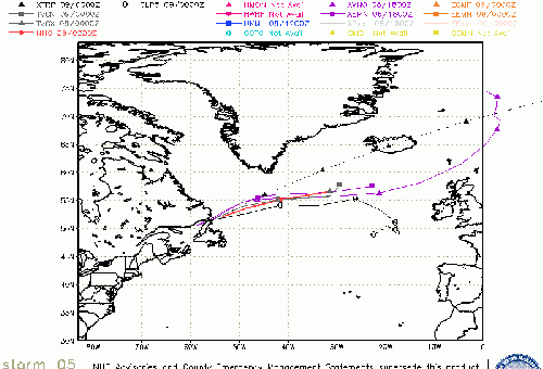
The track has shifted slightly west closer to Florida, but landfall is not expected in Florida, however any slight deviation to the left when motion begins could bring stronger winds onshore. As it stands now based on the official tack, hurricane force winds will be felt along parts of the coast of Florida, even if landfall does not happen. Tropical Storm force winds could reach well inland. Note, most impacts would not be felt in central Florida until TOMORROW night. Although bands will gradually move onshore through today and tomorrow, from the south and spreading north.

The Hurricane Warning along the east coast of Florida has been extended northward to the Flagler/Volusia County Line.

The Hurricane Watch has been extended northward to Altamaha Sound Georgia.

7:00 AM Update 2 September 2019

Hurricane Dorian has begun the stall forecast by the hurricane center today, and the eye is currently over the eastern part of Grand Bahamas island, where it, unfortunately, will probably remain for a good part of today. It is still category 5 hurricane, but weakening slightly due to an eyewall replacement cycle going on right now, as well as some land interaction with the island.

The forecast track takes it east of Florida, but close enough to bring hurricane conditions some some ares and is indicated by the watches and warnings, the wind field may expand so Tropical Storm force winds could expand west though much of the center of the state. Any significant motion isn't expected until late tonight, so today will be a waiting game. Storm Surge and erosion will likely be a large problem for the east coast of Florida in the warning area, and up into the Carolinas later. Rainfall will likely be great in many places as well, particularly closer to the coast.

Some of the outer rain bands will start moving over parts of Florida today.

Based on the forecast southern areas in the watch/warning area will begin to see the most around tomorrow afternoon, gradually spreading northward into Wednesday morning with forward speed increasing to the north. and by Thursday Georgia and parts of South Carolina, by Friday morning speed should have picked up greatly as it moves near/over North Carolina.

Nearly every model keeps Dorian offshore, but very close to Florida, however even a slight shift west could bring it closer, or even over Florida. So today will be a waiting game for Florida, but a devastating day in the northwest Bahamas. Abaco island was hit very hard yesterday, and the storm is still close enough to prevent any mover relief efforts today, as it's still probably experiencing hurricane/tropical storm force winds in parts of Abaco.

5:00 PM Update 1 September 2019

Dorian is moving generally west at 5MPH, heading toward Grand Bahama island.

A Storm Surge Warning has been issued from Lantana to the Volusia/Brevard County Line.

A Storm Surge Watch has been issued from the Volusia/Brevard County Line to the Flagler/Volusia County Line.

A Hurricane Watch has been issued from the Volusia/Brevard County Line to the Flagler/Volusia County Line

A Hurricane Warning has been issued from Jupiter Inlet to the Volusia/Brevard County Line.

4-7 feet Surge in some areas in the storm surge warning area..

12:50 PM Update 1 September 2019
Maximum sustained Winds increased to 185MPH, 911mb pressure with a special advisory. Still moving W at 8mph.

Hazards include
- Wind Gusts over 220 mph
- Storm Surge 18 to 23 feet above normal tide levels with higher
destructive waves

11:15 AM Update 1 September 2019
Hurricane Dorian up to 180mph winds.

Track shifts slightly west, enough to require Hurricane Watches up for the east coast from Deerfield to Volusia/Brevard county line. A Storm Surge Watch has also been issued from north of Deerfield
Beach to the Volusia/Brevard County Line.

A Tropical Storm Watch has been issued for Lake Okeechobee.

Surge projections currently have 1-2 feet by West Palm up to 4-7 ft in Brevard county.

Original Update
Data from an Air Force Reserve Hurricane Hunter aircraft indicate that Dorian has continued to intensify, and now has maximum sustained winds near 175 mph (280 km/h), with a minimum central pressure of 922 mb (27.23 inches).

The eyewall of catastrophic Hurricane Dorian is currently reaching Abaco Island in the Bahamas. This is a life-threatening situation. Residents there should take immediate shelter. Do not venture into the eye if it passes over your location.

Hazards:
- Wind Gusts over 200 mph
- Storm Surge 15 to 20 feet above normal tide levels with higher
destructive waves

These hazards will cause extreme destruction in the affected areas. and will continue for several hours.


Watches and Warnings for Florida will likely be extended at 11AM. The system is expected to turn north after a large slowdown before Florida, but it will likely still be close enough for some impacts along the Florida east coast.


> Bahamas Media

Bahamas Radar

Television & Radio:

ZNS Bahamas, Radio & TV

More 94 FM Bahamas

Newspapers:

Bahamas Tribune

Nassau Guardian

Bahamas B2B

The Abaconian - Abaco Island News

Freeport News

http://www.FloridaDisaster.org - Florida Emergency Management Page


Dorian Event Related Links


float5latest.gif stormplotthumb_5.gif

SFWMD Model Plot (Animated Model Plot) SFWMD Hurricane Page


[https://flhurricane.com/floatanimator.php?year=2019&storm=5 Flhurricane Satellite Floater Animation of Dorian
GOES Floater
Animated Skeetobite Model Plot of Dorian


Clark Evans Track Model Plot of Dorian (Animated!) Model Plots in Google Earth - In Google Maps
Clark Evans Intensity Model Plot of Dorian (Animated!)

Clark Evans Track Plot of Dorian

Other Model Charts from Clark

Clark Evans Top 10 Analog Storms for Dorian
More model runs on from RAL/Jonathan Vigh's page
NRL Info on Dorian -- RAMMB Info
COD Atlantic Satellite View


Bahamas Radar

East Florida Links Southeast Composite Radar Loop (Latest Static) South to North:

Key West, FL Radar Radar Loop (Latest Static)

Miami, FL Radar Radar Loop (Latest Static)

Melbourne, FL Radar Radar Loop (Latest Static)

Jacksonville, FL Radar Radar Loop (Latest Static)


Caribbean/South East Coast Satellite Imagery


SFWMD Radar Loop of South Florida with storm Track


SFWMD Full Florida Radar Loop with Storm Track


Area Forecast Discussions: FLorida Keys - Miami/South Florida - Melbourne/East Central Florida - Jacksonville/Northeast Florida -

News Media (East Central Florida):

Television:

Newspapers:

News Radio:

Check local media and officials when a storm is approaching your area.

News Media (South Florida):

Television:

Newspapers:

News Radio:

Check local media and officials when a storm is approaching your area.

Caribbean Radar Recording

Invest 98L Lounge W Gulf Trof Lounge

Coastal South Carolina Media:

Myrtle Beach Sun News

Charleston Post and Courier

94.3 WSC Charleston News Radio


Power Outage Map: South Carolina Power Outage Map

Jacksonville, FL Area Media:

MikeCAdministrator
Admin


Reged: Sun
Posts: 4543
Loc: Orlando, FL
Re: Category 5 Hurricane Dorian Approaches Abaco Island [Re: MikeC]
      #100409 - Sun Sep 01 2019 10:24 AM

Soical media

snapchat map: https://map.snapchat.com/@26.526420,-77.103157,12.39z


Post Extras: Print Post   Remind Me!   Notify Moderator  
MikeCAdministrator
Admin


Reged: Sun
Posts: 4543
Loc: Orlando, FL
Re: Category 5 Hurricane Dorian Approaches Abaco Island [Re: MikeC]
      #100410 - Sun Sep 01 2019 10:34 AM

Adding recordings for two flavors of Florida Radar

http://flhurricane.com/imageanimator.php?467

and http://flhurricane.com/imageanimator.php?466

Bahamas cams are all down already. 9:26am was the last image out of Abaco.


Post Extras: Print Post   Remind Me!   Notify Moderator  
MikeCAdministrator
Admin


Reged: Sun
Posts: 4543
Loc: Orlando, FL
Re: Category 5 Hurricane Dorian Approaches Abaco Island [Re: MikeC]
      #100418 - Sun Sep 01 2019 11:10 AM

Since 1950, only 3 Atlantic #hurricanes have had max winds stronger than #HurricaneDorian's current max winds of 180 mph:

Allen (1980): Max winds of 190 mph
Gilbert (1988): Max winds of 185 mph
Wilma (2005): Max winds of 185 mph

- Phil K.


Post Extras: Print Post   Remind Me!   Notify Moderator  
cieldumortModerator
Moderator


Reged: Mon
Posts: 2305
Loc: Austin, Tx
Re: Category 5 Hurricane Dorian Approaches Abaco Island [Re: MikeC]
      #100427 - Sun Sep 01 2019 12:03 PM

How Dorian's 913mb (and still falling) compared to the lowest pressures of all TCs in modern Atlantic tropical history (from 1851-2018).
(Credit: Ian Livingston)


--------------------
Fully vaccinated as of May 2021
(Moderna x2)


Post Extras: Print Post   Remind Me!   Notify Moderator  
MikeCAdministrator
Admin


Reged: Sun
Posts: 4543
Loc: Orlando, FL
Re: Category 5 Hurricane Dorian Approaches Abaco Island [Re: MikeC]
      #100428 - Sun Sep 01 2019 12:47 PM

Storm surge map now up https://www.nhc.noaa.gov/refresh/graphics_at5+shtml/155815.shtml?inundation#contents

Post Extras: Print Post   Remind Me!   Notify Moderator  
JMII
Weather Master


Reged: Thu
Posts: 489
Loc: Margate, Florida
Re: Category 5 Hurricane Dorian Approaches Abaco Island [Re: MikeC]
      #100429 - Sun Sep 01 2019 12:49 PM

Dorian has made landfall at 1240 pm
EDT (1640 UTC) in Elbow Cay, Abacos. The winds have increased
to 185 mph (295 km/h) with the minimum central pressure falling to
911 mb (26.90 inches).

--------------------
South FL Native... experienced many tropical systems, put up the panels for:
David 79 - Floyd 87 - Andrew 92 - Georges 98 - Frances 04 - Wilma 05 - Matthew 16 - Irma 17
Lost our St James City rental property to Ian 22


Post Extras: Print Post   Remind Me!   Notify Moderator  
Psyber
Storm Tracker


Reged: Fri
Posts: 231
Loc: Ontario, Canada
Re: Category 5 Hurricane Dorian Approaches Abaco Island [Re: MikeC]
      #100454 - Sun Sep 01 2019 04:28 PM

Quote:

Storm surge map now up https://www.nhc.noaa.gov/refresh/graphics_at5+shtml/155815.shtml?inundation#contents


Mike, what are your thoughts on extending the Saffir Simpson scale to H6 and H7 given this storm? Surely 185 sustained needs to be more than an H5. People listen to the size of the storm and not the speeds and H5 is a full 30 MPH slower than the current speed of Dorian. It's like the largest EF4 tornado ever measured.

--------------------
The safest way to deal with a potential Hurricane hitting you...is to leave and just not be there at all.


Post Extras: Print Post   Remind Me!   Notify Moderator  
MikeCAdministrator
Admin


Reged: Sun
Posts: 4543
Loc: Orlando, FL
Re: Category 5 Hurricane Dorian Approaches Abaco Island [Re: Psyber]
      #100469 - Sun Sep 01 2019 07:26 PM

I think extending the Scale is pointless and just confuses folks.

Post Extras: Print Post   Remind Me!   Notify Moderator  
MikeCAdministrator
Admin


Reged: Sun
Posts: 4543
Loc: Orlando, FL
Re: Category 5 Hurricane Dorian Approaches Abaco Island [Re: MikeC]
      #100476 - Sun Sep 01 2019 08:52 PM

A few scattered reports coming out from Abaco (mianly before the other eyewall hit)

http://bahamaspress.com/2019/09/01/fear-...ur-under-water/


Post Extras: Print Post   Remind Me!   Notify Moderator  
LadyStorm
Weather Guru


Reged: Thu
Posts: 154
Loc: United States
Re: Category 5 Hurricane Dorian Approaches Abaco Island [Re: Psyber]
      #100482 - Sun Sep 01 2019 09:43 PM

Mike, what are your thoughts on extending the Saffir Simpson scale to H6 and H7 given this storm? Surely 185 sustained needs to be more than an H5. People listen to the size of the storm and not the speeds and H5 is a full 30 MPH slower than the current speed of Dorian. It's like the largest EF4 tornado ever measured.

I think it's a good idea. When the original scale was thought of, we did not yet recognize global warming. As our planet's weather patterns change it would be a good idea to update this scale. Stronger winds need to be measured beyond the scale we currently have. We need to accommodate for a changing future. Sorry if this is off topic. Just adding my two cents.

Here is a story that supports my view good read https://www.popsci.com/category-6-hurricane/
Let's stay on topic (on Dorian, right here, right now) and less on climate change or other secondary or tertiary discussion/theories. Feel free to open up a new topic "Climate change and Dorian?" or something like that in ASK/TELL. Thanks! - Ciel

Edited by cieldumort (Sun Sep 01 2019 11:18 PM)


Post Extras: Print Post   Remind Me!   Notify Moderator  
Psyber
Storm Tracker


Reged: Fri
Posts: 231
Loc: Ontario, Canada
Re: Category 5 Hurricane Dorian Approaches Abaco Island [Re: MikeC]
      #100484 - Sun Sep 01 2019 10:00 PM

Quote:

A few scattered reports coming out from Abaco (mianly before the other eyewall hit)

http://bahamaspress.com/2019/09/01/fear-...ur-under-water/


OMG you read some of the points on that page, Mike? They sound umm not to be political but they sound HIGHLY political in nature and suggest some straight on conspiracies. I'm not complaining because it shows some of the devastation however holy cow. :/

As for changing the Scale, the weather is going to be getting more intense and it seems like people don't respect H5s like they used to. Their homes don't all fly away in a normal H5 so whiy leave? We're talking thirty extra miles here though. The scale roughly goes up by 15's and 20's and then ends when Simpson roughly figures that should be about enough however we're looking at a storm that's now 30 higher than an H5. What if it goes 40? 50? It seems irresponsible to stop because people listen to the grade, not the wind speeds. Even local governments will only make people build homes certified to H5/157MPH which if you hear it, they BARELY make 157MPH. If you asked someone what an H1 speed was, they wouldn't even have an idea on it let alone the rest.

Let's stay on topic (on Dorian, right here, right now) and less on secondary or tertiary discussion/theories. Feel free to open up a new topic "Time for Cat 6?" or something like that in ASK/TELL. Thanks! - Ciel

Edited by cieldumort (Sun Sep 01 2019 11:22 PM)


Post Extras: Print Post   Remind Me!   Notify Moderator  
gvl, fl
Verified CFHC User


Reged: Thu
Posts: 12
Loc: Gainesville, FL
Re: Category 5 Hurricane Dorian Approaches Abaco Island [Re: Psyber]
      #100486 - Sun Sep 01 2019 10:21 PM

The Florida Keys storm of 1935 was also 185 mph. Hurricane Allen (1980) was 190 mph. It's just another strong storm. It's not evidence of anything, except perhaps under some pseudo-science.

I don't think anyone says "Oh, it's only a Category 5, honey. No worries!"


Post Extras: Print Post   Remind Me!   Notify Moderator  
MikeCAdministrator
Admin


Reged: Sun
Posts: 4543
Loc: Orlando, FL
Re: Category 5 Hurricane Dorian Grand Bahama Island [Re: MikeC]
      #100487 - Sun Sep 01 2019 10:35 PM

Port Nassau webcam: https://www.youtube.com/watch?v=rk_GoTxJf-g

It's south of Dorian by a fair amount, but will probably stay up.


Post Extras: Print Post   Remind Me!   Notify Moderator  
Psyber
Storm Tracker


Reged: Fri
Posts: 231
Loc: Ontario, Canada
Re: Category 5 Hurricane Dorian Grand Bahama Island [Re: MikeC]
      #100490 - Sun Sep 01 2019 10:55 PM

Quote:

Port Nassau webcam: https://www.youtube.com/watch?v=rk_GoTxJf-g

It's south of Dorian by a fair amount, but will probably stay up.


The camera is, of course, showing a ton of lightning. I saw a met blog...of course I lost the link because with social media, everybody is tweeting but he remarked that the amount of lightning on the leading edge of the eyewall is extreme to what is normal. Is this from the storm being so compact/its weather being compact or another reason?

--------------------
The safest way to deal with a potential Hurricane hitting you...is to leave and just not be there at all.


Post Extras: Print Post   Remind Me!   Notify Moderator  
cieldumortModerator
Moderator


Reged: Mon
Posts: 2305
Loc: Austin, Tx
Re: Category 5 Hurricane Dorian Grand Bahama Island [Re: Psyber]
      #100491 - Sun Sep 01 2019 11:08 PM

Quote:

Port Nassau webcam: https://www.youtube.com/watch?v=rk_GoTxJf-g

It's south of Dorian by a fair amount, but will probably stay up.
Quote:


The camera is, of course, showing a ton of lightning. I saw a met blog...of course I lost the link because with social media, everybody is tweeting but he remarked that the amount of lightning on the leading edge of the eyewall is extreme to what is normal. Is this from the storm being so compact/its weather being compact or another reason?


Port Nassau is in the outer bands, not the eywall. Lightning (and sometimes tornadoes) is fairly common in the outer bands of tropical cyclones.

What is remarkable about Dorian, is the intense, persistent lightning today into tonight in the entire eyewall.

Hurricane lightning science is still in its infancy, and much work is being done to understand it better. It does tell a story, and can be very useful, where understood. Often, lightning in the eyewall at the expense of lightning in the outer bands can be an indication of strengthening - often from tropical storm into a hurricane - but we are not seeing that here. Here, we have blasts of lightning in both the outer banding and the eyewall. Truly impressive.

Edit to add that it does appear that it could be an indication of an ERC underway. Studies have shown this. In watching TWC right now, Dr. Knabb stated that he believes this could be the case here, as well.

--------------------
Fully vaccinated as of May 2021
(Moderna x2)

Edited by cieldumort (Sun Sep 01 2019 11:36 PM)


Post Extras: Print Post   Remind Me!   Notify Moderator  
Psyber
Storm Tracker


Reged: Fri
Posts: 231
Loc: Ontario, Canada
Re: Category 5 Hurricane Dorian Grand Bahama Island [Re: cieldumort]
      #100492 - Sun Sep 01 2019 11:23 PM

Quote:


Hurricane lightning science is still in its infancy, and much work is being done to understand it better. It does tell a story, and can be very useful, where understood. Often, lightning in the eyewall at the expense of lightning in the outer bands can be an indication of strengthening - often from a tropical storm into a hurricane - but we are not seeing that here. Here, we have blasts of lightning in both the outer banding and the eyewall. Truly impressive.


He said lightning was being generated and unleashing uncharacteristically so quickly on the outside of the N/W edge of the eyewall that they couldn't even begin to measure it, even when it moved into doppler range as in over a hundred strikes per hour. The amount of power being expended just in lightning is almost astonishing.

--------------------
The safest way to deal with a potential Hurricane hitting you...is to leave and just not be there at all.


Post Extras: Print Post   Remind Me!   Notify Moderator  
MikeCAdministrator
Admin


Reged: Sun
Posts: 4543
Loc: Orlando, FL
Re: Category 5 Hurricane Dorian Grand Bahama Island [Re: cieldumort]
      #100498 - Sun Sep 01 2019 11:50 PM

Last recon pass shows 912mb, maybe a new vortex will clear it up, but otherwise it's deepening again.

Post Extras: Print Post   Remind Me!   Notify Moderator  
Psyber
Storm Tracker


Reged: Fri
Posts: 231
Loc: Ontario, Canada
Re: Category 5 Hurricane Dorian Grand Bahama Island [Re: MikeC]
      #100500 - Mon Sep 02 2019 12:03 AM

Quote:

Last recon pass shows 912mb, maybe a new vortex will clear it up, but otherwise it's deepening again.


Very little drop in intensity which is within fluctuation from the last tests by like 1% so if anything, this establishes that the sampling of the storm is spot on.

EXTENDED OUTLOOK. NOTE...ERRORS FOR TRACK HAVE AVERAGED NEAR 150 NM
ON DAY 4 AND 175 NM ON DAY 5...AND FOR INTENSITY NEAR 15 KT EACH DAY

Doesn't that just call the truth? A storm that's spent a ton of its life at 60-70NM wide with errors out to 175 NM and almost full category intensity changes in error.

--------------------
The safest way to deal with a potential Hurricane hitting you...is to leave and just not be there at all.


Post Extras: Print Post   Remind Me!   Notify Moderator  
MikeCAdministrator
Admin


Reged: Sun
Posts: 4543
Loc: Orlando, FL
Re: Category 5 Hurricane Dorian Grand Bahama Island [Re: Psyber]
      #100520 - Mon Sep 02 2019 09:46 AM

This morning it's weakening (relative, still cat 5) a bit as the land interaction plus eyewall replacement going on, from radar it looks like it is expanding in size

Some rain bands are in South Florida, and there's a training rainband on the tail over the Keys that are things to watch beyond just the center which is devastating Grand Bahama today, no info really coming out of there at all..

I started the local conditions thread here http://flhurricane.com/cyclone/showflat.php?Number=100518&gonew=1#UNREAD


Post Extras: Print Post   Remind Me!   Notify Moderator  
Pages: 1 | 2 | >> (show all)


Extra information
0 registered and 1 anonymous users are browsing this forum.

Moderator:  CFHC, Ed Dunham, Colleen A., Atricks, danielw, Clark, Christine H, RedingtonBeachGuy, SkeetoBite, Bloodstar, tpratch, typhoon_tip, cieldumort, Jackie M, Wigeon, Hank Buck 

Print Topic

Forum Permissions
      You cannot start new topics
      You cannot reply to topics
      HTML is disabled
      UBBCode is enabled

Rating:
Topic views: 27077

Rate this topic

Jump to

Mobile Home - Login - Normal Flhurricane Site
This is NOT an official page. It is run by weather hobbyists and should not be used as a replacement for official sources.
Generated April 16, 2024, 7:57:25 AM EDT
When in doubt, take the word of the National Hurricane Center