
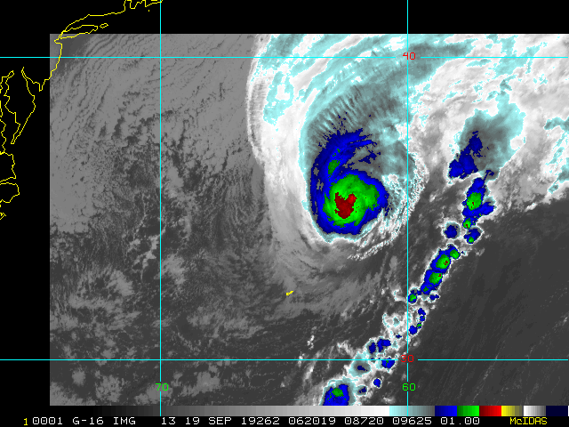
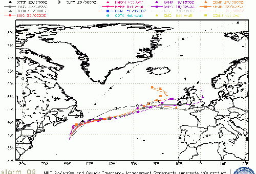
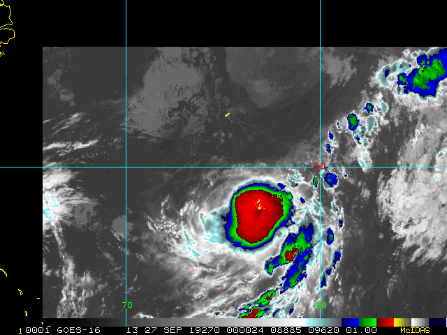
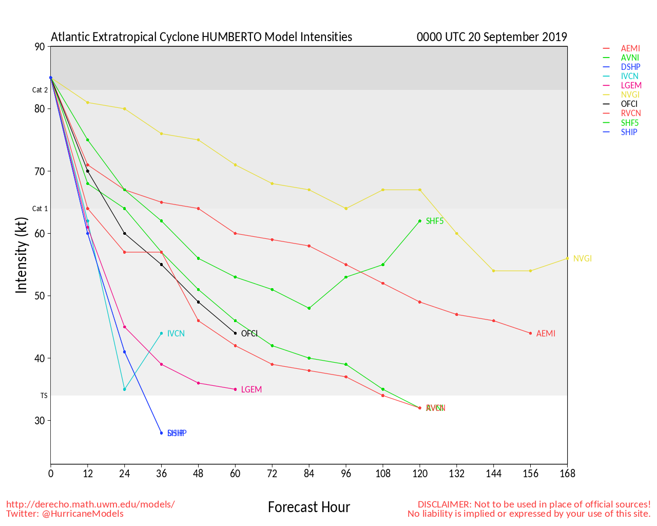
Conditions for development across the Atlantic are entering a new phase, with several systems worth watching, not the least of which is powerful Hurricane Humberto, now expected to become a Major within the next 36 hours and potentially directly impact Bermuda.
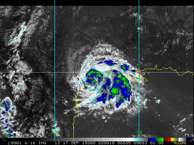
Much closer to the , an area of disturbed weather in the western Gulf of Mexico has strong model support to produce a deluge in eastern Texas whether or not it ever gets a name. This system is potentially a particularly dangerous situation unfolding, and just because it does not already have a name (and may never get one) is no reason not to prepare for something akin to a very slow moving Tropical Storm, with training bands of showers and thunderstorms setting up over some of the same areas - exact locations which as of yet are still unknown, but could even include parts of the very flood-prone Houston metro.
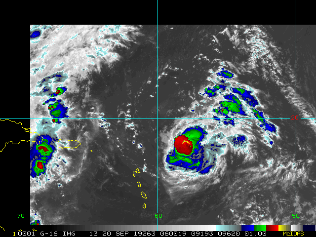
In the eastern Caribbean we are still keeping an eye out on Invest 96L, which is being held in check from high shear. However, behind 96L we are laser focused on 97L, with now 90% odds of development, and a track that at this point is just too close to call for the Antilles.
As always, feel free to follow along with us in the Forecast Lounge, where we dive into a good deal of model talk.
Current active Lounges include:
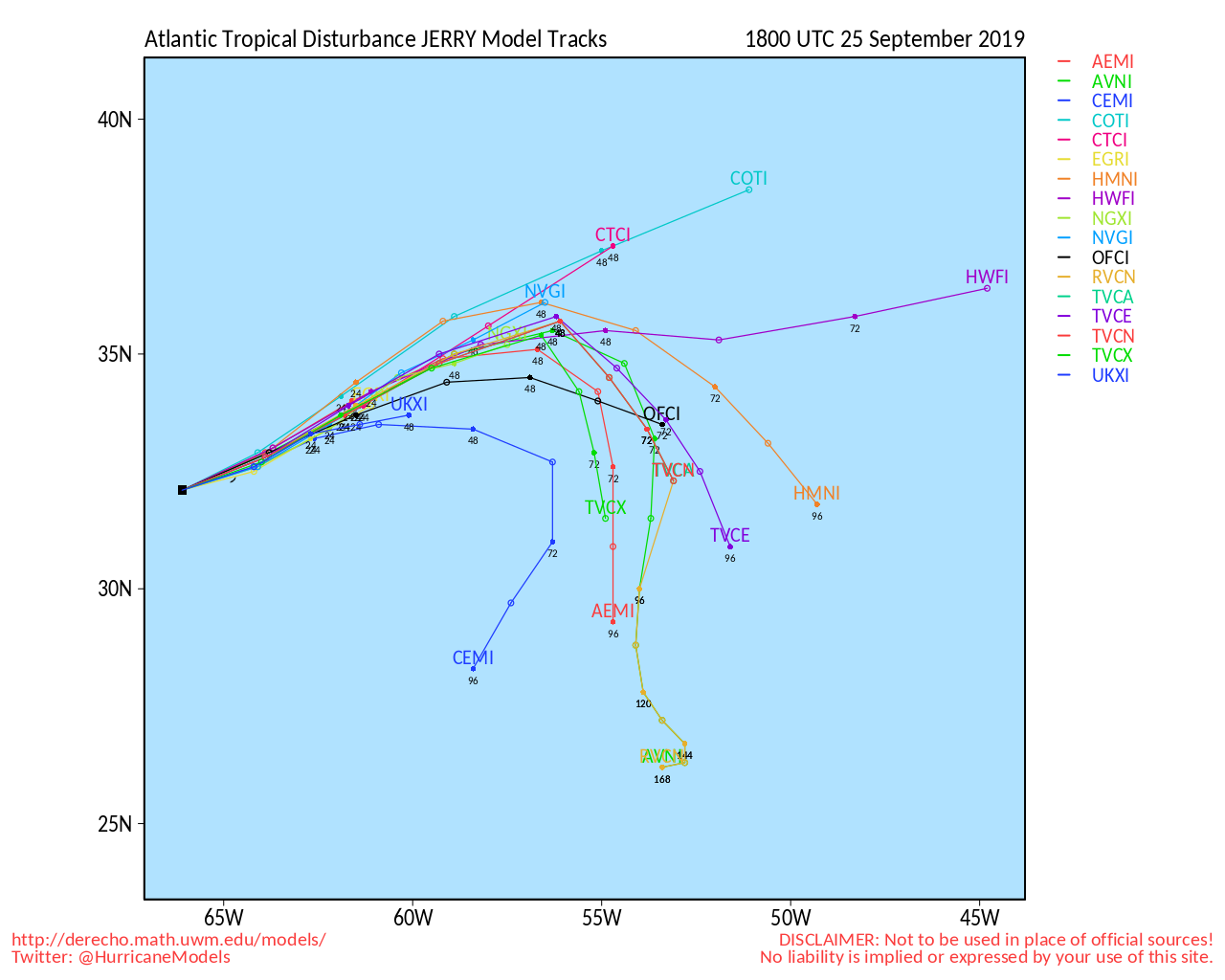
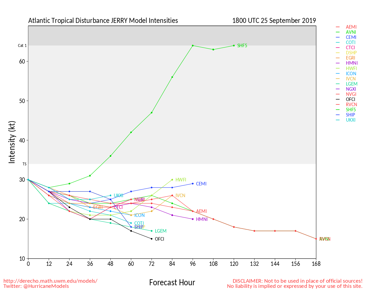
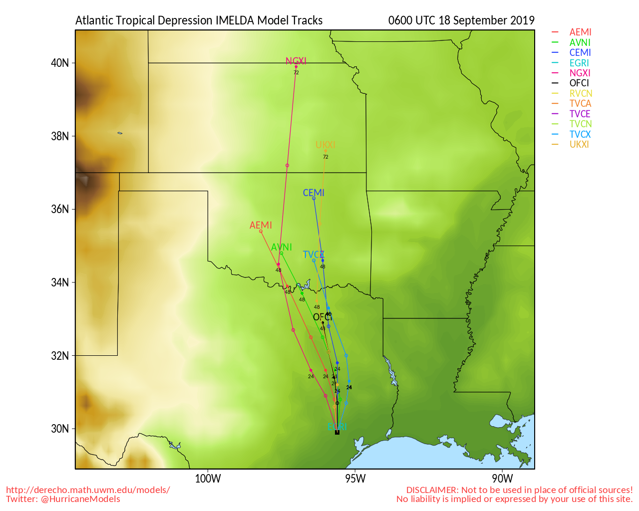
Humberto Lounge , Invest 96L Lounge , Jerry Lounge, Imelda Lounge , Invest 99L Lounge
Harris County Flood Warning System
Houston/Galveston Related Links:
Texas Emergency Management
Galveston area Storm Surge Map (pdf)
Webcams:
Surfside Beach Jetty Cam
Octogon View (Surfside Beach, TX)
Matagoria Beach Webcam
North TextVisual WebCam summary Page from HurricaneCity,com
Corpus Christi city Webcams
Media:
Houston Area:
Click2Houston/Local 2
KHOU
Galveston County The Daily News
chron.com
ABC13 KTRK
Houston Press
Corpus Christi:
KRIS NBC 6
KIII TV 3 ABC
MZTV 10 CBS
Corpus Christi Caller Times Paper
Power:
Center Point Energy Power Outages (Houston Area)
AEP Texas Outage map
Texas Gulf Coast Links
[http://moe.met.fsu.edu/~mnissenbaum/radar.html Mark Nissenbaum's radar page}
East to West:
Houston/Galveston, TX Radar Radar Loop
(Latest Static)
Corpus Christi, TX Radar Radar Loop
(Latest Static)
Brownsville, TX Radar Radar Loop
(Latest Static)
Gulf of Mexico Satellite Imagery
Area Forecast Discussions:
Houston/Galveston, TX
- Corpus Christi, TX - Browsnville/South Padre Island, TX
Bermuda Newspapers/Media:
BerNews
Royal Gazette (Bermuda)
Bermuda Sun
Hott 107.5 Bermuda Radio
Storm Carib Bermuda Reports
Bermuda Weather Service
Humberto Event Related Links
SFWMD Model Plot (Animated Model Plot) SFWMD Hurricane Page
[https://flhurricane.com/floatanimator.php?year=2019&storm=9 Flhurricane Satellite Floater Animation of Humberto
GOES Floater
Animated Model Plot of Humberto
Clark Evans Track Model Plot of Humberto
(Animated!) Model Plots in Google Earth - In Google Maps
Clark Evans Intensity Model Plot of Humberto (Animated!)
Clark Evans Track Plot of Humberto
Other Model Charts from Clark
Clark Evans Top 10 Analog Storms for Humberto
More model runs on from RAL/Jonathan Vigh's page
NRL Info on Humberto -- RAMMB Info
COD Atlantic Satellite View
j
Jerry Event Related Links
SFWMD Model Plot (Animated Model Plot) SFWMD Hurricane Page
[https://flhurricane.com/floatanimator.php?year=2019&storm=10 Flhurricane Satellite Floater Animation of Jerry
GOES Floater
Animated Model Plot of Jerry
Clark Evans Track Model Plot of Jerry
(Animated!) Model Plots in Google Earth - In Google Maps
Clark Evans Intensity Model Plot of Jerry (Animated!)
Clark Evans Track Plot of Jerry
Other Model Charts from Clark
Clark Evans Top 10 Analog Storms for Jerry
More model runs on from RAL/Jonathan Vigh's page
NRL Info on Jerry -- RAMMB Info
COD Atlantic Satellite View
Imelda Event Related Links
SFWMD Model Plot (Animated Model Plot) SFWMD Hurricane Page
[https://flhurricane.com/floatanimator.php?year=2019&storm=11 Flhurricane Satellite Floater Animation of Imelda
GOES Floater
Animated Model Plot of Imelda
Clark Evans Track Model Plot of Imelda
(Animated!) Model Plots in Google Earth - In Google Maps
Clark Evans Intensity Model Plot of Imelda (Animated!)
Clark Evans Track Plot of Imelda
Other Model Charts from Clark
Clark Evans Top 10 Analog Storms for Imelda
More model runs on from RAL/Jonathan Vigh's page
NRL Info on Imelda -- RAMMB Info
COD Atlantic Satellite View
Karen Event Related Links
SFWMD Model Plot (Animated Model Plot) SFWMD Hurricane Page
[https://flhurricane.com/floatanimator.php?year=2019&storm=12 Flhurricane Satellite Floater Animation of Karen
GOES Floater
Animated Model Plot of Karen
Clark Evans Track Model Plot of Karen
(Animated!) Model Plots in Google Earth - In Google Maps
Clark Evans Intensity Model Plot of Karen (Animated!)
Clark Evans Track Plot of Karen
Other Model Charts from Clark
Clark Evans Top 10 Analog Storms for Karen
More model runs on from RAL/Jonathan Vigh's page
NRL Info on Karen -- RAMMB Info
COD Atlantic Satellite View
East Florida Links
Southeast Composite Radar Loop
(Latest Static)
South to North:
Key West, FL Radar Radar Loop
(Latest Static)
Miami, FL Radar Radar Loop
(Latest Static)
Melbourne, FL Radar Radar Loop
(Latest Static)
Jacksonville, FL Radar Radar Loop
(Latest Static)
Caribbean/South East Coast Satellite Imagery
SFWMD Radar Loop of South Florida with storm Track
SFWMD Full Florida Radar Loop with Storm Track
Area Forecast Discussions:
FLorida Keys -
Miami/South Florida -
Melbourne/East Central Florida -
Jacksonville/Northeast Florida -
Edited by MikeC (Sun Sep 22 2019 10:45 AM)
 Threaded


