3AM EDT Update 23 October 2020
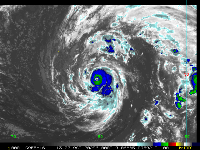
An area of low pressure in the north central Caribbean has been Invest tagged 95L and is worth monitoring closely.
-Ciel
8AM EDT Update 19 October 2020
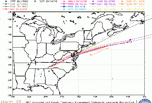
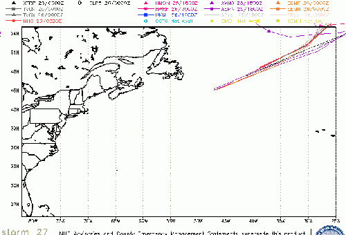
Tropical Depression 27 forms from 94L, the cone takes it near, but east of Bermuda, and is likely no threat to land beyond the island. Another area in the west Caribbean has a 20% chance to develop, but is also unlikely to do much.
Original Update
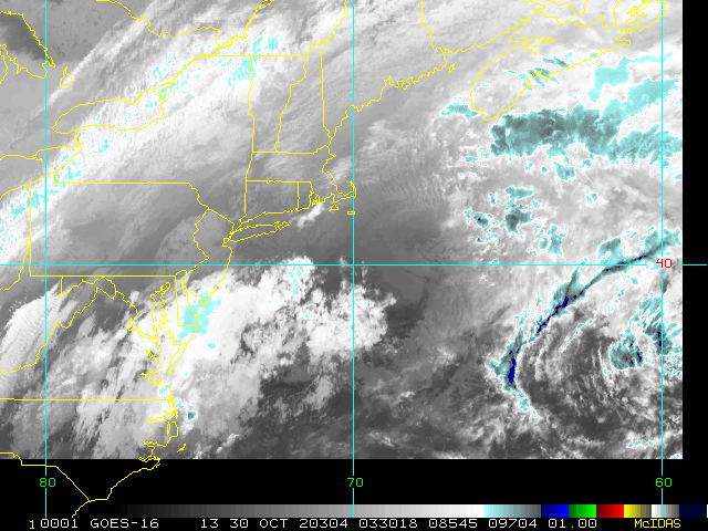
There's a 90% chance area in the Central Atlantic (Invest 94L) that likely will develop as a subtropical depression or storm, and generally move away from land.
Another area in the west Caribbean has a 30% chance to develop, mostly mid to late this coming week. It's worth watching because of the area, but there is no solid indication that it will develop or where it may go. Other than those in the Caymans, and Cuba will want to watch it closely. Beyond that is into high speculation. That can be found in the forecast lounge.
StormCarib Reports from the Caribbean Islands
Caribbean Weather Observations
Barbados Brohav Weather Fax
Full Caribbean Radar Composite
Caribbean Broadcast Corporation (TV/Radio from Antilles)
San Juan, PR NWS Page
Various Caribbean Radio Stations
DR1 Dominican Republic Hurricanes
Invest 95L Event Related Links
SFWMD Model Plot (Animated Model Plot) SFWMD Hurricane Page
[https://flhurricane.com/floatanimator.php?year=2020&storm=28 Flhurricane Satellite Floater Animation of 95L
GOES Floater
Animated Model Plot of 95L
Clark Evans Track Model Plot of 95L
(Animated!) Model Plots in Google Earth - In Google Maps
Clark Evans Intensity Model Plot of 95L (Animated!)
Clark Evans Track Plot of 95L
Other Model Charts from Clark
Clark Evans Top 10 Analog Storms for 95L
More model runs on from RAL/Jonathan Vigh's page
NRL Info on 95L -- RAMMB Info
COD Atlantic Satellite View
Epsilon Event Related Links
SFWMD Model Plot (Animated Model Plot) SFWMD Hurricane Page
[https://flhurricane.com/floatanimator.php?year=2020&storm=27 Flhurricane Satellite Floater Animation of Epsilon
GOES Floater
Animated Model Plot of Epsilon
Clark Evans Track Model Plot of Epsilon
(Animated!) Model Plots in Google Earth - In Google Maps
Clark Evans Intensity Model Plot of Epsilon (Animated!)
Clark Evans Track Plot of Epsilon
Other Model Charts from Clark
Clark Evans Top 10 Analog Storms for Epsilon
More model runs on from RAL/Jonathan Vigh's page
NRL Info on Epsilon -- RAMMB Info
COD Atlantic Satellite View
 Threaded


