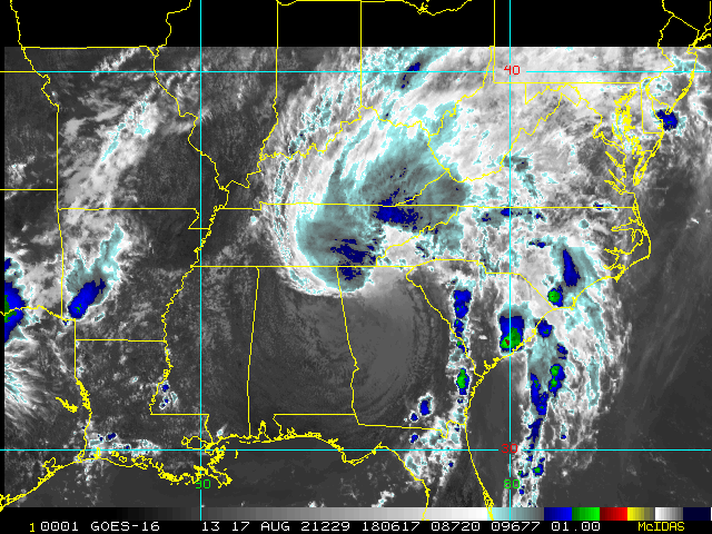
8AM EDT 10 August 2021 Update
Potential Tropical Cyclone Six is primed to become a depression or storm later today based on the official forecast. If it were to be named, it would be Fred.
Tropical Storm Watches are now up for the Turks and Caicos Islands, and for the southeastern Bahamas,
including the Acklins, Crooked Island, Long Cay, the Inaguas, Mayaguana, and the Ragged Islands.
This is in addition to the ones for Martinique, Guadeloupe, Dominica, Saba, St. Eustatius, Dominican Republic on the north coast from Cabo Viejo to the Dominican Republic/Haiti border, Haiti from the northern border with the Dominican Republic to Gonaives
There is still a great deal of uncertainty in the longer part of the track and intensity, due to any potential land interaction and shear impacts. The general gist is that the storm will probably remain weak, but has a chance to strengthen as it nears the western Bahamas, and if it makes it into the Gulf, yet another chance to strengthen. There are some negative factors that will likely prevent it from strengthening rapidly, but many of them can change by then, so it'll be important to find out. It's possible watches could go up for South Florida and/or the Keys on late Wednesday or Thursday.
In the US, those in the Keys should pay the most attention to this, but extreme South Florida should watch as well.
Another wave in the East Atlantic is not tagged in the 's Outlook, but is flaring up this morning.
4PM EDT 9 August 2021 Update
Tropical Cyclone or Potential Tropical Cyclone watches and warnings may be issued at any time now for Invest 94L. Interests in the eastern Antilles may want to prepare for a strong wave or TD with attendant very heavy rain and blustery winds pushing in later today through early in the week.
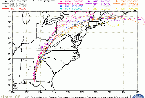
Model discussion has begun in the Tropical Storm Fred Forecast Lounge
-Ciel
8:30 AM EDT 9 August 2021 Update
Tropical storm watches or warnings could be required today with shorter-than-normal lead times for portions of the Lesser Antilles, the Virgin Islands, and Puerto Rico as 94L moves west. The disturbance now has a 70% chance to develop within the next 48 hours, and will likely move closer to Hispaniola by the middle of the week. If it does develop later today or tomorrow, forecast tracks will begin. If it gets named, ti would be called "Fred".
Beyond Wednesday things are clouded by conditions ahead of the system, including land interaction.
93L Behind it is less likely to develop, with chances at 20%.
10:30 AM EDT 8 August 2021 Update
There are two disturbances in the Atlantic worth watching this morning, 93L and 94L. Both of which have a 40% chance to develop in the next 5 days, and neither have great conditions in the near term for development. Dry air in the mid layer and shear around 94L will likely keep this system (Closer to the Caribbean) in check for now. However down the line beyond 5 days things get a bit cloudy.
93L is in a similar situation.
Of the two, 94L seems likely to be the better one overall for development chances. They'll have to be watched in the Caribbean and Bahamas through the week.
These systems aren't typical tropical waves, more like monsoon troughs, so it's a bit more difficult to forecast than typical.
Original Update
With July over, only Elsa at the beginning, and not much toward the rest of the month (Which is typical for July), we now move into August. In the Atlantic things remain slow, however signals of things beginning to happen by mid month start to show up, and that is the case here as well.
Long range models (particularly ensembles) are good at pointing toward possible areas for development, but are not so great at track or intensity. In this case, the main development region may see something in about 2 weeks. It's possible something develops elsewhere, too, but in the next 5 days or so, that seems unlikely. Starting next weekend, though, there may be a bit more to track.
Fred Event Related Links
SFWMD Model Plot (Animated Model Plot) SFWMD Hurricane Page
[https://flhurricane.com/floatanimator.php?year=2021&storm=6 Flhurricane Satellite Floater Animation of Fred
GOES Floater
Animated Model Plot of Fred
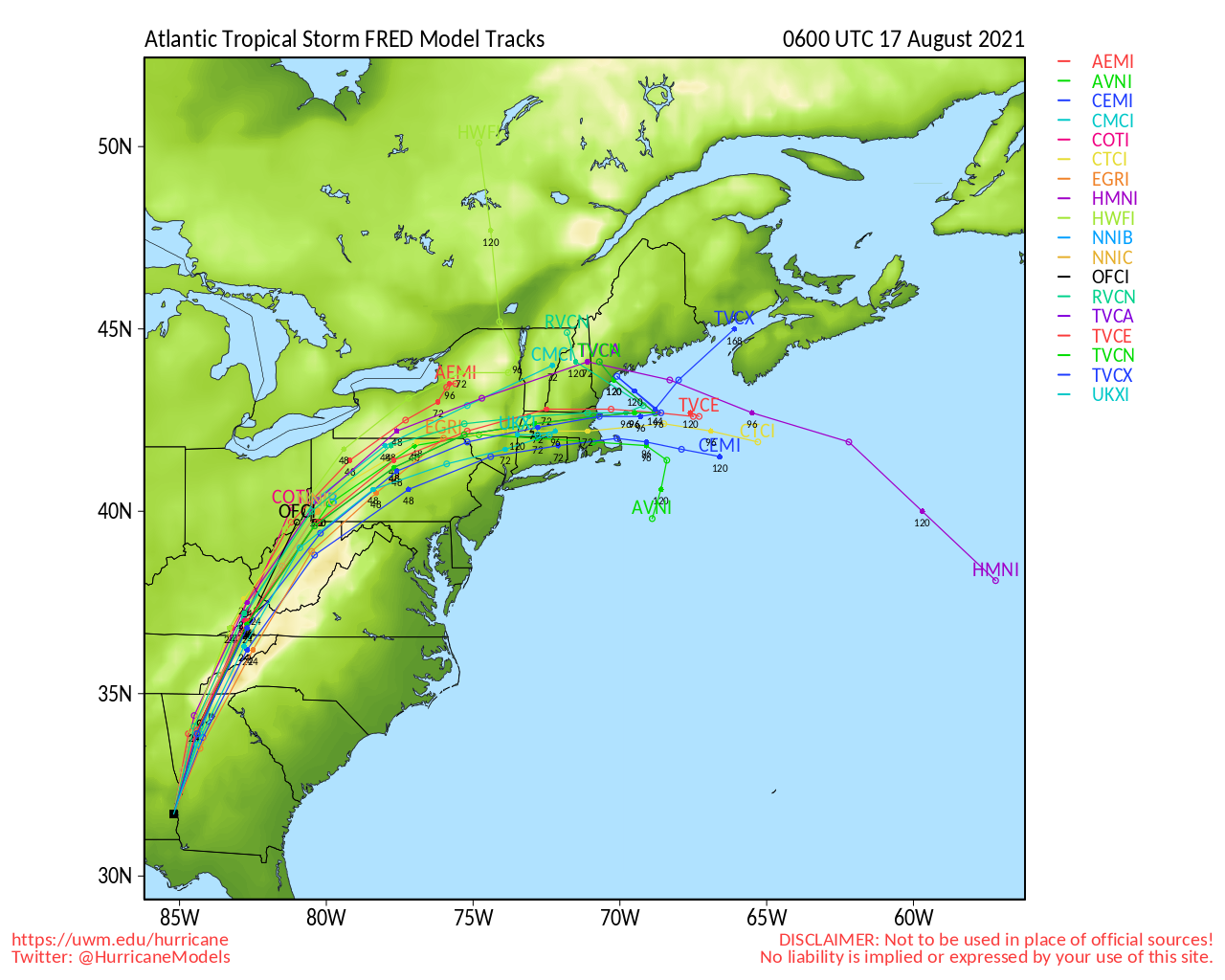
Clark Evans Track Model Plot of Fred
(Animated!) Model Plots in Google Earth - In Google Maps
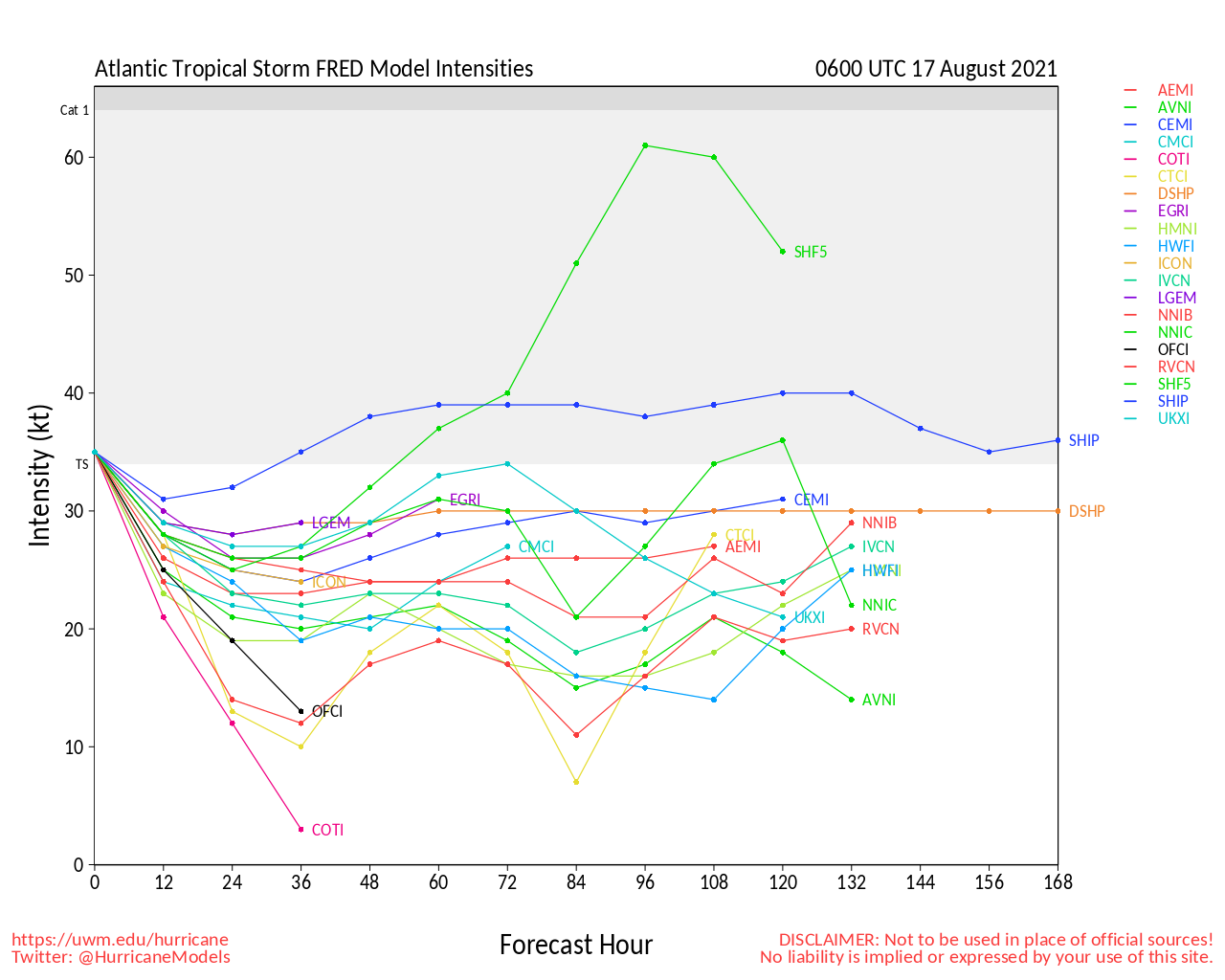
Clark Evans Intensity Model Plot of Fred (Animated!)
Clark Evans Track Plot of Fred
Other Model Charts from Clark
Clark Evans Top 10 Analog Storms for Fred
More model runs on from RAL/Jonathan Vigh's page
NRL Info on Fred -- RAMMB Info
COD Atlantic Satellite View
Invest 95L Event Related Links
SFWMD Model Plot (Animated Model Plot) SFWMD Hurricane Page
[https://flhurricane.com/floatanimator.php?year=2021&storm=7 Flhurricane Satellite Floater Animation of 95L
GOES Floater
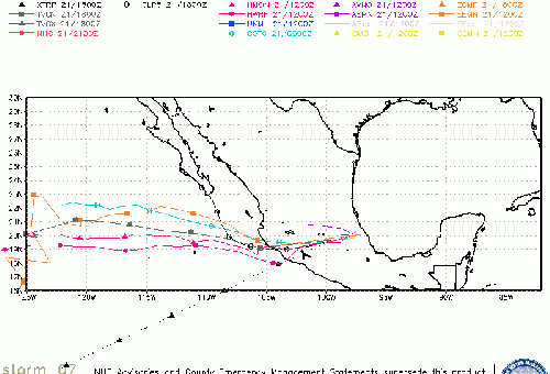
Animated Model Plot of 95L
Clark Evans Track Model Plot of 95L
(Animated!) Model Plots in Google Earth - In Google Maps
Clark Evans Intensity Model Plot of 95L (Animated!)
Clark Evans Track Plot of 95L
Other Model Charts from Clark
Clark Evans Top 10 Analog Storms for 95L
More model runs on from RAL/Jonathan Vigh's page
NRL Info on 95L -- RAMMB Info
COD Atlantic Satellite View
StormCarib Reports from the Caribbean Islands
Caribbean Weather Observations
Barbados Brohav Weather Fax
Full Caribbean Radar Composite
Caribbean Broadcast Corporation (TV/Radio from Antilles)
San Juan, PR NWS Page
Various Caribbean Radio Stations
DR1 Dominican Republic Hurricanes
Edited by cieldumort (Tue Aug 10 2021 10:52 PM)
 Threaded


