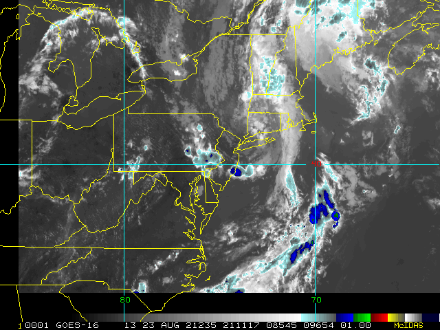
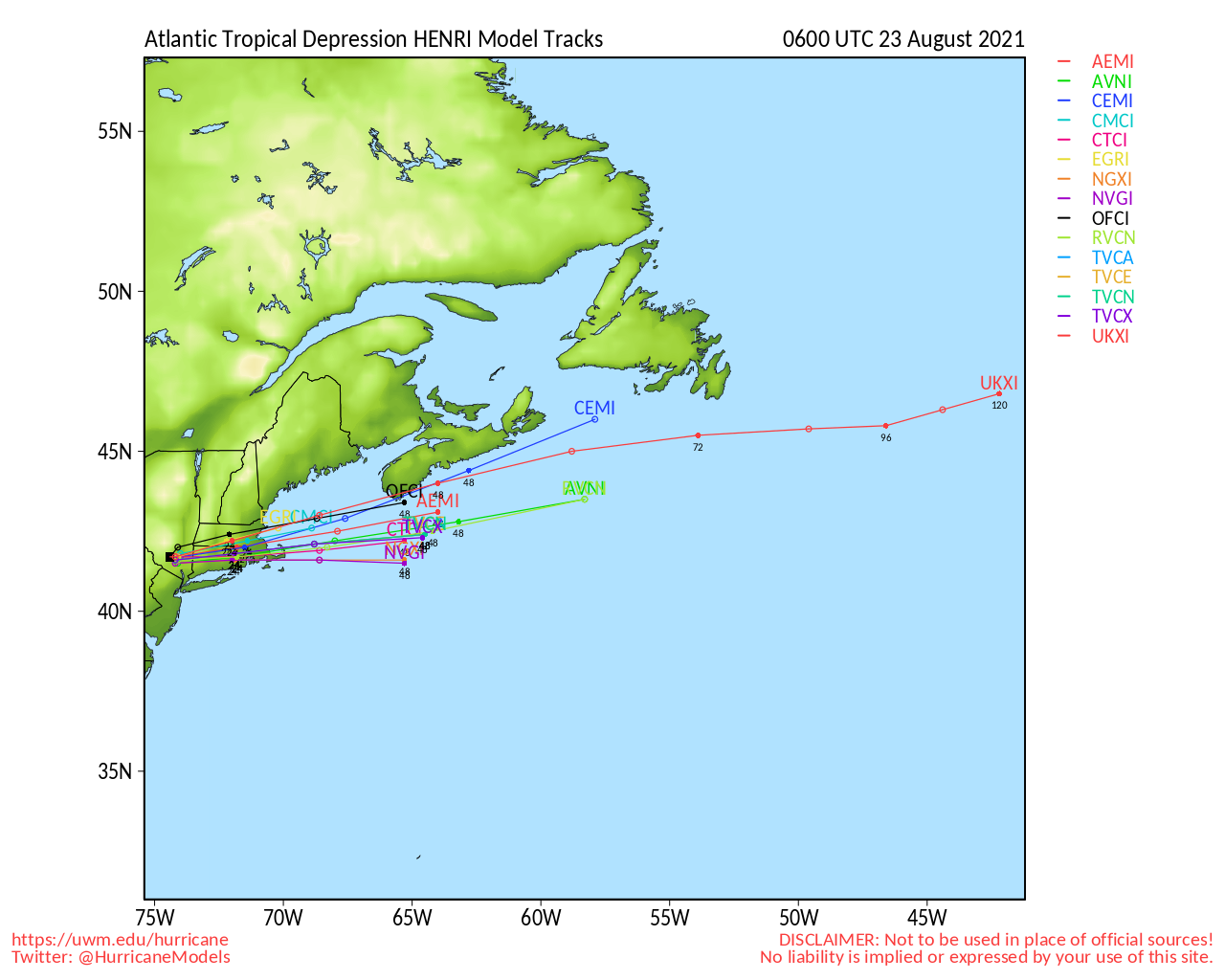
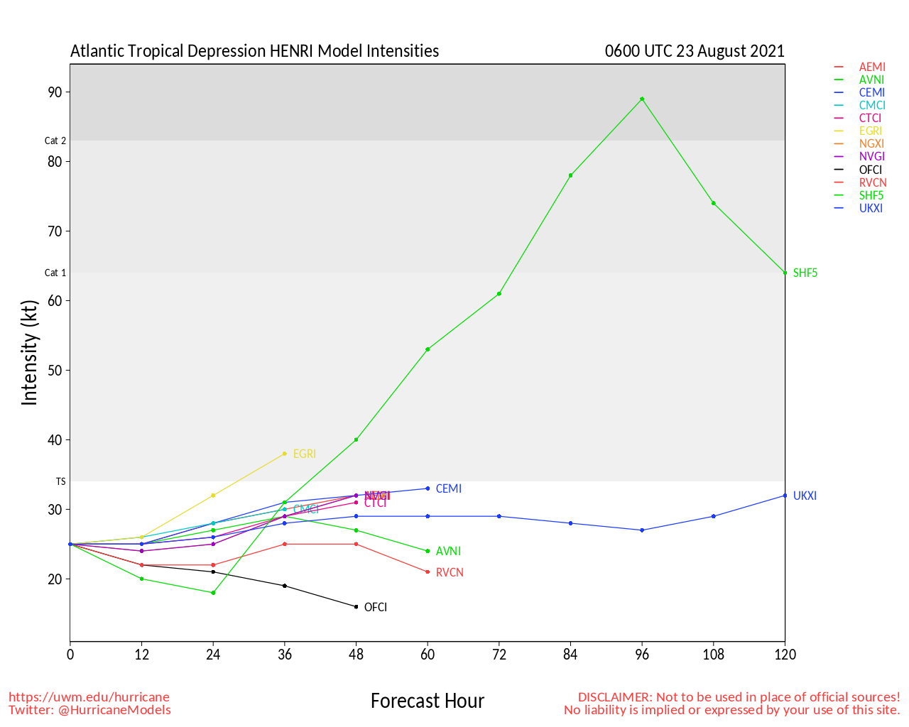
11PM EDT 23 August 2021 Update
Henri is now Post-Tropical Depression Henri and pushing out to sea, at last.
"Former" Tropical Storm Linda is presently crossing the northern Hawaiian Islands producing locally heavy rain and sustained winds at or near Tropical Storm Force, with higher gusts. Flash Flood Watches and Wind Advisories remain in effect.
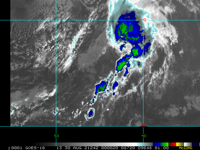
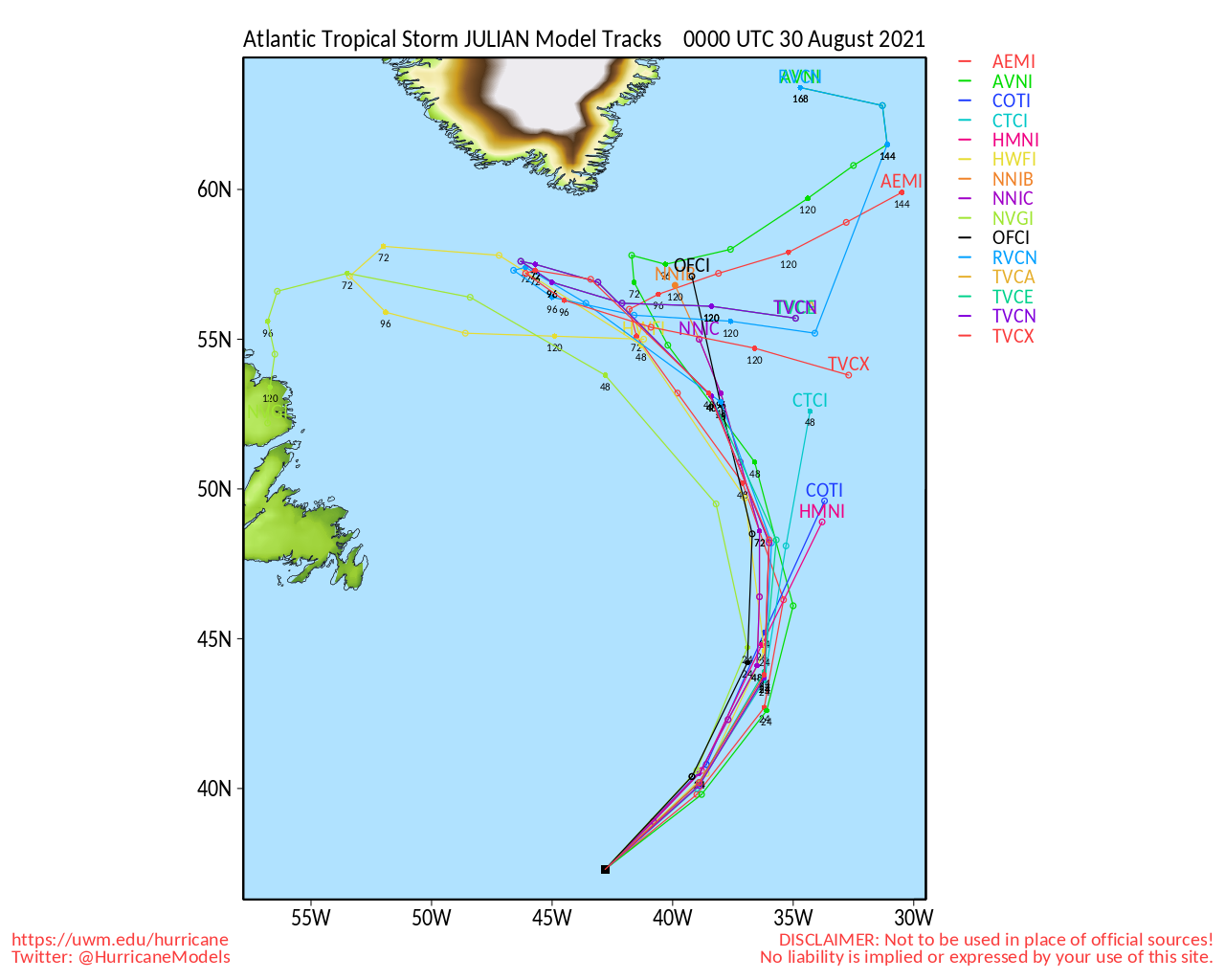
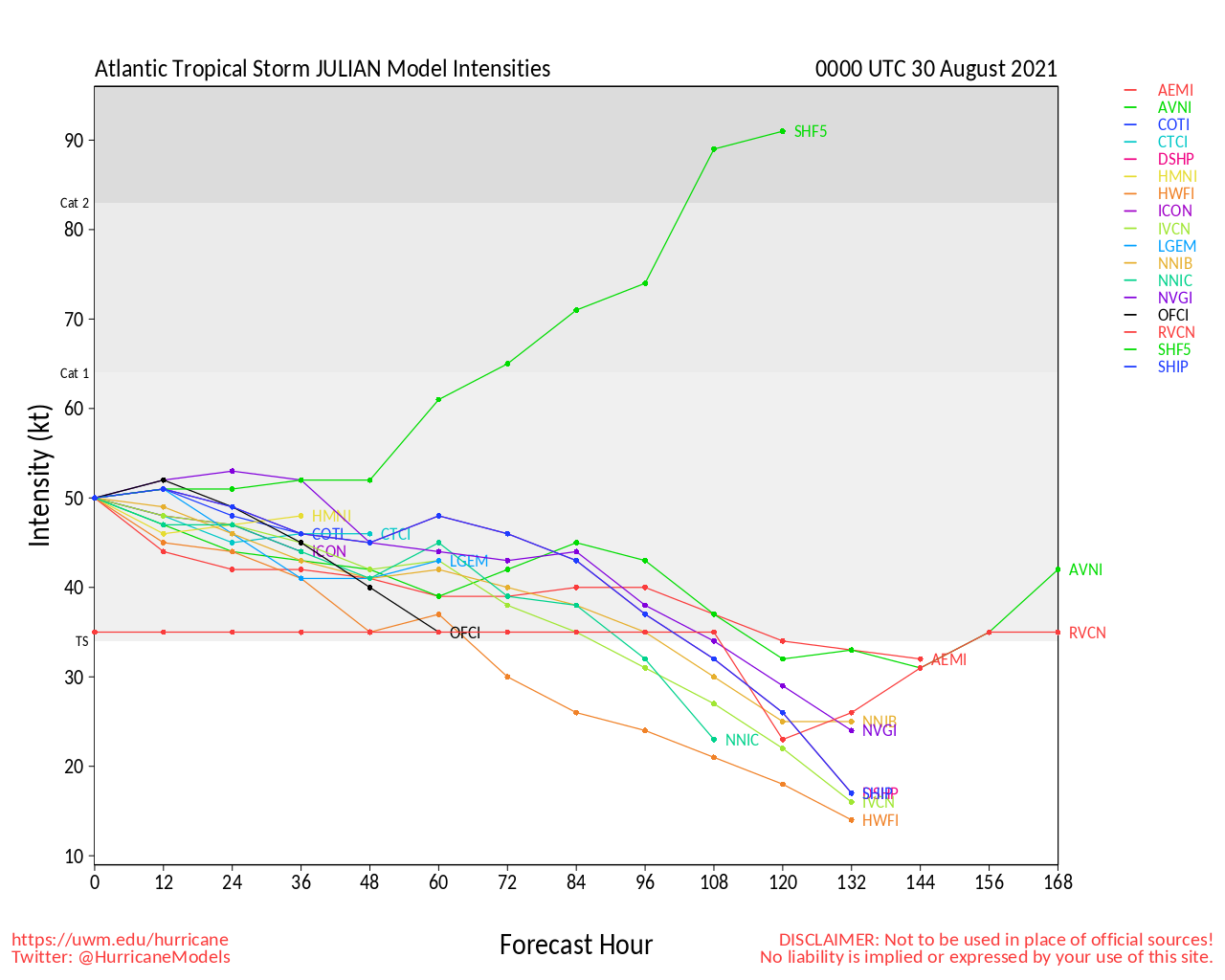
Elsewhere, we are quickly turning attention to three features in the Atlantic basin that have medium and rising odds of developing into Tropical Cyclones this week. 2021 Forecast Lounges are now open on all three of these systems, and a new Main Page thread is probably just around the corner.
2PM EDT 22 August 2021 Update
Flood threats continue to be the theme today with also Central Pac Linda now on approach to the Hawaiian Islands looking at least sufficiently organized to necessitate Flood Watches for the entire chain. Tropical rains capable of producing flash flooding are expected to start soon over the Big Island today and spread across much of the rest of the state throughout the day today into Monday night.
We have opened a Linda Forecast Lounge Model runs are still actively tracking the system, and given recent satellite trends, it would not surprise to find it a Tropical Cyclone yet again.
1PM EDT 22 August 2021 Update
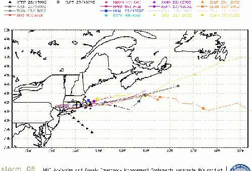
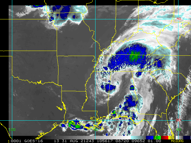
Henri has made landfall along the coast of Rhode Island at around 12:15PM EDT with maximum sustained winds at time of landfall estimated to be around 60 MPH and with a central pressure of 989mb. Continued weakening is expected as the now Tropical Storm Henri continues north-northwestward with forward speed continuing to slow, and bend even further to the west, to perhaps outright stalling near the New York/Connecticut border tonight.
Original Update
HURRICANE HENRI STRENGTHENING HEADING TOWARDS LANDFALL
Now Hurricane Henri is on approach to an almost certain direct landfall along the Northeastern US coast between upper New Jersey and Providence, R.I. This is a rare occurrence, and many who live here have not experienced a hurricane for many years, if at all.
Recon is now finding that Hurricane Henri is definitely intensifying tonight, and he may even come in notably above forecast. Regardless, in addition to strong winds and storm surge, there is even greater potential for the forward speed of the cyclone to slow down near or soon after landfall, creating a long duration coastal and inland flood threat, and one that is potentially locally catastrophic in some places.
Preparations to protect life and property should be nearing completion as conditions starting as soon as late tonight and spreading in tomorrow and tomorrow night could prevent them from being done at that time, and also prevent first responders from providing aid.
SUMMARY OF WATCHES AND WARNINGS IN EFFECT AS OF 5PM AUG 21:
A Storm Surge Warning is in effect for...
* South shore of Long Island from Mastic Beach to Montauk Point New York
* North shore of Long Island from Montauk Point to Flushing New York
* Flushing New York to Chatham Massachusetts
* Nantucket, Martha's Vineyard, and Block Island
A Storm Surge Watch is in effect for...
* East Rockaway Inlet to Mastic New York
* North of Chatham Massachusetts to Sagamore Beach Massachusetts
* Cape Cod Bay
A Hurricane Warning is in effect for...
* South shore of Long Island from Fire Island Inlet to Montauk Point
* North shore of Long Island from Port Jefferson Harbor to Montauk Point
* New Haven Connecticut to west of Westport Massachusetts
* Block Island
A Tropical Storm Warning is in effect for...
* Port Jefferson Harbor to west of New Haven Connecticut
* South shore of Long Island from west of Fire Island Inlet to East Rockaway Inlet
* Westport Massachusetts to Chatham Massachusetts, including Martha's Vineyard and Nantucket
* Coastal New York and New Jersey west of East Rockaway Inlet to Manasquan Inlet, including New York City
Henri Event Related Links
SFWMD Model Plot (Animated Model Plot) SFWMD Hurricane Page
[https://flhurricane.com/floatanimator.php?year=2021&storm=8 Flhurricane Satellite Floater Animation of Henri
GOES Floater
Animated Model Plot of Henri
Clark Evans Track Model Plot of Henri
(Animated!) Model Plots in Google Earth - In Google Maps
Clark Evans Intensity Model Plot of Henri (Animated!)
Clark Evans Track Plot of Henri
Other Model Charts from Clark
Clark Evans Top 10 Analog Storms for Henri
More model runs on from RAL/Jonathan Vigh's page
NRL Info on Henri -- RAMMB Info
COD Atlantic Satellite View
Henri Forecast Lounge
Northeast US Radar Links
Northeast Composite Radar Loop
(Latest Static)
Dover, DE Radar Radar Loop
(Latest Static)
Mt. Holly, NJ Radar Radar Loop
(Latest Static)
Upton/NYC/Long Island, NY Radar Radar Loop
(Latest Static)
Boston/Cape Cod, MA Radar Radar Loop
(Latest Static)
Portland, ME Radar Radar Loop
(Latest Static)
Carabou, ME Radar Radar Loop
(Latest Static)
Mid-Atlantic/Carolina Links
Southeast Composite Radar Loop
(Latest Static)
Charleston, SC Radar Radar Loop
(Latest Static)
Wilmington, NC Radar Radar Loop
(Latest Static)
Morehead City, NC Radar Radar Loop
(Latest Static)
Norfolk/Wakefield, VA Radar Radar Loop
(Latest Static)
Area Forecast Discussions:
Charleston, SC -
Wilmington, NC -
Morehead City, NC -
Norfolk/Virginia Beach/Hampton Roads, VA
Power Outage Maps:
South Carolina Power Outage Map
North Carolina Power Outage Map
Virginia Power Outage Map
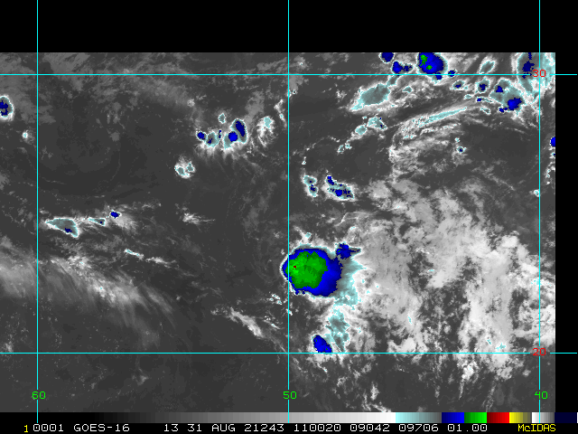
Invest 97L Event Related Links
SFWMD Model Plot (Animated Model Plot) SFWMD Hurricane Page
[https://flhurricane.com/floatanimator.php?year=2021&storm=12 Flhurricane Satellite Floater Animation of 97L
GOES Floater
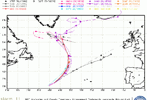
Animated Model Plot of 97L
Clark Evans Track Model Plot of 97L
(Animated!) Model Plots in Google Earth - In Google Maps
Clark Evans Intensity Model Plot of 97L (Animated!)
Clark Evans Track Plot of 97L
Other Model Charts from Clark
Clark Evans Top 10 Analog Storms for 97L
More model runs on from RAL/Jonathan Vigh's page
NRL Info on 97L -- RAMMB Info
COD Atlantic Satellite View
Invest 98L Event Related Links
SFWMD Model Plot (Animated Model Plot) SFWMD Hurricane Page
[https://flhurricane.com/floatanimator.php?year=2021&storm=10 Flhurricane Satellite Floater Animation of 98L
GOES Floater
Animated Model Plot of 98L
Clark Evans Track Model Plot of 98L
(Animated!) Model Plots in Google Earth - In Google Maps
Clark Evans Intensity Model Plot of 98L (Animated!)
Clark Evans Track Plot of 98L
Other Model Charts from Clark
Clark Evans Top 10 Analog Storms for 98L
More model runs on from RAL/Jonathan Vigh's page
NRL Info on 98L -- RAMMB Info
COD Atlantic Satellite View
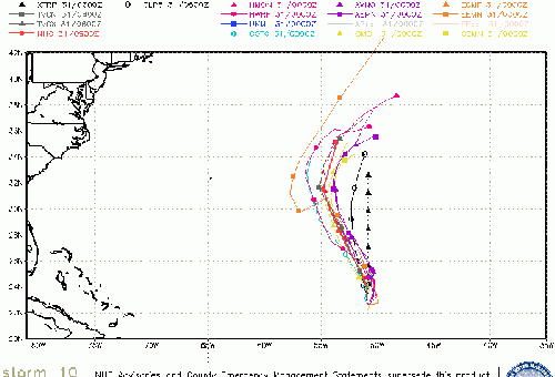
Tropical Depression Nine Event Related Links
SFWMD Model Plot (Animated Model Plot) SFWMD Hurricane Page
[https://flhurricane.com/floatanimator.php?year=2021&storm=9 Flhurricane Satellite Floater Animation of 9
GOES Floater
Animated Model Plot of 9
Clark Evans Track Model Plot of 9
(Animated!) Model Plots in Google Earth - In Google Maps
Clark Evans Intensity Model Plot of 9 (Animated!)
Clark Evans Track Plot of 9
Other Model Charts from Clark
Clark Evans Top 10 Analog Storms for 9
More model runs on from RAL/Jonathan Vigh's page
NRL Info on 9 -- RAMMB Info
COD Atlantic Satellite View
Edited by MikeC (Thu Aug 26 2021 10:22 AM)
 Threaded


