cieldumort
Moderator

Reged: Mon
Posts: 2305
Loc: Austin, Tx
|
|
A well-defined area of non-tropical low pressure began taking on more tropical characteristics despite moderate westerly shear on the morning of July 1st, and one could make the case that it was a T.D. by about noon Friday July 1 using a more flexible definition.
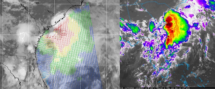
After drifting just inland near/over Charleston, S.C. the low has continued to slowly show signs of increasing organization.
96L is now being tugged offshore and drawn into a blossoming area of deep convection with very cold cloud tops, and it looks increasingly likely that a Tropical Storm may be forming, so we are starting a lounge on this well-formed cyclone at this time.
At 5AM ET July 2, upgraded 96L directly to Tropical Storm Colin, and the title has been updated accordingly.
Edited by cieldumort (Sat Jul 02 2022 06:05 AM)
|
cieldumort
Moderator
Reged: Mon
Posts: 2305
Loc: Austin, Tx
|
|
Invest 96L, likely already a tropical cyclone for over the past 12-18 hours, has just seen an upgrade by directly to Colin.
Models are not going to be particularly useful at this time, as they have mostly all missed forecasting this, say nothing of even seeing it.
|
|
 Threaded


