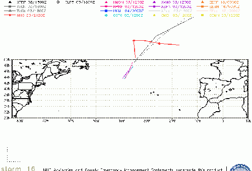
1:00AM EDT Update 25 October 2022 Update
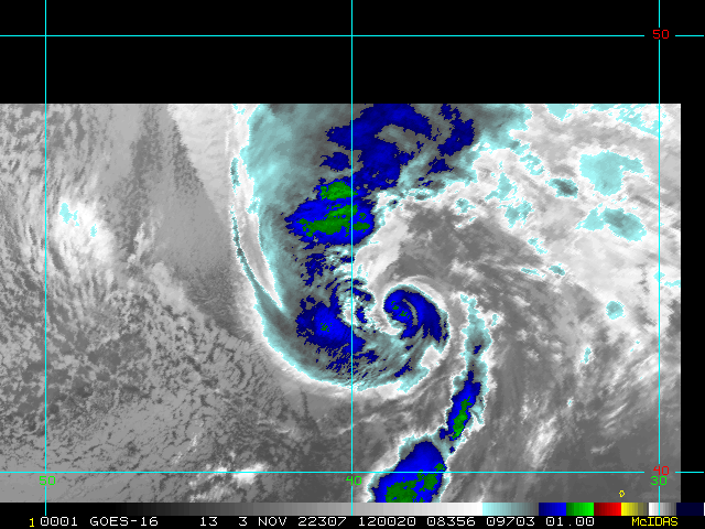
Today we are watching several low probability areas in the Atlantic, and one "high" probability system, 94L. Invest 94L has been recently and presently affecting Bermuda and its nearby waters as an almost-classifiable depression or very weak storm. Battling modest shear and dry air, it does not have very good odds of getting much stronger.
It is noteworthy that things are percolating this late in the season.
2:00PM EDT Update 24 October 2022 Update
Shower and thunderstorm activity associated with a formerly non-tropical but well-defined low is increasing, and it appears a tropical storm may be forming with the system, Invest 94L, presently located about 150m east-southeast of Bermuda. Interests in and around Bermuda may want to pay close attention as Watches and Warnings may be issued at any time if current trends continue.
9:00PM CDT Update 11 October 2022 Update
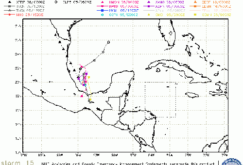
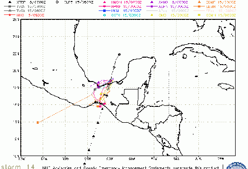
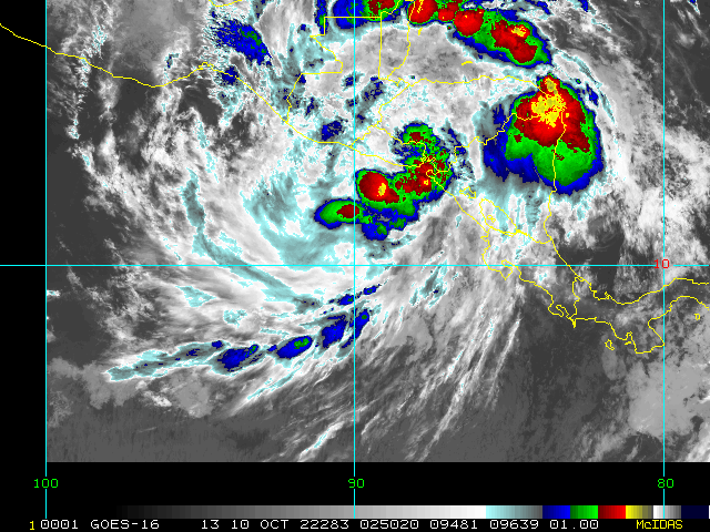
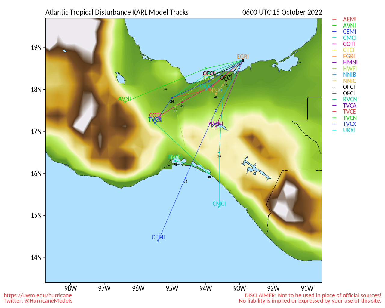
Recon found the disturbance in the southwestern GOM sufficiently organized, and with maximum sustained winds of 40MPH, advisories on Tropical Storm Karl began this afternoon.
9:00AM CDT Update 11 October 2022 Update
It appears that a tropical cyclone is forming in the southwestern GOM with what has now been designated Invest 93L, and we have started a Lounge on this system Karl Forecast Lounge
3:00AM CDT Update 11 October 2022 Update
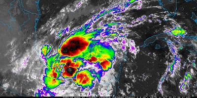
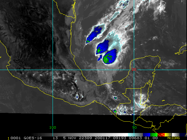
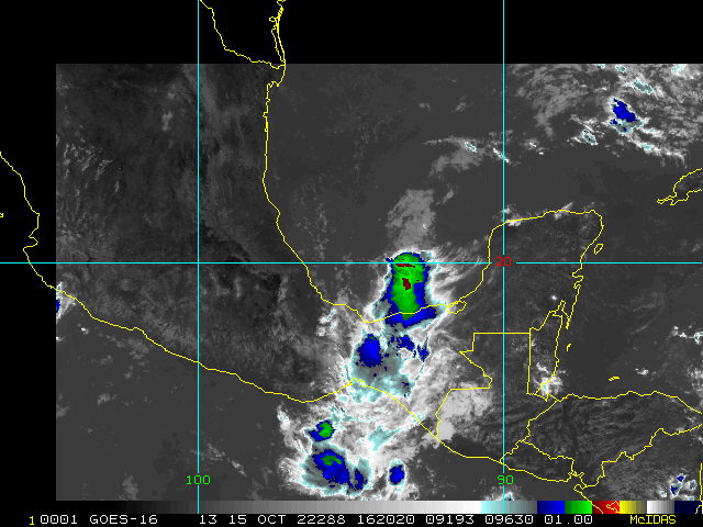
A trof of low pressure, largely associated with remnants of Hurricane Julia, is presently situated across the Bay of Campeche in the southwestern Gulf of Mexico and drapes across the Isthmus of Tehuantepec into the Gulf of Tehuantepec on the eastern Pacific side.
This elongated area of low pressure is focusing disorganized showers and thunderstorms in the southwestern Gulf, and development into a Tropical Depression or named storm is possible this week. presently gives this disturbance 40% odds of becoming a TC within the next few days, and recon is tentatively scheduled to investigate it this afternoon.
Original entry
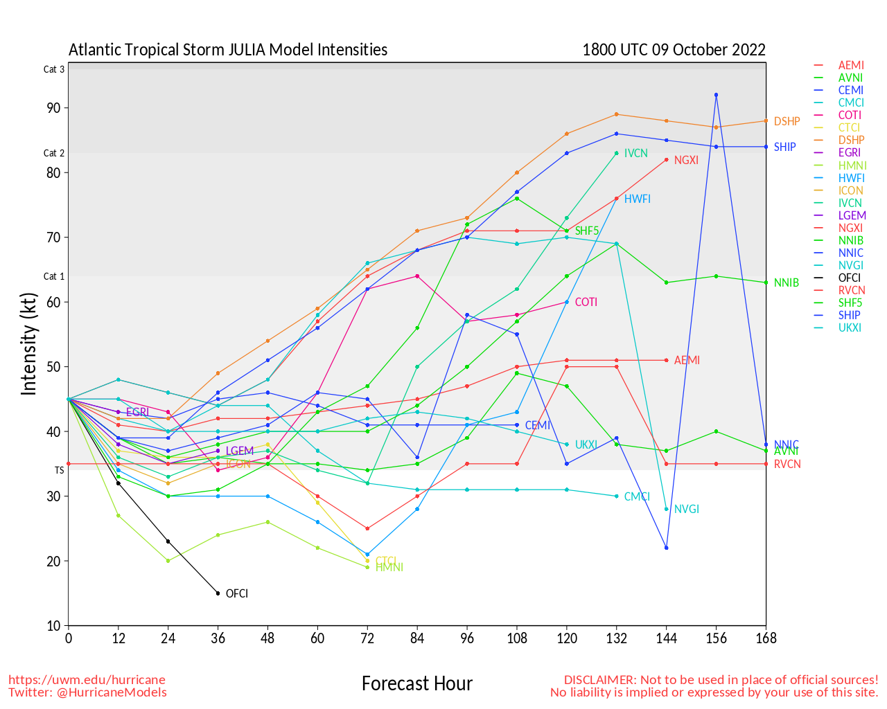
Generally marginally favorable to favorable conditions for development and strengthening remain across sections of the Atlantic basin thus far in October, with two tropical cyclones forming in the past few days. One, now impacting land and threatening to become a hurricane and possibly even go under Rapid Intensirffication, Julia, is likely to remain a threat to Central America, but there is a non-zero chance of it recurving into or redeveloping in the SW Gulf later, and will be watched closely. Otherwise, stays TC-Free for the foreseeable future.
Lisa Event Related Links
SFWMD Model Plot (Animated Model Plot) SFWMD Hurricane Page
[https://flhurricane.com/floatanimator.php?year=2022&storm=15 Flhurricane Satellite Floater Animation of Lisa
GOES Floater
Animated Model Plot of Lisa
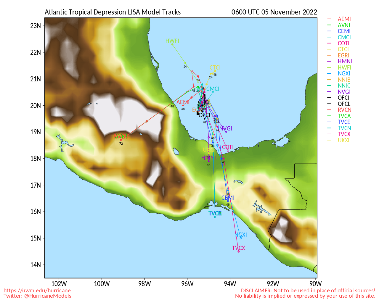
Clark Evans Track Model Plot of Lisa
(Animated!) Model Plots in Google Earth - In Google Maps
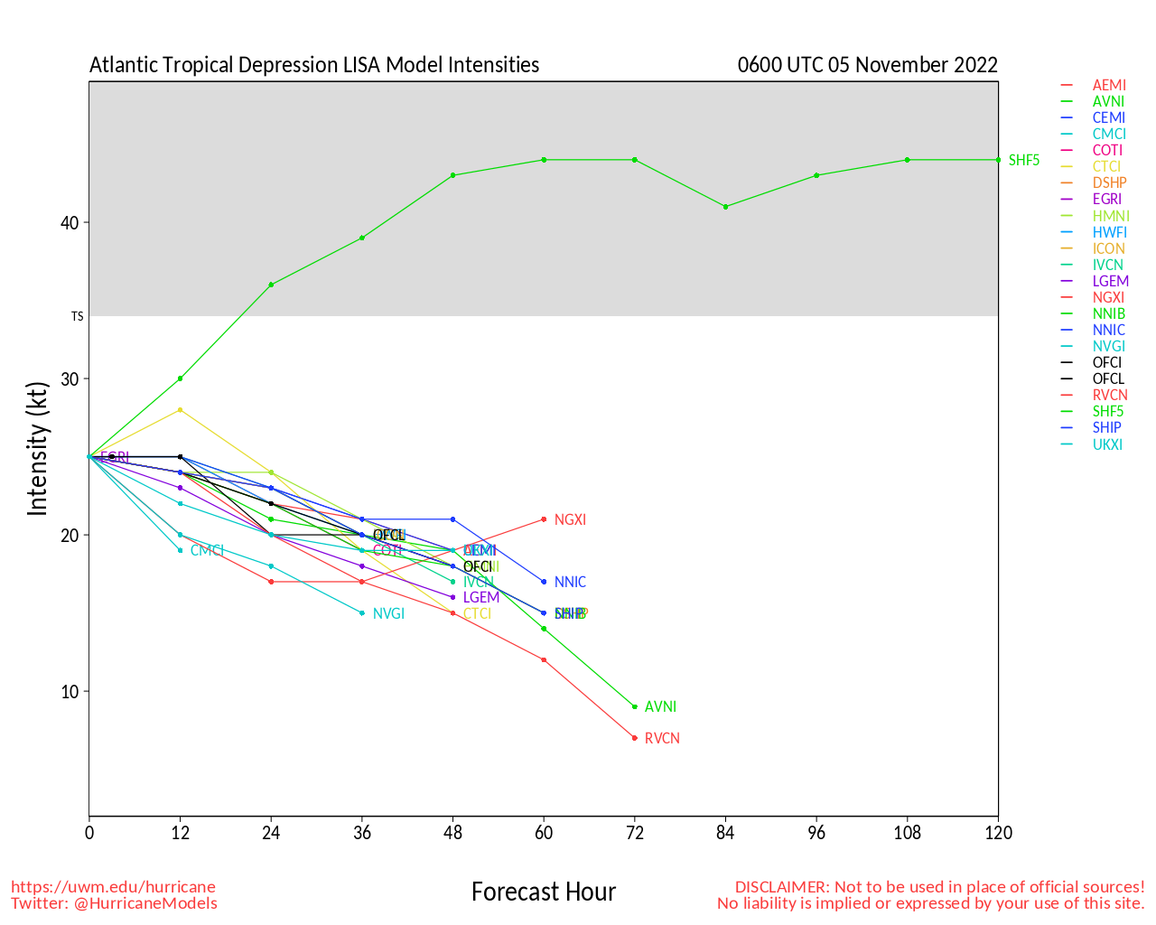
Clark Evans Intensity Model Plot of Lisa (Animated!)
Clark Evans Track Plot of Lisa
Other Model Charts from Clark
Clark Evans Top 10 Analog Storms for Lisa
More model runs on from RAL/Jonathan Vigh's page
NRL Info on Lisa -- RAMMB Info
COD Atlantic Satellite View
Invest 96L Event Related Links
SFWMD Model Plot (Animated Model Plot) SFWMD Hurricane Page
[https://flhurricane.com/floatanimator.php?year=2022&storm=16 Flhurricane Satellite Floater Animation of 96L
GOES Floater
Animated Model Plot of 96L
Clark Evans Track Model Plot of 96L
(Animated!) Model Plots in Google Earth - In Google Maps
Clark Evans Intensity Model Plot of 96L (Animated!)
Clark Evans Track Plot of 96L
Other Model Charts from Clark
Clark Evans Top 10 Analog Storms for 96L
More model runs on from RAL/Jonathan Vigh's page
NRL Info on 96L -- RAMMB Info
COD Atlantic Satellite View
Karl Event Related Links
SFWMD Model Plot (Animated Model Plot) SFWMD Hurricane Page
[https://flhurricane.com/floatanimator.php?year=2022&storm=14 Flhurricane Satellite Floater Animation of Karl
GOES Floater
Animated Model Plot of Karl
Clark Evans Track Model Plot of Karl
(Animated!) Model Plots in Google Earth - In Google Maps
Clark Evans Intensity Model Plot of Karl (Animated!)
Clark Evans Track Plot of Karl
Other Model Charts from Clark
Clark Evans Top 10 Analog Storms for Karl
More model runs on from RAL/Jonathan Vigh's page
NRL Info on Karl -- RAMMB Info
COD Atlantic Satellite View
Julia Event Related Links
SFWMD Model Plot (Animated Model Plot) SFWMD Hurricane Page
[https://flhurricane.com/floatanimator.php?year=2022&storm=13 Flhurricane Satellite Floater Animation of Julia
GOES Floater
Animated Model Plot of Julia
Clark Evans Track Model Plot of Julia
(Animated!) Model Plots in Google Earth - In Google Maps
Clark Evans Intensity Model Plot of Julia (Animated!)
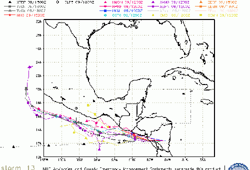
Clark Evans Track Plot of Julia
Other Model Charts from Clark
Clark Evans Top 10 Analog Storms for Julia
More model runs on from RAL/Jonathan Vigh's page
NRL Info on Julia -- RAMMB Info
COD Atlantic Satellite View
Edited by CFHC (Tue Nov 01 2022 09:52 AM)
 Threaded


