8:30 AM EST 1 August 2023 Update
As we enter August, Invest 96L chances have lowered for development to 50% and likely will decrease more as it's generally moving into a more unfavorable area in the next few days. 97L is over colder water and much less likely to develop now.
In general the Atlantic should remain quiet elsewhere for at least the next 8-10 days or so.
8:30 AM EST 30 July 2023 Update
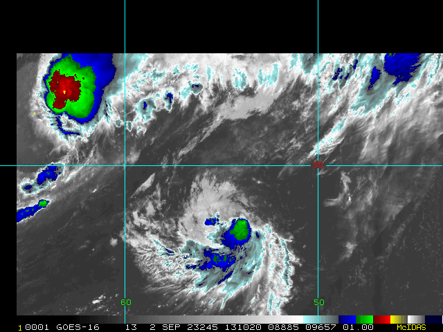
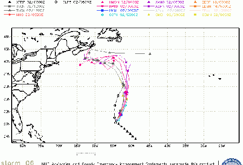
The area that was near Jacksonville that spun up a few days ago, but made landfall before it could get developed is now offshore of Myrtle Beach and now has a 20% chance to develop as it moves out to sea. Thankfully away from any land areas (including Bermuda), this area is now being tracked as invest 97L.
Beyond that the area to the east an area tracked as Invest 96L has a 70% chance to develop, but it also will remain out to sea.
Those at the beaches along SC/NC may want to watch for rip currents.
Outside of these areas nothing else is expected at least for the next week and half or so.
8:30 AM EST 27 July 2023 Update
The area off Florida this morning (a weak surface trough) is not expected to develop but should bring a good deal of rain to the Bahamas and Florida later today, especially along the east coast, particularly the Space and Treasure Coasts, and inland toward Okeechobee and Osceola county..
Out in the Atlantic a wave (not currently tagged as an Invest) has a 40% chance to develop over the next 7 days. It is expected to stay east of the Caribbean islands, but Bermuda may need to watch it later.
8:30 AM EST 21 July 2023 Update
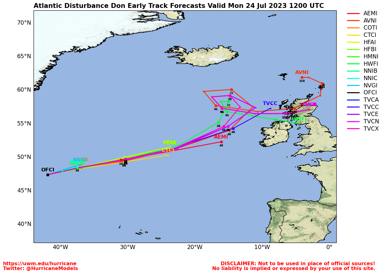
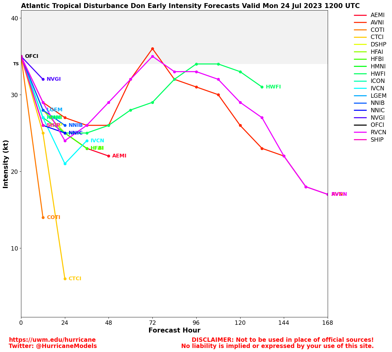
Tropical Storm Don is still spinning in the Atlantic well away from land and expected to dissipate late Sunday or Monday.
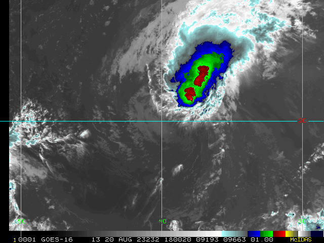
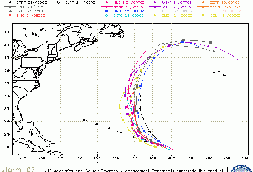
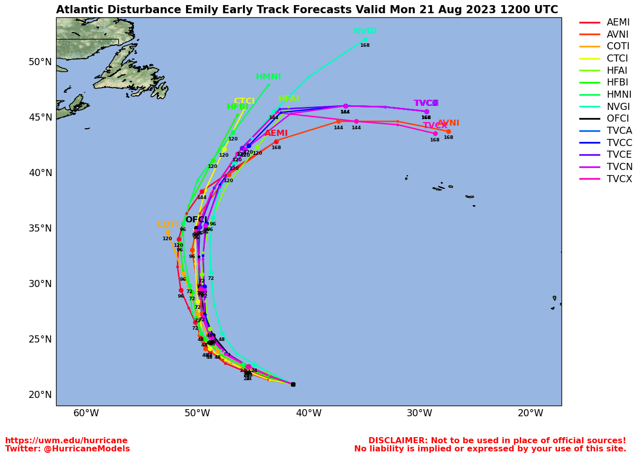
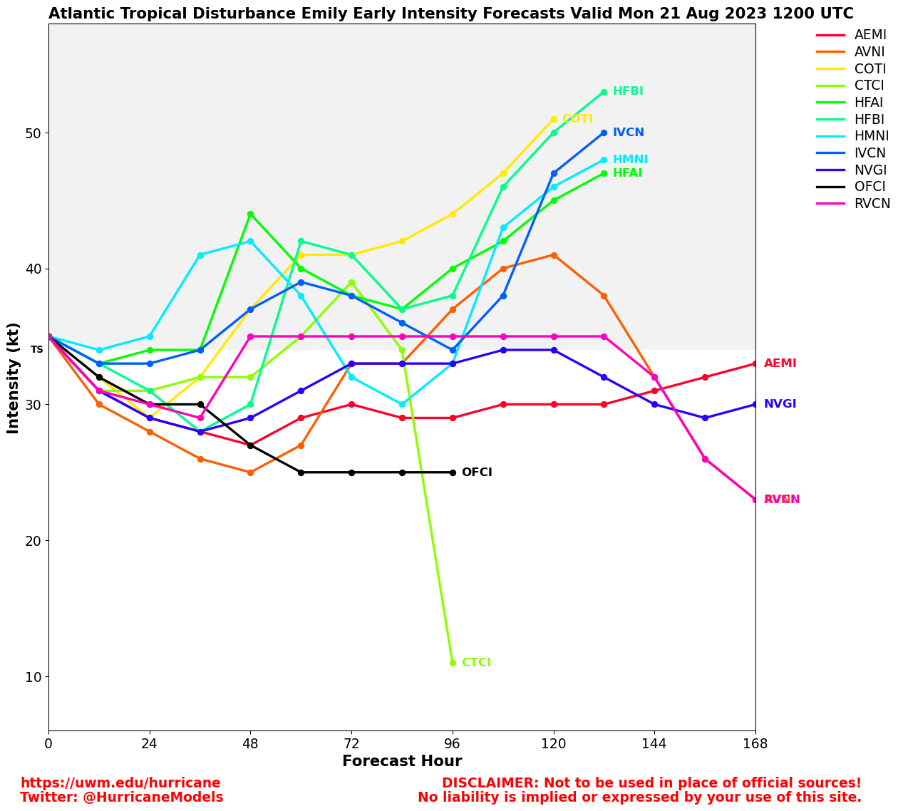
The relatively small area in the Central Atlantic (Invest 95L) now has a 40% chance to develop over the next 7 days. Consolidating from a broad area, the currently small size of the low makes intensity a bit more difficult to forecast, so those in the leeward Islands of the Caribbean will want to keep watch on this for Tuesday or Wednesday. Global models tend not to handle the intensity changes in small systems well, but the general rule of thumb for this development area may apply here, where a stronger storm may attempt to go further north in this area where a weaker one would move more to the west. It is very much worth watching next week for the Caribbean.
StormCarib Reports from the Caribbean Islands
Caribbean Weather Observations
Barbados Brohav Weather Fax
Full Caribbean Radar Composite
Caribbean Broadcast Corporation (TV/Radio from Antilles)
San Juan, PR NWS Page
Various Caribbean Radio Stations
DR1 Dominican Republic Hurricanes
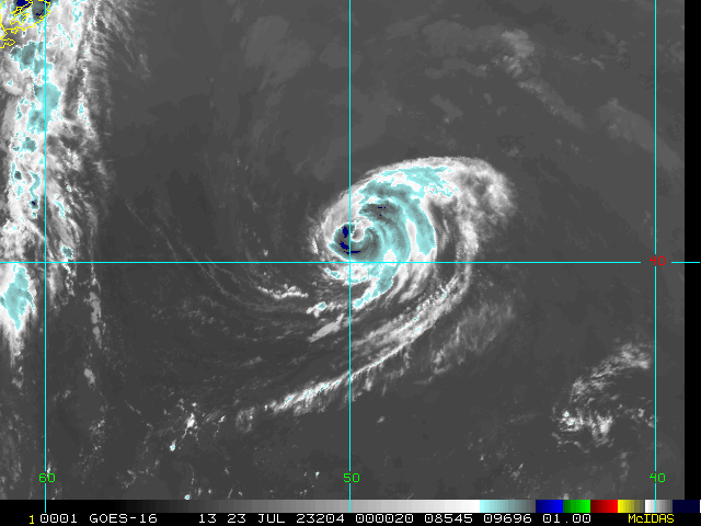
9:15 PM EST Thu Jul 20 2023 Update
Tropical Storm Don Continues to meander and probably will until Sunday or Monday when it should dissipate. The area in the Central Atlantic is now being tracked as Invest 95L and has a 30% chance to develop over the next 7 days. Those in the East Caribbean islands should keep an eye out, however the area is very wide and may take a while to get going, if at all. If 95L develops it may be a small (in size) storm which may make intensity very difficult to forecast.
4:15 PM HST Tue Jul 18 2023 Update
Former East Pac Major Hurricane Calvin, the first Major hurricane of the 2023 Pacific Hurricane Season, tracked into the Central Pacific and is now bearing down on Hawaii, having regained some strength again after a pronounced weakening. Most intense impacts are likely to be experienced along windward and south-facing portions of Hawaii County.
-Ciel
Original Update
This July, other than Subtropical Storm Don,has been a typical July for the Atlantic Hurricane Season. However there are a few signs on some of the global model ensembles that activity may be on the rise later this month from the ensembles. So there may be something to watch late next week into the following week around the Caribbean, but chances are still low.
However, there's quite a bit of possibility for shear in that time frame, so anything that tries to get going may have a rough time to get going because of that fact. However, sea surface temperatures are very high in many areas around Florida, the Bahamas and in and around the
Caribbean. So anything that does find a window of low shear may have a chance to develop, this is likely the next area to watch beyond Don. The forecast lounge has more on this potential system.
Don has weakened into a subtropical depression but is forecast to regain strength as it loops around in the Central Atlantic.
Invest 96L Event Related Links
SFWMD Model Plot (Animated Model Plot) SFWMD Hurricane Page
[https://flhurricane.com/floatanimator.php?year=2023&storm=6 Flhurricane Satellite Floater Animation of 96L
GOES Floater
Animated Model Plot of 96L
Clark Evans Track Model Plot of 96L
(Animated!) Model Plots in Google Earth - In Google Maps
Clark Evans Intensity Model Plot of 96L (Animated!)
Clark Evans Track Plot of 96L
Other Model Charts from Clark
Clark Evans Top 10 Analog Storms for 96L
More model runs on from RAL/Jonathan Vigh's page
NRL Info on 96L -- RAMMB Info
COD Atlantic Satellite View
Invest 97L Event Related Links
SFWMD Model Plot (Animated Model Plot) SFWMD Hurricane Page
[https://flhurricane.com/floatanimator.php?year=2023&storm=7 Flhurricane Satellite Floater Animation of 97L
GOES Floater
Animated Model Plot of 97L
Clark Evans Track Model Plot of 97L
(Animated!) Model Plots in Google Earth - In Google Maps
Clark Evans Intensity Model Plot of 97L (Animated!)
Clark Evans Track Plot of 97L
Other Model Charts from Clark
Clark Evans Top 10 Analog Storms for 97L
More model runs on from RAL/Jonathan Vigh's page
NRL Info on 97L -- RAMMB Info
COD Atlantic Satellite View
Don Event Related Links
SFWMD Model Plot (Animated Model Plot) SFWMD Hurricane Page
[https://flhurricane.com/floatanimator.php?year=2023&storm=5 Flhurricane Satellite Floater Animation of Don
GOES Floater
Animated Model Plot of Don
Clark Evans Track Model Plot of Don
(Animated!) Model Plots in Google Earth - In Google Maps
Clark Evans Intensity Model Plot of Don (Animated!)
Clark Evans Track Plot of Don
Other Model Charts from Clark
Clark Evans Top 10 Analog Storms for Don
More model runs on from RAL/Jonathan Vigh's page
NRL Info on Don -- RAMMB Info
COD Atlantic Satellite View
Calvin in the Pacific should be watched by Hawaii, but colder water temperatures will keep that weak to just be a rain event for parts of the islands, however a Tropical Storm Watch could be issued for portions of the main Hawaiian Islands later today, and interests in Hawaii should closely monitor the latest forecast updates.
Central Pacific Hurricane Center
Radar:
South Shore Big Island, HI Radar Radar Loop
(Latest Static)
Kohala, HI (Big Island) Radar Radar Loop
(Latest Static)
Molokai, HI (Maui/Oahu) Radar Radar Loop
(Latest Static)
Kauai, HI Radar Radar Loop
(Latest Static)
River/Stream Gauges in Hawaii
Hawaii Power Outage Map
Hawaiian Media:
TV:
KITV 4 - Honolulu (ABC)
KHON 2 - Honolulu (Fox)
Hawaii News Now KGMB 9 (CBS)/KHNL 13 (NBC)
Newspaper:
Hawaii 24/7 (Big Island Newspaper)
Hawaii Tribune-Herald
Maui News
Honolulu Star Advertiser
Other:
Big Island News Now
Hawaii Tracker Big Island News
 Threaded


