8:00 AM EDT 21 August 2023 Update
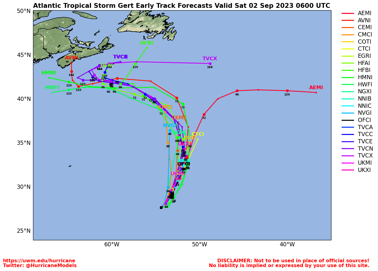
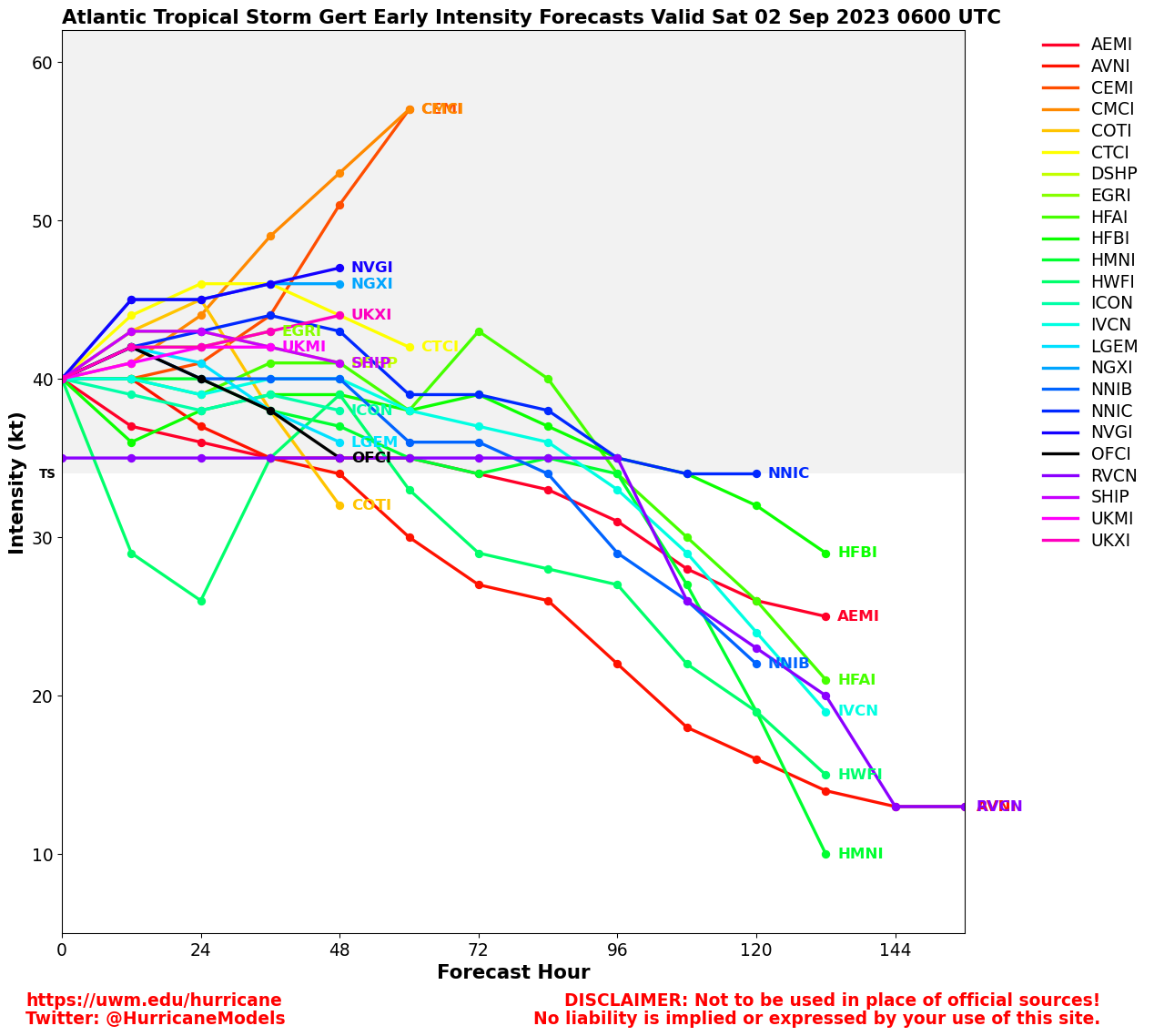
Tropical Storm Gert formed overnight from Tropical Depression Six, still expected to be short-lived. Harold and Idalia are the next two names.
It's extremely busy in the Atlantic, but only two threats to land at the moment.
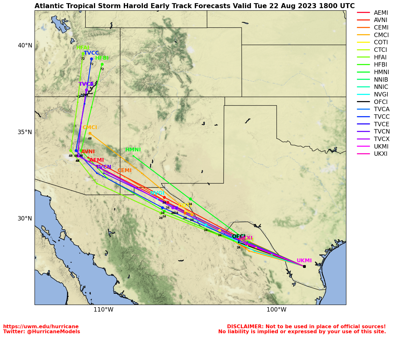
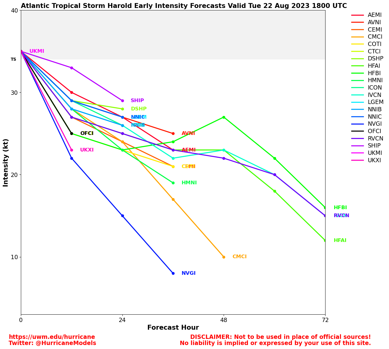
91L in the Gulf has a 80% chance to develop, those in the western Gulf of Mexico should monitor the progress of this system. Tropical storm watches or warnings may be necessary on Monday for portions of the southern Texas and northern Mexico. The next name is now Harold.
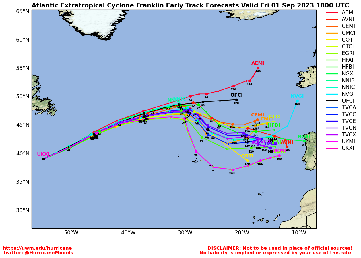
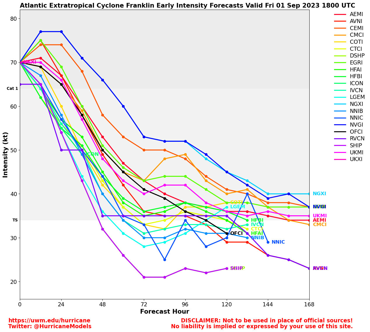
Tropical Storm Franklin has developed from 90L and Tropical Storm Warnings and Watches are up for Hispaniola as it approaches. Beyond this those in Bermuda may need to watch.
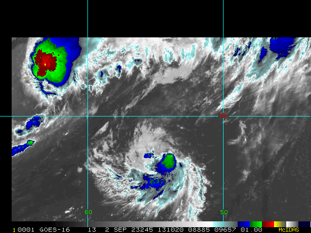
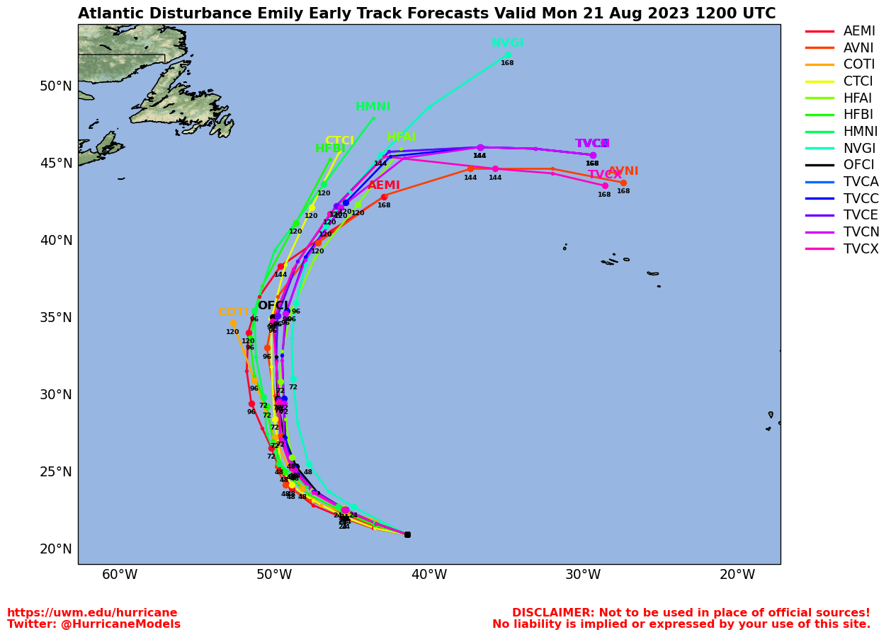
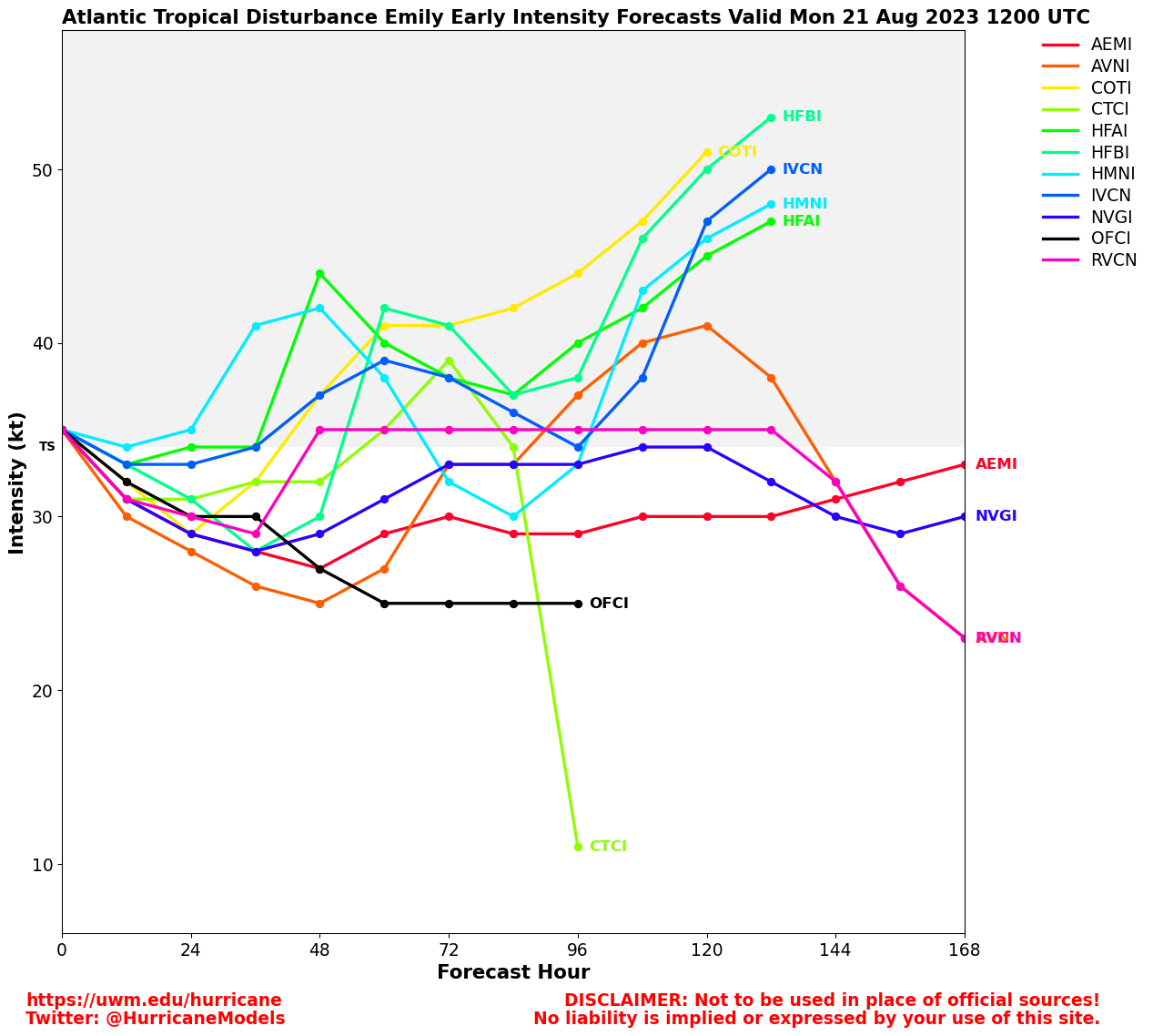
Emily continues out to sea and the final area 92L has a 70% chance to develop. Another area, currently not on the Outlook may show up later this week near the Gulf or Western Caribbean.
The last advisory for Tropical Storm Hilary was issued in Nevada. Flooding rains continue in parts of Nevada, Northern California, Interior Oregon, and Idaho. Flooding in southern California was varied, but large sections of I-10 are closed due to flooding around Palm Springs. Some localized areas in California did worse than others.
4:45 PM EDT 20 August 2023 Update
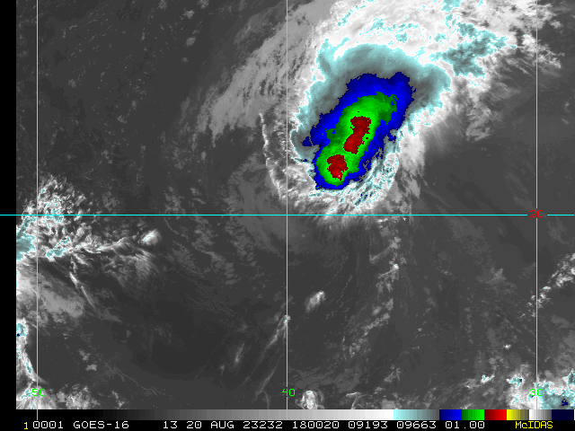
Invest 98L was upgraded to Tropical Storm Emily earlier today. 50 MPH sheared tropical cyclone as of 5PM.
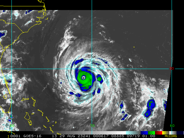
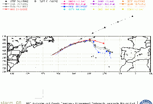
Invest 90L is being upgraded to Tropical Storm Franklin at 5PM. Franklin is a moisture-laden tropical storm capable of causing severe flooding in portions of the Caribbean, such as Hispaniola and Puerto Rico, and warrants being closely monitored for interests from the Greater Antilles to Bermuda and eastern Canada.
Lounges are open for deeper dives into model forecasts and personal best guesses.
5:45 AM EDT 20 August 2023 Update
Invests 98L and 90L are likely to be declared Tropical Cyclones at any time today, becoming SEVEN and/or EIGHT. 98 probably just spins fish far out at sea. However, 90 is a threat in the Caribbean and looks set to produce storm or hurricane conditions there over the next few days before possibly also heading off towards Bermuda later next week.
Elsewhere, the disturbance near Florida continues heading towards Texas, yet another vigorous wave has rolled off Africa, and Hilary in the eastern Pacific is making for rare weather in the southwest, potentially resulting in some catastrophic flooding.
4:00PM EDT 19 August 2023 Update
Advisories are being prepared for TD SIX in the central Atlantic (Formerly Invest 99L). SIX Lounge
Recon missions have tentatively been scheduled for Sunday to investigate what is now TD SIX as well as Invest 90L to its west.
7:30AM EDT 19 August 2023 Update
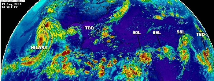
We kick off the first full day of the weekend with now five areas to watch in the Atlantic: Bahamas disturbance with strong model support for Gulf development, NEW Invest 90L 90L Forecast Lounge approaching the Lesser Antilles, Invest 99L that is - being honest - probably classifiable already, 98L on the cusp of being classifiable, and yet another vigorous wave rolling into the far eastern Atlantic likely to get Invest tagged as well.
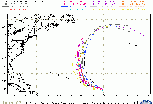
Once again, Hurricane Hilary takes the show with a very rare setup that is taking this very strong tropical cyclone into California and other parts of the southwest. Flooding will be the #1 threat - and not just for the deserts of California - as Hilary's moisture plume will be swept all around the Heat Dome in the middle of the country.
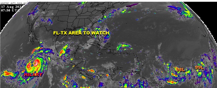
8AM EDT 18 August 2023 Update
Four Atlantic areas continue, Gulf of Mexico area could wind up actually in the Gulf on Sunday, and arriving toward Texas on Tuesday. 30% chance to develop.
The area east of the lesser Antilles (also needs to be watched closely, especially for the Antilles and Caribbean islands) is up to 30% chance to develop.
The area east of that, 99L, is down a bit to 40%, and the far east area, 98L, has a 70% chance to develop. The last two areas are unlikely to affect land areas.
Hilary in the East Pacific is now a Category 4 hurricane, rainfall is the biggest potential issue for Southern California. Particularly areas that don't drain well, urban areas, and arroyos in the desert areas. Those in southern California, especially interior desert areas, western Arizona, and Nevada will likely see much of the flooding rain.
Hilary will likely stay a major hurricane until Sunday when it should begin to rapidly weaken over colder water (or on the Baja if it landfalls there) However it will likely still be a tropical storm by the time it reaches southern California, especially if it doesn't landfall before then, therefore tropical storm watches will likely be extended north into the Baja and possibly into Southern California later today (afternoon/evening).
Original Update
Conditions for tropical cyclone development in the Tropical Atlantic have now gone from very unfavorable to modestly-conducive-looking-to-become-even-more-conducive-over-the-foreseeable-future, and multiple Areas to Watch abound and are forecast. As of this update, two of these have just been Invest tagged in the eastern Atlantic, 98L and 99L.
Invest 98L is presently a broad area of low pressure associated with a tropical wave centered west-southwest of the Cabo Verde Islands. Plenty of time to watch this one, which should it develop sooner rather than later, would likely be steered well away from the .
Invest 99L to 98L's west is a even more amorphous at the time, as merely an elongated trough of low pressure about 800-900 miles west-southwest of the Cabo Verdes. Again, it also gives us plenty of time to track.
A couple more Areas of Interest to the west of Invests 98L and 99L also exist, but have not yet been Invest tagged. Presently, and of greatest immediate interest, much closer to home convection and moisture associated with a stalled frontal boundary is set to be reinforced and invigorated by a moisture surge from the deep tropics over the coming days in the vicinity of Florida. Conditions for development look favorable to very favorable by the early to middle part of next week and even though initial odds for development are low, they will probably be rising, and a Lounge has been opened on this forecast feature. Likely track of this forecast system would be west across the northern GOM. FL-TX Area to Watch Forecast Lounge
Not to be outdone and as a reminder that transition to a strong El Niño is underway, Tropical Storm Hilary in the eastern Pacific has a chance to become the first tropical storm to make landfall on California since 1939. Already, Los Angeles is in the official Cone of Uncertainty, something it hasn't ever been since fixed cone radii were provided since 2008, this in and of itself already a very rare occurrence EPAC Hilary Forecast Lounge
Southwest Storm Event Links and Media
NHC East Pacific Page
San Diego Radar
San Diego, CA Radar Radar Loop
(Latest Static)
Santa Ana/Anaheim, CA Radar Radar Loop
(Latest Static)
Los Angeles/Oxnard, CA Radar Radar Loop
(Latest Static)
Yuma, AZ Radar Radar Loop
(Latest Static)
Las Vegas, NV Radar Radar Loop
(Latest Static)
Area Forecast Discussions
San Diego, CA -
Los Angeles, CA -
Las Vegas, NV -
Phoenix, AZ
Webcams
UC San Diego Alert California Webcam Network - Many fire and other Cameras
Caltrans Road Camera Network
Arizona Road Conditions and Cameras
Nevada Road Conditions and Cameras
Alert Wildfire Southwest US Camera Network
San Diego Harbor Cam
Rotating Live San Diego Cameras
Salton Sea Area Panoramic Cameras
Television:
-
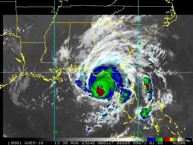
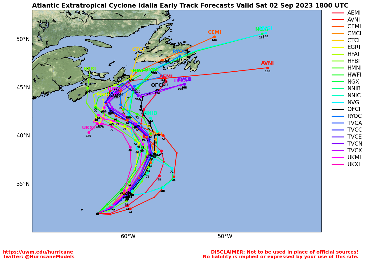
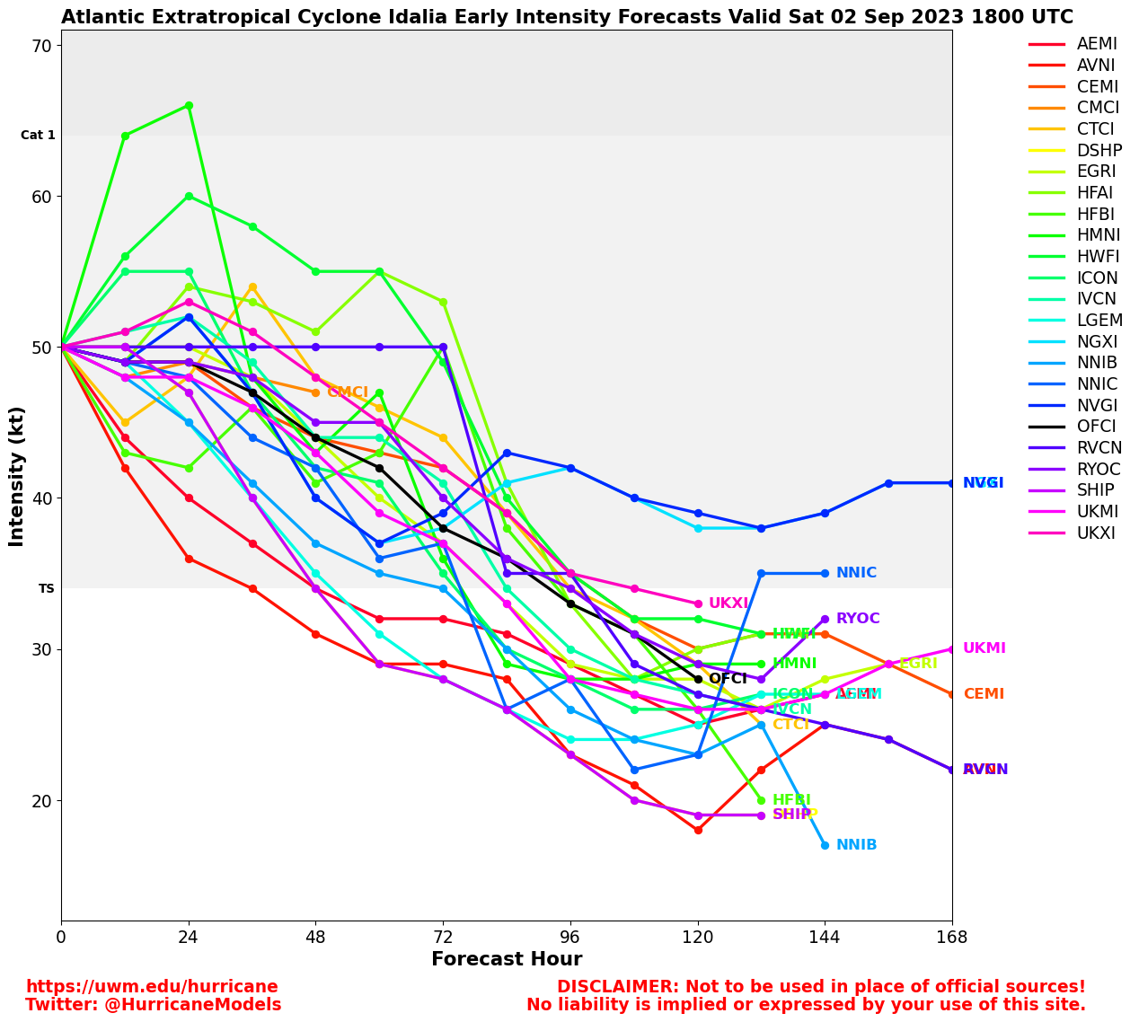
Potential Tropical Cyclone Nine Event Related Links
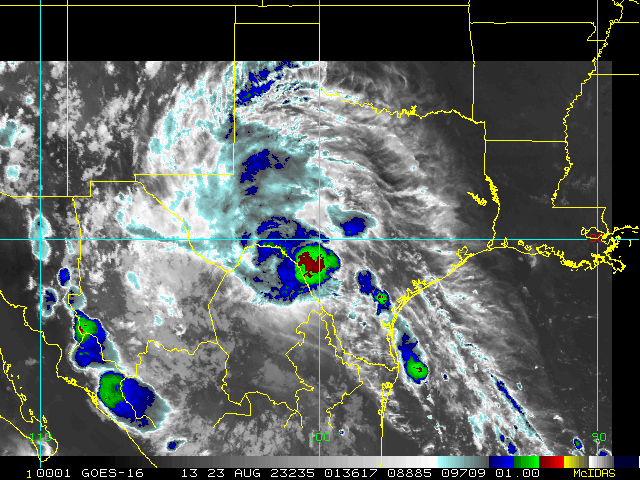
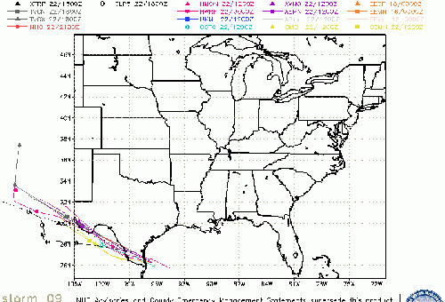
SFWMD Model Plot (Animated Model Plot) SFWMD Hurricane Page
[https://flhurricane.com/floatanimator.php?year=2023&storm=9 Flhurricane Satellite Floater Animation of Nine
GOES Floater
Animated Model Plot of Nine
Clark Evans Track Model Plot of Nine
(Animated!) Model Plots in Google Earth - In Google Maps
Clark Evans Intensity Model Plot of Nine (Animated!)
Clark Evans Track Plot of Nine
Other Model Charts from Clark
Clark Evans Top 10 Analog Storms for Nine
More model runs on from RAL/Jonathan Vigh's page
NRL Info on Nine -- RAMMB Info
COD Atlantic Satellite View
Franklin Event Related Links
SFWMD Model Plot (Animated Model Plot) SFWMD Hurricane Page
[https://flhurricane.com/floatanimator.php?year=2023&storm=8 Flhurricane Satellite Floater Animation of Franklin
GOES Floater
Animated Model Plot of Franklin
Clark Evans Track Model Plot of Franklin
(Animated!) Model Plots in Google Earth - In Google Maps
Clark Evans Intensity Model Plot of Franklin (Animated!)
Clark Evans Track Plot of Franklin
Other Model Charts from Clark
Clark Evans Top 10 Analog Storms for Franklin
More model runs on from RAL/Jonathan Vigh's page
NRL Info on Franklin -- RAMMB Info
COD Atlantic Satellite View
Emily Event Related Links
SFWMD Model Plot (Animated Model Plot) SFWMD Hurricane Page
[https://flhurricane.com/floatanimator.php?year=2023&storm=7 Flhurricane Satellite Floater Animation of Emily
GOES Floater
Animated Model Plot of Emily
Clark Evans Track Model Plot of Emily
(Animated!) Model Plots in Google Earth - In Google Maps
Clark Evans Intensity Model Plot of Emily (Animated!)
Clark Evans Track Plot of Emily
Other Model Charts from Clark
Clark Evans Top 10 Analog Storms for Emily
More model runs on from RAL/Jonathan Vigh's page
NRL Info on Emily -- RAMMB Info
COD Atlantic Satellite View
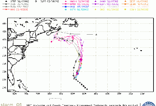
Gert Event Related Links
SFWMD Model Plot (Animated Model Plot) SFWMD Hurricane Page
[https://flhurricane.com/floatanimator.php?year=2023&storm=6 Flhurricane Satellite Floater Animation of Gert
GOES Floater
Animated Model Plot of Gert
Clark Evans Track Model Plot of Gert
(Animated!) Model Plots in Google Earth - In Google Maps
Clark Evans Intensity Model Plot of Gert (Animated!)
Clark Evans Track Plot of Gert
Other Model Charts from Clark
Clark Evans Top 10 Analog Storms for Gert
More model runs on from RAL/Jonathan Vigh's page
NRL Info on Gert -- RAMMB Info
COD Atlantic Satellite View
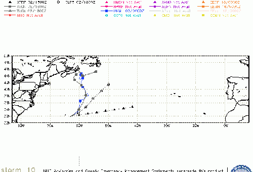
Invest 92L Event Related Links
SFWMD Model Plot (Animated Model Plot) SFWMD Hurricane Page
[https://flhurricane.com/floatanimator.php?year=2023&storm=10 Flhurricane Satellite Floater Animation of 92L
GOES Floater
Animated Model Plot of 92L
Clark Evans Track Model Plot of 92L
(Animated!) Model Plots in Google Earth - In Google Maps
Clark Evans Intensity Model Plot of 92L (Animated!)
Clark Evans Track Plot of 92L
Other Model Charts from Clark
Clark Evans Top 10 Analog Storms for 92L
More model runs on from RAL/Jonathan Vigh's page
NRL Info on 92L -- RAMMB Info
COD Atlantic Satellite View
StormCarib Reports from the Caribbean Islands
Caribbean Weather Observations
Barbados Brohav Weather Fax
Full Caribbean Radar Composite
Caribbean Broadcast Corporation (TV/Radio from Antilles)
San Juan, PR NWS Page
Various Caribbean Radio Stations
DR1 Dominican Republic Hurricanes
Edited by MikeC (Mon Aug 21 2023 10:40 AM)
 Threaded


