cieldumort
Moderator

Reged: Mon
Posts: 2305
Loc: Austin, Tx
|
|
1:15PM EDT 30 August 2023 Update
A fortuitously timed Eyewall Replacement Cycle began as Idalia made landfall, weakening the hurricane, and thus lowering the maximum sustained winds. Nonetheless, severe impacts were and still are widely felt.
As of this update, Idalia continues pushing inland, analyzed by as a Cat 1. The center is clearly located east of Valdosta, GA.
NHC is now ending hourly advisories. The next intermediate advisory will be issued at 2:00 PM EDT.
9:00PM EDT 29 August 2023 Update
Idalia is continuing to rapidly intensify. Interests along the west and northwest Florida coast, especially those in Surge Warning and Hurricane Warning areas should now be rushing any last minute preps to protect life and property to completion. Impacts will also be felt well inland. Power outages may last days or even weeks. Hazards such as felled and falilng trees, roof and even building failures, rapidly rising water, could soon make passage to safety difficult and potentially deadly in your area.
1:30PM EDT 29 August 2023 Update
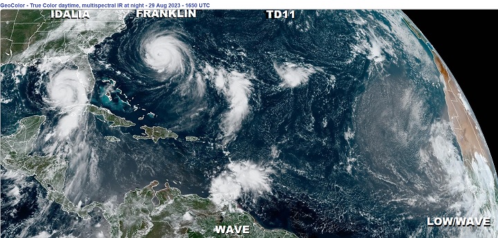
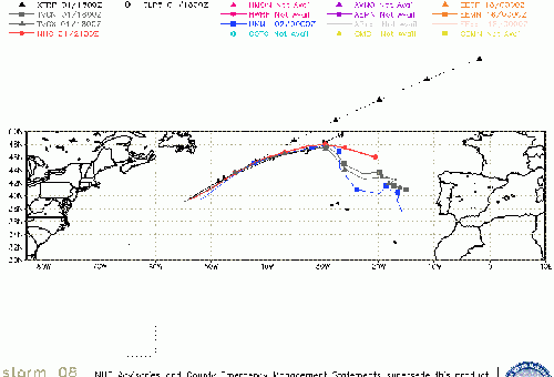
This wide view of the Tropical Atlantic really highlights how much larger Hurricane Idalia has become. While the cyclone has a well-defined and tight inner core with an increasingly healthy eyewall, the reach of Idalia's winds and heavy rains extends out up to hundreds of miles from the center. This not only will prolong the wind and rain over many locations, but also dramatically increase the fetch of storm surge. Deadly storm surge.
This image is also a reminder that the entire basin is still favorable for development, with two more Tropical Cyclones being tracked (Franklin and T.D. 11), as well as two other areas of interest.
Original Update
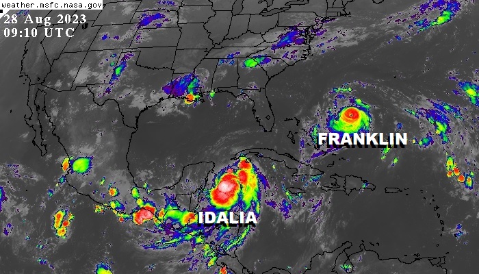
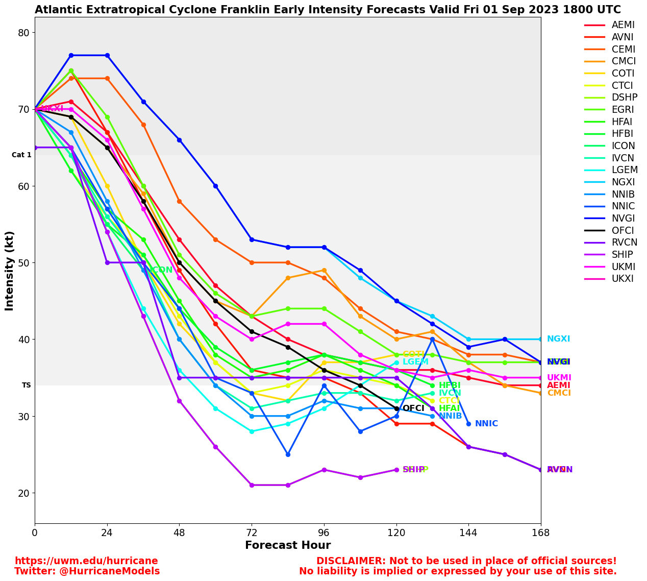
Overnight, Hurricane Franklin became the first Major Hurricane of the 2023 Atlantic Hurricane Season, and as of the 4AM CT Advisory, Hurricane Idalia is now officially forecast to become a Major Hurricane as well.
The time for Floridians to prepare for potentially life-threatening storm surge, wind and rain is today. By Tuesday conditions (and not just the weather) may start to become far too difficult for many.
Models are ingesting flight after flight of recon data now, and this should assist forecasters. We go into them in greater detail in the Idalia Forecast Lounge , which is also a good place to discuss pure informed speculation and best guesses as to Idalia's future.
Social Media: Follow us on Facebook
Tropical Storm Idalia Local Statement Advisory Number 7
National Weather Service Tallahassee FL AL102023
515 AM EDT Mon Aug 28 2023 /415 AM CDT Mon Aug 28 2023/
This product covers eastern Florida panhandle, Florida Big Bend, southeastern Alabama and southwestern GeorgiaQuote:
...IDALIA NOW FORECAST TO BECOME A MAJOR HURRICANE BEFORE LANDFALL...
...POTENTIAL IMPACTS...
-----------------
* SURGE:
Prepare for life-threatening surge having possible devastating impacts across Taylor and Dixie Counties. Potential impacts in this area include:
- Widespread deep inundation, with storm surge flooding greatly accentuated by powerful battering waves. Structural damage to buildings, with many washing away. Damage greatly compounded from considerable floating debris. Locations may be uninhabitable for an extended period.
- Near-shore escape routes and secondary roads washed out or severely flooded. Flood control systems and barriers may become stressed.
- Extreme beach erosion. New shoreline cuts possible.
- Massive damage to marinas, docks, boardwalks, and piers. Numerous small craft broken away from moorings with many lifted onshore and stranded.
Also, prepare for life-threatening surge having possible significant to extensive impacts across Wakulla and Jefferson Counties.
Also, prepare for locally hazardous surge having possible limited impacts across Franklin and Gulf Counties.
Elsewhere across eastern Florida panhandle, Florida Big Bend, southeastern Alabama and southwestern Georgia, little to no impact is anticipated.
* WIND:
Prepare for life-threatening wind having possible devastating impacts across coastal Taylor and Dixie Counties. Potential impacts in this area include:
- Structural damage to sturdy buildings, some with complete roof and wall failures. Complete destruction of mobile homes. Damage greatly accentuated by large airborne projectiles. Locations may be uninhabitable for weeks or months.
- Numerous large trees snapped or uprooted along with fences and roadway signs blown over.
- Many roads impassable from large debris, and more within urban or heavily wooded places. Many bridges, causeways, and access routes impassable.
- Widespread power and communications outages.
Also, prepare for life-threatening wind having possible limited to extensive impacts across the remainder of the Florida Big Bend.
* FLOODING RAIN:
Prepare for life-threatening rainfall flooding having possible extensive impacts in the far eastern Big Bend and Suwannee Valley. Potential impacts include:
- Major rainfall flooding may prompt many evacuations and rescues.
- Rivers and tributaries may rapidly overflow their banks in multiple places. Small streams, creeks, and ditches may become dangerous rivers. Flood control systems and barriers may become stressed.
- Flood waters can enter many structures within multiple communities, some structures becoming uninhabitable or washed away. Many places where flood waters may cover escape routes. Streets and parking lots become rivers of moving water with underpasses submerged. Driving conditions become dangerous. Many road and bridge closures with some weakened or washed out.
Prepare for dangerous rainfall flooding having possible limited to significant impacts across southeast Alabama, southwest and south central Georgia, and the Florida Panhandle and western Big Bend.
* TORNADOES:
Prepare for a dangerous tornado event having possible significant impacts across the southeast Big Bend. Potential impacts include:
- The occurrence of scattered tornadoes can hinder the execution of emergency plans during tropical events.
- Several places may experience tornado damage with a few spots of considerable damage, power loss, and communications failures.
- Locations could realize roofs torn off frame houses, mobile homes demolished, boxcars overturned, large trees snapped or uprooted, vehicles tumbled, and small boats tossed about. Dangerous projectiles can add to the toll.
Prepare for a tornado event having possible limited impacts across the eastern and coastal Big Bend and Lowndes and Lanier Counties in Georgia.
Elsewhere across eastern Florida panhandle, Florida Big Bend, southeastern Alabama and southwestern Georgia, little to no impact is anticipated.
PRECAUTIONARY/PREPAREDNESS ACTIONS
----------------------------------
* EVACUATIONS:
Listen to local official for recommended preparedness actions, including possible evacuation. If ordered to evacuate, do so immediately.
For those not under evacuation orders, assess the risk from wind, falling trees, and flooding at your location. If you decide to move, relocate to a safer location nearby. If you do not relocate, help keep roadways open for those under evacuation orders.
If evacuating, leave with a destination in mind and allow extra time to get there. Take your emergency supplies kit. Gas up your vehicle ahead of time.
* OTHER PREPAREDNESS INFORMATION:
Now is the time to check your emergency plan and emergency supplies kit and take necessary actions to protect your family and secure your home or business.
SUMMARY OF WATCHES AND WARNINGS IN EFFECT:
A Hurricane Warning is in effect for...
* Pinar del Rio Cuba
A Tropical Storm Warning is in effect for...
* Yucatan Peninsula from Tulum to Rio Lagartos, including Cozumel
* Isle of Youth Cuba
* Dry Tortugas Florida
A Storm Surge Watch is in effect for...
* Chokoloskee to Indian Pass Florida, including Tampa Bay
A Hurricane Watch is in effect for...
* Englewood to Indian Pass Florida, including Tampa Bay
A Tropical Storm Watch is in effect for...
* South of Englewood to Chokoloskee Florida
* Lower Florida Keys west of the west end of the Seven Mile Bridge
Idalia Event Related Links
SFWMD Model Plot (Animated Model Plot) SFWMD Hurricane Page
[https://flhurricane.com/floatanimator.php?year=2023&storm=10 Flhurricane Satellite Floater Animation of Idalia
GOES Floater
Animated Model Plot of Idalia
Clark Evans Track Model Plot of Idalia
(Animated!) Model Plots in Google Earth - In Google Maps
Clark Evans Intensity Model Plot of Idalia (Animated!)
Clark Evans Track Plot of Idalia
Other Model Charts from Clark
Clark Evans Top 10 Analog Storms for Idalia
More model runs on from RAL/Jonathan Vigh's page
NRL Info on Idalia -- RAMMB Info
COD Atlantic Satellite View
Franklin Event Related Links
SFWMD Model Plot (Animated Model Plot) SFWMD Hurricane Page
[https://flhurricane.com/floatanimator.php?year=2023&storm=8 Flhurricane Satellite Floater Animation of Franklin
GOES Floater
Animated Model Plot of Franklin
Clark Evans Track Model Plot of Franklin
(Animated!) Model Plots in Google Earth - In Google Maps
Clark Evans Intensity Model Plot of Franklin (Animated!)
Clark Evans Track Plot of Franklin
Other Model Charts from Clark
Clark Evans Top 10 Analog Storms for Franklin
More model runs on from RAL/Jonathan Vigh's page
NRL Info on Franklin -- RAMMB Info
COD Atlantic Satellite View
Tropical Depression Eleven Event Related Links
SFWMD Model Plot (Animated Model Plot) SFWMD Hurricane Page
[https://flhurricane.com/floatanimator.php?year=2023&storm=11 Flhurricane Satellite Floater Animation of TD#11
GOES Floater
Animated Model Plot of TD#11
Clark Evans Track Model Plot of TD#11
(Animated!) Model Plots in Google Earth - In Google Maps
Clark Evans Intensity Model Plot of TD#11 (Animated!)
Clark Evans Track Plot of TD#11
Other Model Charts from Clark
Clark Evans Top 10 Analog Storms for TD#11
More model runs on from RAL/Jonathan Vigh's page
NRL Info on TD#11 -- RAMMB Info
COD Atlantic Satellite View
Tampa Area Media:
Bay News 9
WFLA News 8 (NBC)
Bay Action News (ABC)
WTSP Channel 10 (CBS)
My Fox Tampa Bay
WWSB ABC 7 Sarasota
Tampa Bay Times
Tampa Bay Online
Sarasota Herald Tribune
970 WFLA Tampa News/Talk Radio
Florida Panhandle Media/Links
WJHG TV 7 (NBC) Panama City Beach, FL
WMBB TV 13 (ABC) Panama City Beach, FL / My Panhandle
WCTV 6 (CBS) Tallahassee, FL
WTXL 27 (ABC) Tallahassee, FL
WTWC-DT2 49 (Fox) Tallahassee, FL
WTWC 40 (NBC) Tallahassee, FL
WEAR TV 3 (ABC) Pensacola, FL
Newspapers
Panama City Beach News Herald
Tallahassee Democrat
Radio (some)
News Talk 94.5 WFLA Panama City Beach
]https://wflafm.iheart.com/ 100.7 WFLA News Radio Tallahassee, FL]
Power Outage
Florida Power Outage Map
Alabama Power Outage Map
Southwest Florida (Naples/Ft.Myers) Area Media:
WINK News 11 Fort Myers CBS
WBBH NBC 2 Fort Myers NBC
ABC 7 Naples ABC
FOX 4 Florida Cape Coral FOX
WFSX Fox 92.5 News Radio
WCCF News Radio 1580 Port Charlotte
News Press
Naples Daily News
Northeast Gulf Links
Southeast Composite Radar Loop
(Latest Static)
Tampa Bay, FL Radar Radar Loop
(Latest Static)
Key West, FL Radar Radar Loop
(Latest Static)
Mobile, AL Radar Radar Loop
(Latest Static)
Tallahassee FL Radar Radar Loop
(Latest Static)
Northwest Florida Radar Radar Loop
(Latest Static)
Gulf of Mexico Satellite Imagery
SFWMD Full Florida Radar (Includes east LA, MS,AL) Loop with Storm Track
Area Forecast Discussions:
New Orleans -
Mississippi/Alabama/Pensacola -
Panhandle/Tallahassee -
Tampa/West Central Florida
Bermuda Newspapers/Media:
BerNews
Royal Gazette (Bermuda)
Bermuda Sun
Hott 107.5 Bermuda Radio
Storm Carib Bermuda Reports
Bermuda Weather Service
|
cieldumort
Moderator
Reged: Mon
Posts: 2305
Loc: Austin, Tx
|
|
Tropical Storm Idalia Local Statement Advisory Number 7
National Weather Service Tampa Bay Ruskin FL AL102023
515 AM EDT Mon Aug 28 2023
This product covers West Central and Southwest Florida
**IDALIA CONTINUES TO INTENSIFY WITH LIFE-THREATENING STORM SURGE AND
DANGEROUS WINDS BECOMING INCREASINGLY LIKELY FOR PORTIONS OF
FLORIDA**
NEW INFORMATION
---------------
* CHANGES TO WATCHES AND WARNINGS:
- None
* CURRENT WATCHES AND WARNINGS:
- A Storm Surge Watch and Hurricane Watch are in effect for
Coastal Citrus, Coastal Hernando, Coastal Hillsborough, Coastal
Levy, Coastal Manatee, Coastal Pasco, Coastal Sarasota, Inland
Citrus, and Pinellas
- A Storm Surge Watch and Tropical Storm Watch are in effect for
Coastal Charlotte and Coastal Lee
- A Hurricane Watch is in effect for Inland Hernando, Inland
Hillsborough, Inland Levy, Inland Manatee, Inland Pasco, Inland
Sarasota, and Sumter
- A Tropical Storm Watch is in effect for DeSoto, Hardee, Inland
Charlotte, Inland Lee, and Polk
* STORM INFORMATION:
- About 540 miles south-southwest of Mouth of Tampa Bay FL or
about 500 miles south-southwest of Fort Myers FL
- 20.1N 85.2W
- Storm Intensity 65 mph
- Movement North or 360 degrees at 7 mph
SITUATION OVERVIEW
------------------
Tropical Storm Idalia continues to intensify off of the Yucatan
Coast this morning. Idalia is forecast to move north and eventually
northeast across the eastern Gulf of Mexico, making its way towards
the Florida peninsula and intensifying to a major hurricane. Watches
remain in effect for West Central and Southwest Florida and adjacent
coastal waters.
The following are the primary hazards of concern with Idalia:
* Wind - Winds will increase Tuesday and remain gusty even after the
storm passes into Thursday. Hurricane force winds are possible across
much of the area and should be what residents prepare for, with
tropical storm force winds possible across the southern zones.
* Storm Surge - Areas across the Nature Coast are forecast
to see extreme life-threatening levels of storm surge, with
life-threatening surge also possible across west-central Florida.
The main period of coastal flooding looks to occur Tuesday afternoon
through early Thursday.
* Rainfall - The majority of the rainfall associated with the system
is forecast to fall Tuesday and Wednesday. A slight to moderate risk
for flooding is possible, mainly along the coast and across the
northern zones. Rainfall totals of 4 to 8 inches with locally higher
amounts up to 12 inches is possible.
POTENTIAL IMPACTS
-----------------
* WIND:
Prepare for life-threatening wind having possible devastating impacts
across the Nature Coast and Tampa Bay region. Potential impacts in
this area include:
- Structural damage to sturdy buildings, some with complete roof
and wall failures. Complete destruction of mobile homes. Damage
greatly accentuated by large airborne projectiles. Locations
may be uninhabitable for weeks or months.
- Numerous large trees snapped or uprooted along with fences and
roadway signs blown over.
- Many roads impassable from large debris, and more within urban
or heavily wooded places. Many bridges, causeways, and access
routes impassable.
- Widespread power and communications outages.
Also, prepare for life-threatening wind having possible limited to
extensive impacts across Southwest Florida.
* SURGE:
Prepare for life-threatening surge having possible devastating
impacts along the Nature Coast. Potential impacts in this area
include:
- Widespread deep inundation, with storm surge flooding greatly
accentuated by powerful battering waves. Structural damage to
buildings, with many washing away. Damage greatly compounded
from considerable floating debris. Locations may be
uninhabitable for an extended period.
- Near-shore escape routes and secondary roads washed out or
severely flooded. Flood control systems and barriers may become
stressed.
- Extreme beach erosion. New shoreline cuts possible.
- Massive damage to marinas, docks, boardwalks, and piers.
Numerous small craft broken away from moorings with many lifted
onshore and stranded.
Also, prepare for life-threatening surge having possible significant
to extensive impacts across Tampa Bay and Southwest Florida.
* FLOODING RAIN:
Prepare for life-threatening rainfall flooding having possible
extensive impacts across the Nature Coast. Potential
impacts include:
- Major rainfall flooding may prompt many evacuations and rescues.
- Rivers and tributaries may rapidly overflow their banks in
multiple places. Small streams, creeks, canals, and ditches may
become dangerous rivers. Flood control systems and barriers may
become stressed.
- Flood waters can enter many structures within multiple
communities, some structures becoming uninhabitable or washed
away. Many places where flood waters may cover escape routes.
Streets and parking lots become rivers of moving water with
underpasses submerged. Driving conditions become dangerous.
Many road and bridge closures with some weakened or washed out.
Prepare for dangerous rainfall flooding having possible limited to
significant impacts across Tampa Bay and Southwest Florida.
* TORNADOES:
Prepare for a dangerous tornado event having possible significant
impacts across West-Central Florida. Potential impacts
include:
- The occurrence of scattered tornadoes can hinder the execution
of emergency plans during tropical events.
- Several places may experience tornado damage with a few spots
of considerable damage, power loss, and communications failures.
- Locations could realize roofs torn off frame houses, mobile
homes demolished, boxcars overturned, large trees snapped or
uprooted, vehicles tumbled, and boats tossed about. Dangerous
projectiles can add to the toll.
Prepare for a tornado event having possible limited impacts across
Southwest Florida.
PRECAUTIONARY/PREPAREDNESS ACTIONS
----------------------------------
* EVACUATIONS:
Listen to local officials for recommended preparedness actions,
including possible evacuation. If ordered to evacuate, do so
immediately.
For those not under evacuation orders, assess the risk from wind,
falling trees, and flooding at your location. If you decide to move,
relocate to a safer location nearby. If you do not relocate, help
keep roadways open for those under evacuation orders.
* OTHER PREPAREDNESS INFORMATION:
When making safety and preparedness decisions, do not focus on the
exact forecast track since hazards such as flooding rain, damaging
wind gusts, storm surge, and tornadoes extend well away from the
center of the storm.
If you live in a place particularly vulnerable to flooding, such as
near the ocean or a large inland lake, in a low-lying or poor
drainage area, or near an already swollen river, plan to move to safe
shelter on higher ground.
Always heed the advice of local officials and comply with orders that
are issued. Do not needlessly jeopardize your life or the lives of
others.
* ADDITIONAL SOURCES OF INFORMATION:
- For information on appropriate preparations see ready.gov
- For information on creating an emergency plan see getagameplan.org
- For additional disaster preparedness information see redcross.org
|
cieldumort
Moderator
Reged: Mon
Posts: 2305
Loc: Austin, Tx
|
|
Tropical Storm Idalia Local Statement Advisory Number 7
National Weather Service Melbourne FL AL102023
534 AM EDT Mon Aug 28 2023
This product covers East Central Florida
**Tropical Storm Idalia Forecast to Strengthen into a Hurricane as
it Moves Into the Southeastern Gulf of Mexico Later Today**
NEW INFORMATION
---------------
* CHANGES TO WATCHES AND WARNINGS:
- A Tropical Storm Watch has been issued for Orange, Osceola, and
Seminole
* CURRENT WATCHES AND WARNINGS:
- A Tropical Storm Watch is in effect for Northern Lake, Orange,
Osceola, Seminole, and Southern Lake
* STORM INFORMATION:
- About 640 miles south-southwest of Leesburg FL
- 20.1N 85.2W - Storm Intensity 65 mph
- Movement North or 360 degrees at 7 mph
SITUATION OVERVIEW
------------------
The center of Tropical Storm Idalia is located around 125 miles
south of the tip of western Cuba early this morning. Idalia is
moving north at about 7 mph, with a continued northward motion
expected today and Tuesday. The storm is currently forecast to
approach the Florida Gulf coast Tuesday night into Wednesday as a
major hurricane.
Preparations should be ongoing for at least tropical storm
conditions by mid week.
A Tropical Storm Watch is now in effect for Lake, Seminole, Orange
and Osceola Counties, where confidence is highest in tropical storm
conditions occurring. Additional watches may be necessary for
portions of east-central Florida later this morning.
Showers, squalls and thunderstorms associated with outer rain bands
from Idalia may reach central Florida by late this afternoon, with
conditions further deteriorating Tuesday afternoon and evening as
Idalia accelerates north-northeastward across the eastern Gulf of
Mexico. As coverage of showers and squalls increases Tuesday
afternoon into Wednesday, the possibility of strong to damaging wind
gusts will also increase. Tropical storm force winds are forecast to
extend outward from the storm's center, potentially reaching
interior portions of east-central Florida Tuesday night into
Wednesday morning.
Based on the current forecast track, Idalia will make its closest
pass to east-central Florida late Tuesday night and early Wednesday
morning, continuing northeastward during the day on Wednesday.
While the heaviest rainfall from Idalia is currently forecast to
fall along the Gulf Coast and western Florida Peninsula, gusty
squalls will be capable of torrential downpours, especially Tuesday
and Wednesday over Lake County. One to two inches of rain from
Monday afternoon through Wednesday night is expected for coastal
areas and Okeechobee County and two to four inches are expected west
of I-95 from Brevard and Osceola Counties northward, with locally
higher amounts possible.
Locations in closer proximity to the center of Idalia, such as Lake
County in east-central Florida, may receive higher rainfall totals.
In addition to strong wind gusts, a threat for tornadoes is forecast
to develop as the center of Idalia moves into the eastern Gulf of
Mexico from Tuesday afternoon into Wednesday.
Incoming swell from Hurricane Franklin combined with winds from
Idalia will lead to high seas, rough surf, an increase in life-
threatening rip currents, and beach erosion Tuesday into Wednesday.
Do not let your guard down, especially in locations outside of the
current Tropical Storm Watch. Impacts from Idalia will be felt far
from the center of the storm. Now is the time to ensure your
hurricane supply kit is stocked and your safety plan is in place.
As Idalia becomes better organized through this afternoon,
additional changes to the current forecast are possible. Eastward
shifts in the forecast track would increase the potential for local
impacts, so continue to monitor the latest forecasts from the
National Hurricane Center and National Weather Service in Melbourne,
Florida.
POTENTIAL IMPACTS
-----------------
* WIND: Prepare for dangerous wind having possible significant
impacts across portions of east central Florida. Potential impacts
in this area include:
- Some damage to roofing and siding materials, along with damage
to porches, awnings, carports, and sheds. A few buildings
experiencing window, door, and garage door failures. Mobile homes
damaged, especially if unanchored. Unsecured lightweight objects
become dangerous projectiles.
- Several large trees snapped or uprooted, but with greater
numbers in places where trees are shallow rooted. Several fences
and roadway signs blown over.
- Some roads impassable from large debris, and more within urban
or heavily wooded places. A few bridges, causeways, and access
routes impassable.
- Scattered power and communications outages, but more prevalent
in areas with above ground lines.
* FLOODING RAIN: Prepare for dangerous rainfall flooding having
possible significant impacts across portions of east central
Florida. Potential impacts include:
- Moderate rainfall flooding may prompt several evacuations and
rescues.
- Rivers and tributaries may quickly become swollen with swifter
currents and overspill their banks in a few places, especially
in usually vulnerable spots. Small streams, creeks, canals and
ditches overflow.
- Flood waters can enter some structures or weaken foundations.
Several places may experience expanded areas of rapid inundation
at underpasses, low-lying spots, and poor drainage areas. Some
streets and parking lots take on moving water as storm drains and
retention ponds overflow. Driving conditions become hazardous.
Some road and bridge closures.
* TORNADOES: Prepare for a dangerous tornado event having possible
significant impacts across portions of east central Florida.
Potential impacts include:
- The occurrence of scattered tornadoes can hinder the execution of
emergency plans during tropical events.
- Several places may experience tornado damage with a few spots of
of considerable damage, power loss, and communications failures.
- Locations could realize roofs torn off frame houses, mobile
homes demolished, boxcars overturned, large trees snapped or
uprooted, vehicles tumbled, and small boats tossed about.
Dangerous projectiles can add to the toll.
* SURGE: Direct surge impacts from Idalia are not currently
anticipated at this time. However, larger swells and surf combined
with Hurricane Franklin will bring a threat for minor coastal
flooding and beach erosion.Locations more vulnerable to coastal
flooding and beach erosion, such as portions of the Volusia County
coast, should stay updated on the latest forecasts.
PRECAUTIONARY/PREPAREDNESS ACTIONS
----------------------------------
* EVACUATIONS: Listen to local official for recommended preparedness
actions, including possible evacuation. If ordered to evacuate, do
so immediately.
* OTHER PREPAREDNESS INFORMATION: Now is the time to check your
emergency plan and emergency supplies kit and take necessary
actions to protect your family and secure your home or business.
When making safety and preparedness decisions, do not focus on the
exact forecast track since hazards such as flooding rain, damaging
wind gusts, storm surge, and tornadoes extend well away from the
center of the storm.
When securing your property, outside preparations should be
concluded as soon as possible before conditions deteriorate. The
onset of strong gusty winds or flooding can cause certain
preparedness activities to become unsafe.
Closely monitor weather.gov, NOAA Weather Radio and local news
outlets for official storm information. Listen for possible changes
to the forecast.
There is a threat from tornadoes with this storm. Have multiple ways
to receive Tornado Warnings. Be ready to shelter quickly.
* ADDITIONAL SOURCES OF INFORMATION:
- For information on appropriate preparations see ready.gov
- For information on creating an emergency plan see getagameplan.org
- For additional disaster preparedness information see redcross.org
NEXT UPDATE
-----------
The next local statement will be issued by the National Weather
Service in Melbourne FL around 12 Noon EDT, or sooner if conditions
warrant.
$$
Cristaldi
Quick Link
|
cieldumort
Moderator
Reged: Mon
Posts: 2305
Loc: Austin, Tx
|
|
Idalia Conditions in Your Area
|
cieldumort
Moderator
Reged: Mon
Posts: 2305
Loc: Austin, Tx
|
|
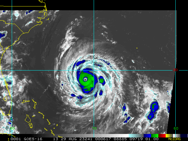
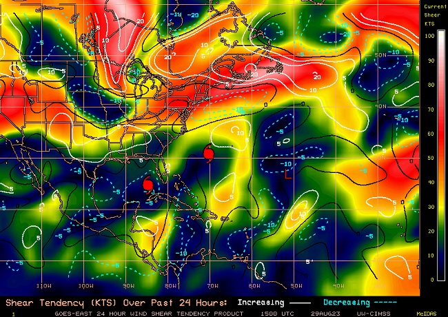
Shear over Idalia has continued to come way down over the past 24 hours and is analyzed by the CIMSS Wind Shear Product at just 4 knots.
Favorable to Very Favorable shear is forecast for the next 24 hours.
HURRICANE 10L 12:00UTC 29August2023
UW-CIMSS Experimental Vertical Shear and TC Intensity Trend Estimates
Current Conditions (from ) :
Latitude : 23:49:44 N
Longitude : 84:57:32 W
Intensity (MSLP) : 983.7 hPa
Max Pot Int (MPI,from Emanuel) : 890.0 hPa
MPI differential (MSLP-MPI) : 93.7 hPa
CIMSS Vertical Shear Magnitude : 2.2 m/s ( 4.2 kts)
Direction : 206.5 deg
Outlook for TC Intensification Based on Current Env. Shear Values and MPI Differential
Forecast Interval : 6hr: F 12hr: VF 18hr: VF 24hr: VF
|
cieldumort
Moderator
Reged: Mon
Posts: 2305
Loc: Austin, Tx
|
|
Relatively cool and moist eye at the moment, but pressure is still lower than earlier, with the winds a bit stronger. It should be noted that these winds are from the NW and SE quadrants, recon having not yet sampled what are probably even stronger winds in the Right Front Quadrant (NE).
Worth noting that there may be a little bit of increased shear over Idalia this afternoon. However, this is expected to drop again tonight, along with increased instability from the atmosphere cooling while the ocean remains exceptionally warm.
Product: Air Force Vortex Message (URNT12 KNHC)
Transmitted: 29th day of the month at 20:26Z
Agency: United States Air Force
Aircraft: Lockheed WC-130J Hercules with reg. number AF97-5304
Storm Name: Idalia
Storm Number & Year: 10 in 2023 (flight in the North Atlantic basin)
Mission Number: 11
Observation Number: 04
A. Time of Center Fix: 29th day of the month at 20:21:40Z
B. Center Fix Coordinates: 25.91N 84.82W
B. Center Fix Location: 190 statute miles (306 km) to the WSW (255°) from Fort Myers, FL, USA.
C. Minimum Height at Standard Level: 2,879m (9,446ft) at 700mb
D. Minimum Sea Level Pressure: 972mb (28.71 inHg)
E. Dropsonde Surface Wind at Center: From 205° at 5kts (From the SSW at 6mph)
F. Eye Character: Open in the northwest
G. Eye Shape & Diameter: Circular with a diameter of 25 nautical miles (29 statute miles)
H. Estimated (by SFMR or visually) Maximum Surface Wind Inbound: 63kts (72.5mph)
I. Location & Time of the Estimated Maximum Surface Wind Inbound: 5 nautical miles to the NW (312°) of center fix at 20:20:00Z
J. Maximum Flight Level Wind Inbound: From 34° at 53kts (From between the NNE and NE at 61.0mph)
K. Location & Time of the Maximum Flight Level Wind Inbound: 5 nautical miles to the NW (312°) of center fix at 20:20:00Z
L. Estimated (by SFMR or visually) Maximum Surface Wind Outbound: 69kts (79.4mph)
M. Location & Time of the Estimated Maximum Surface Wind Outbound: 14 nautical miles (16 statute miles) to the SE (136°) of center fix at 20:25:30Z
N. Maximum Flight Level Wind Outbound: From 237° at 91kts (From the WSW at 104.7mph)
O. Location & Time of the Maximum Flight Level Wind Outbound: 18 nautical miles (21 statute miles) to the SE (135°) of center fix at 20:26:30Z
P. Maximum Flight Level Temp & Pressure Altitude Outside Eye: 14°C (57°F) at a pressure alt. of 3,067m (10,062ft)
Q. Maximum Flight Level Temp & Pressure Altitude Inside Eye: 15°C (59°F) at a pressure alt. of 3,068m (10,066ft)
R. Dewpoint Temp (collected at same location as temp inside eye): 14°C (57°F)
R. Sea Surface Temp (collected at same location as temp inside eye): Not Available
S. Fix Determined By: Penetration, Radar, Wind, Pressure and Temperature
S. Fix Levels (surface & flight level centers within 5nm of each other): Surface and 700mb
T. Navigational Fix Accuracy: 0.02 nautical miles
T. Meteorological Accuracy: 1 nautical mile
Remarks Section:
Maximum Flight Level Wind: 91kts (~ 104.7mph) which was observed 18 nautical miles (21 statute miles) to the SE (135°) from the flight level center at 20:26:30Z
|
cieldumort
Moderator
Reged: Mon
Posts: 2305
Loc: Austin, Tx
|
|
Quote:
SUMMARY OF 1100 PM EDT...0300 UTC...INFORMATION
-----------------------------------------------
LOCATION...27.7N 84.5W
ABOUT 125 MI...200 KM W OF TAMPA FLORIDA
ABOUT 185 MI...300 KM S OF TALLAHASSEE FLORIDA
MAXIMUM SUSTAINED WINDS...110 MPH...175 KM/H
PRESENT MOVEMENT...N OR 10 DEGREES AT 18 MPH...30 KM/H
MINIMUM CENTRAL PRESSURE...958 MB...28.29 INCHES
WATCHES AND WARNINGS
--------------------
CHANGES WITH THIS ADVISORY:
The Tropical Storm Warning for the Dry Tortugas is discontinued, and the Tropical Storm Watch for the Lower Florida Keys is discontinued.
SUMMARY OF WATCHES AND WARNINGS IN EFFECT:
A Storm Surge Warning is in effect for...
* Englewood northward to Indian Pass, including Tampa Bay
A Hurricane Warning is in effect for...
* Middle of Longboat Key northward to Indian Pass, including Tampa Bay
A Tropical Storm Warning is in effect for...
* Chokoloskee northward to the Middle of Longboat Key
* West of Indian Pass to Mexico Beach
* Sebastian Inlet Florida to Surf City North Carolina
A Storm Surge Watch is in effect for...
* Bonita Beach northward to Englewood, including Charlotte Harbour
* Mouth of the St. Mary's River to South Santee River South Carolina
* Beaufort Inlet to Drum Inlet North Carolina
* Neuse and Pamlico Rivers North Carolina
A Hurricane Watch is in effect for...
* Mouth of the St. Mary's River to Edisto Beach South Carolina
A Tropical Storm Watch is in effect for...
* North of Surf City North Carolina to the North Carolina/Virginia border
* Pamlico and Albemarle Sounds
A Hurricane Warning means that hurricane conditions are expected somewhere within the warning area. Preparations to protect life and property should be rushed to completion.
A Storm Surge Warning means there is a danger of life-threatening inundation, from rising water moving inland from the coastline, during the next 36 hours in the indicated locations. For adepiction of areas at risk, please see the National WeatherService Storm Surge Watch/Warning Graphic, available at hurricanes.gov. This is a life-threatening situation. Persons located within these areas should take all necessary actions to protect life and property from rising water and the potential for other dangerous conditions. Promptly follow evacuation and other instructions from local officials.
|
|
 Threaded


