11AM EDT Update 28 September 2023
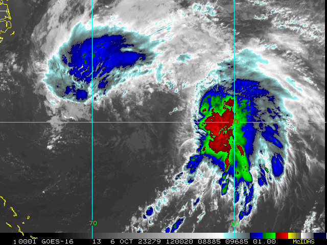
Tropical Storms Philippe and newly-named Rina both east of the Antilles and warming up to perform a Fujiwara dance for show. No near-term threats to land. - Ciel
7AM EDT Update 26 September 2023
This morning the gulf area that was being tracked yesterday has dissipated, and is no longer being tracked. Phillipe is gradually weakening as it moves into an area of strong vertical shear, and should disspate. Of note this will allow the enegery associated with Phillipe's remnants to shift much further west, however conditions at the moment are not conductive for development.
91L which will likely become Rina is expected to overtake from Phillipe and most likely turn out to sea, however it may get close enough to the Caribbean islands that they should watch. This area currently has a 90% chance to develop, 60% chance in the next 48 hours.
Beyond this week into October the idea will likely be watching for anything developing closer to land as the mix of fronts and remnant lows will provide an opportunity for something to form closer to land, however what and how much would be up in the air. Meaning rain likely for a lot, but development chances won't be known until next week.
7AM EDT Update 25 September 2023
Right now the the tropics there's activity with Phillipe, but nothing else really imminent. The area in the Gulf has a 10% chance to develop, and probably won't as shear conditions right now in the area its at is just a bit too hostile for development. The area east of Phillipe (91L) has an 805 chance to develop over the next 7 days, but both Phillipe and the east Atlantic system very likely will stay out to sea and away from the Caribbean Islands and Bermuda. So for at least the next week, there shouldn't be anything threatening. The pattern this year has kept anything developing east of the Islands mostly away from land, so the focus beyond next week is for anything that develops closer to land.
3PM EDT Update 22 September 2023
Tropical Storm Ophelia has formed from PTC16.
11AM EDT Update 21 September 2023
Tropical Storm Warnings up for NC/VA/Maryland for Potential Tropical Cyclone 16. This will develop quickly. PTC#16 Forms. Tropical Warning up Cape Fear, NC, to Fenwick Island, DE Storm Surge Watches up from Surf City, North Carolina to Chincoteague, VA, and the Chesapeake Bay south of Smith Point, including Albemarle and Pamlico Sounds
Original Update
Hurricane Nigel continues its long turn in the Central Atlantic and should be moving back to the northeast by tomorrow evening.
The area in the East Atlantic has a 70% chance to develop, and it too is likely to remain away from land areas.
An area off Florida may form this weekend and drift northward, possibly subtropical, from a stalled front. If anything does develop it could happen quickly once going (but likely won't have long enough to get to hurricane strength), so those in the coastal Carolinas and Southeast Virginia should monitor this, especially toward the end of the week.
The current pattern in the main development region is for things to recurve, so the closer to home systems are the one to pay attention to. Either near the US or the Caribbean.
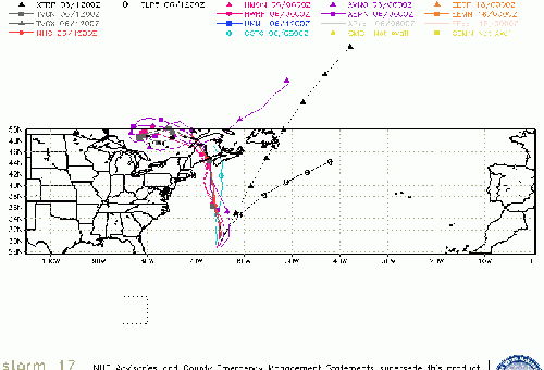
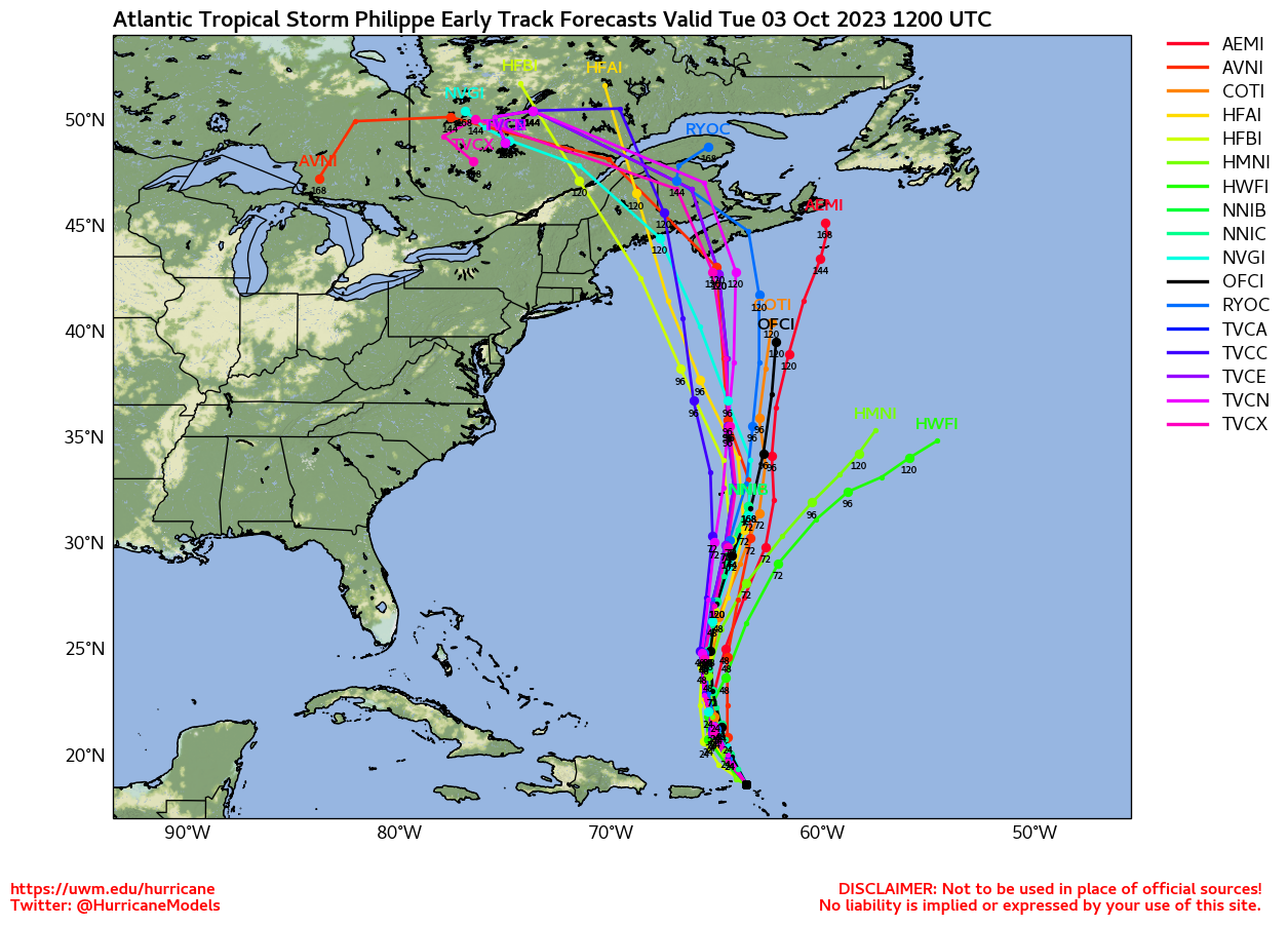
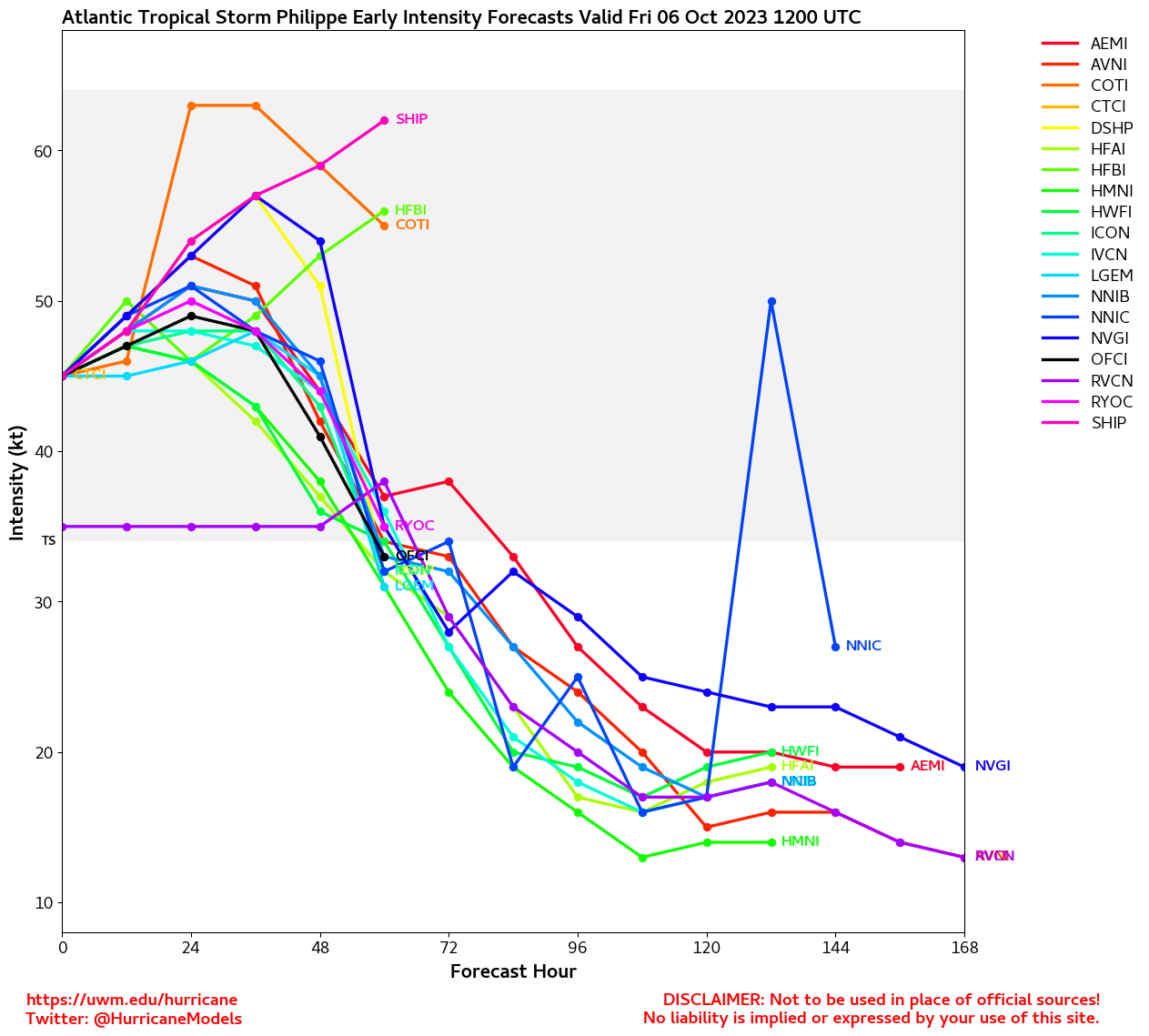
Philippe Event Related Links
SFWMD Model Plot (Animated Model Plot) SFWMD Hurricane Page
[https://flhurricane.com/floatanimator.php?year=2023&storm=17 Flhurricane Satellite Floater Animation of Philippe
GOES Floater
Animated Model Plot of Philippe
Clark Evans Track Model Plot of Philippe
(Animated!) Model Plots in Google Earth - In Google Maps
Clark Evans Intensity Model Plot of Philippe (Animated!)
Clark Evans Track Plot of Philippe
Other Model Charts from Clark
Clark Evans Top 10 Analog Storms for Philippe
More model runs on from RAL/Jonathan Vigh's page
NRL Info on Philippe -- RAMMB Info
COD Atlantic Satellite View
StormCarib Reports from the Caribbean Islands
Caribbean Weather Observations
Barbados Brohav Weather Fax
Full Caribbean Radar Composite
Caribbean Broadcast Corporation (TV/Radio from Antilles)
San Juan, PR NWS Page
Various Caribbean Radio Stations
DR1 Dominican Republic Hurricanes
Bermuda Newspapers/Media:
BerNews
Royal Gazette (Bermuda)
Bermuda Sun
Hott 107.5 Bermuda Radio
Storm Carib Bermuda Reports
Bermuda Weather Service
 Threaded


