1:30PM EDT Update 23 October
Steering currents continue to favor tracks that take systems or their remnants in both the W ATL and E PAC towards Central and/or North America.
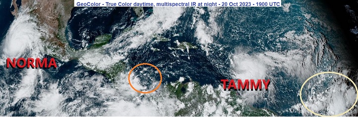
Invest 95L, quite possibly already a TD, will probably make landfall in Central America tonight or tomorrow, and could linger, producing heavy rain and flooding. Also, Hurricane Tammy is now officially forecast to recurve back towards the US in the 4-5 day outlook. Beyond that time there are still too many variables to speculate beyond Lounge Talk.
Longer-range keeps much of the West Atlantic in a somewhat favorable state for tropical cyclone formation during the extended period into at least the early part of November.
6:30PM EDT Update 21 October
Both track and development potential continue shifting and consolidating closer to home this weekend, with nearly all activity in both the Atlantic and East Pac either possibly if not likely to have some North America impacts.
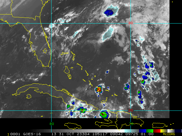
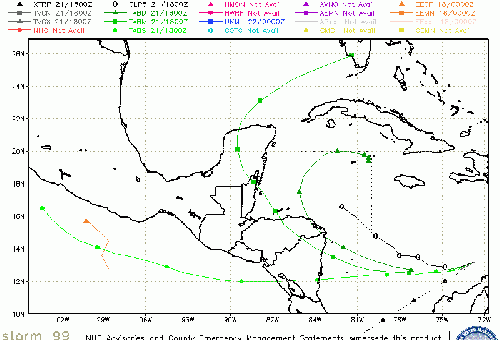
Almost definitely soon-to-be-Invest-tagged if it stays over water Caribbean Low may not only become a tropical cyclone, but also has the potential to linger or meander around Central America. Two obvious concerns: Flood threat to Central America. Also, the longer it lingers without crossing over to the East Pac or falling apart over land, the greater the chance steering currents could swoop it up towards the .
Tammy is skating by just east of the Leewards tonight, with hurricane conditions just offshore. Models have massively diverged on her future track once she clears the Leewards.
Original Update
Recon is continuing frequent flights into Hurricanes Tammy and Norma this weekend, and the invaluable data collected will be fed into models to help fine-tune official forecasts.
Tammy has potential to strengthen more than currently forecast, and possibly track a bit west as well, and interests in the eastern Caribbean should continue to be prepared for substantial impacts from rain, flood, wind and surge.
Major Hurricane Norma in the East Pac has restrengthened, and as such is much more likely to bring central US states from Texas on north-northeast copious rains next week after a direct hit on western Mexico. While the rains will be welcome relief in many locations, too much of a good thing can become problematic, and the risk of flooding may be going up markedly with this set up.
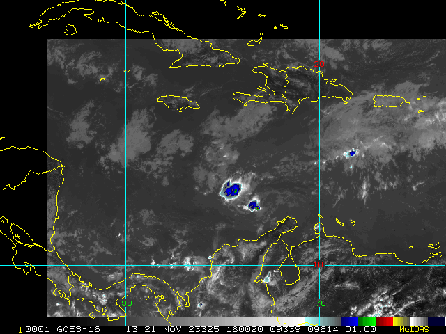
Big picture, steering currents look to be shifting in a way that have the potential to send any tropical cyclones that form or get close enough towards the south to southeast United States for a while, and as waters are still very warm, some conditionally concerning areas are worth noting. First, we have an area of low pressure that has recently formed in the Southern Caribbean. Also, much farther out, another monsoon trof wave east of the Caribbean has some potential to track farther west and cook up. Lounges have been started on both of these.
Forecast Lounges/Model Talk:
Tammy Lounge
South Caribbean Low (Now 95L) Lounge
Tropical Atlantic Wave Lounge
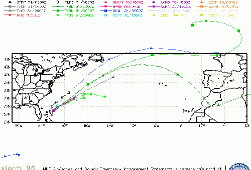
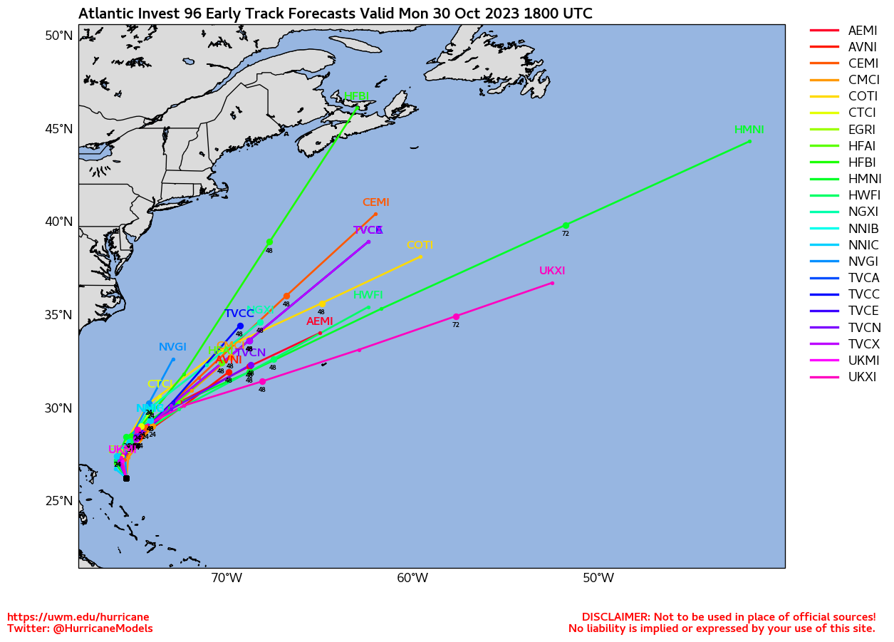
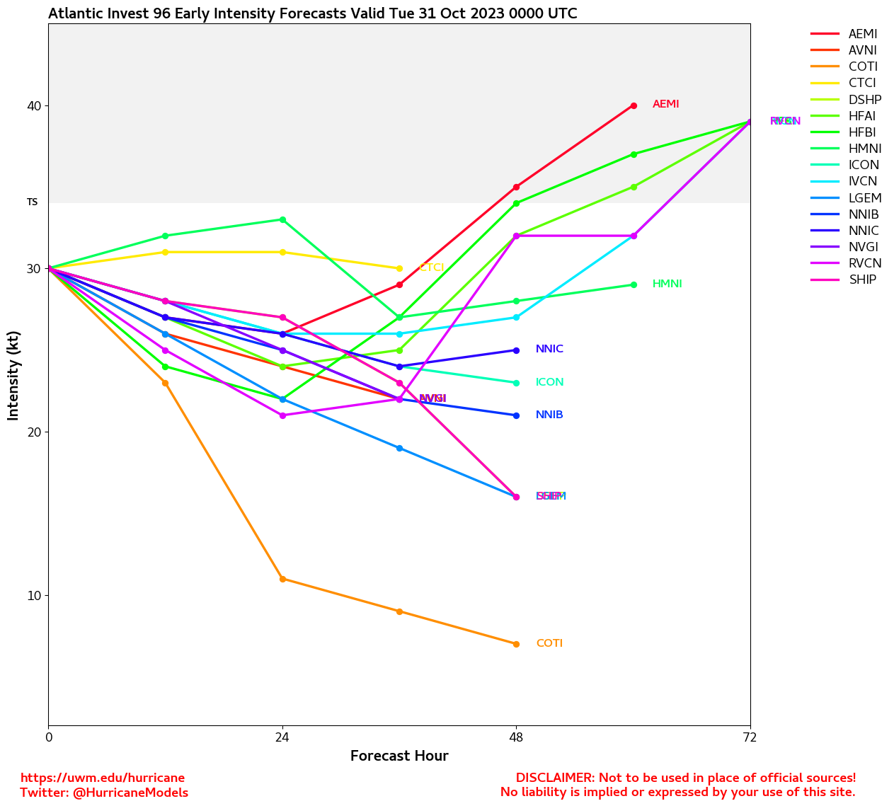
Invest 96L Event Related Links
SFWMD Model Plot (Animated Model Plot) SFWMD Hurricane Page
[https://flhurricane.com/floatanimator.php?year=2023&storm=22 Flhurricane Satellite Floater Animation of 96L
GOES Floater
Animated Model Plot of 96L
Clark Evans Track Model Plot of 96L
(Animated!) Model Plots in Google Earth - In Google Maps
Clark Evans Intensity Model Plot of 96L (Animated!)
Clark Evans Track Plot of 96L
Other Model Charts from Clark
Clark Evans Top 10 Analog Storms for 96L
More model runs on from RAL/Jonathan Vigh's page
NRL Info on 96L -- RAMMB Info
COD Atlantic Satellite View
Invest 97L Event Related Links
SFWMD Model Plot (Animated Model Plot) SFWMD Hurricane Page
[https://flhurricane.com/floatanimator.php?year=2023&storm=23 Flhurricane Satellite Floater Animation of 97L
GOES Floater
Animated Model Plot of 97L
Clark Evans Track Model Plot of 97L
(Animated!) Model Plots in Google Earth - In Google Maps
Clark Evans Intensity Model Plot of 97L (Animated!)
Clark Evans Track Plot of 97L
Other Model Charts from Clark
Clark Evans Top 10 Analog Storms for 97L
More model runs on from RAL/Jonathan Vigh's page
NRL Info on 97L -- RAMMB Info
COD Atlantic Satellite View
StormCarib Reports from the Caribbean Islands
Caribbean Weather Observations
Barbados Brohav Weather Fax
Full Caribbean Radar Composite
Caribbean Broadcast Corporation (TV/Radio from Antilles)
San Juan, PR NWS Page
Various Caribbean Radio Stations
DR1 Dominican Republic Hurricanes
 Threaded


