iuhoosiers
Verified CFHC User
Reged: Tue
Posts: 16
|
|
HAS ANYONE TAKEN A LOOK AT THE A98E MODEL? OBVIOUSLY THAT IS THE BEST CASE SCENARIO FOR US ALL, DOES ANYONE KNOW HOW ACCURATE THIS MODEL IS? AS FOR THE MODELS MOVING NORTH THEY LOOK THE SAME TO ME, LBAR MAYBE A LITTLE FURTHER NORTH TAKING THE STORM BETWEEN TAMPA AND FT, MYERS, BUT BAMM AND BAMD ARE QUITE CONSISTENT IN BRINGING THE STORM OVER SOUTH FLORIDA.
|
Margie
Senior Storm Chaser

Reged: Fri
Posts: 1191
Loc: Twin Cities
|
|
Actually a good track as far as development/buildings/people, to have it come in right there in the Everglades. The natural ecosystem there has had years and years to adjust to surviving powerful hurricane landfalls.
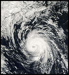
Looks like convection peaked with the 0115Z, which was the most impressive of the wv images from the past couple hours. The central core has that rounded rising-donut appearance right now that I've come to associate with Cat 4 intensity. I have a strong belief that recon will find a pressure in the 930s.
Note: I meant the 1am recon mentioned earlier. The 11pm gives an est pressure of 945mb.
--------------------
Katrina's Surge: http://www.wunderground.com/hurricane/Katrinas_surge_contents.asp
Edited by Margie (Tue Oct 18 2005 10:38 PM)
|
damejune2
Storm Tracker

Reged: Sat
Posts: 237
Loc: Torrington, CT
|
|
I know it doesn't mean much, but i checked several buoys in the area projected to be the landfall point and the water temp is 80-83 degrees F. I also checked a buoy way out in the gulf - off the Ft. Myers shore and the water out there is 82 F.
--------------------
Gloria 1985 (Eye passed over my house in...get this...northwestern CT!)
|
NewWatcher
Storm Tracker

Reged: Wed
Posts: 388
Loc: Port Orange, FL
|
|
11 p m out at wunderground
...Wilma continues to rapidly strengthen...should become a major
hurricane in a few hours...
http://www.wunderground.com/tropical/at200524.public.html
winds up to 110 Estimated minimum central pressure is 945 mb...27.91 inches.
--------------------
Pam in Volusia County
According to Colleen A ... "I AM A HURRICANE FREAK"
2007 Predictions 16/9/6
|
dave foster
Weather Hobbyist

Reged: Sun
Posts: 73
Loc: UK
|
|
Sorry, don't understand...I see the same water temps all day.
--------------------
Dave Foster
http://www.ascn92.dsl.pipex.com
|
Colleen A.
Moderator

Reged: Sat
Posts: 1432
Loc: Florida
|
|
That would be a good scenario! As far as the other models being consistent in keeping it further south, keep in mind that sometimes they do not pick up on the speed or strength of the other players ... like the ones we are talking about tonight. If the A98E is the only one doing that, that's an outlier.
I believe Denis Phillips said we will know by tomorrow whether the two features in the Western US will combine. That's when we will a *pretty* good idea of what's to come down the road.
The models are only as good as what information is put into them...some don't pick up features, some overstrengthen them, some understrengthen them. That's why it's usually two days out before we have good idea of where the general area of landfall will be.
--------------------
You know you're a hurricane freak when you wake up in the morning and hit "REFRESH" on CFHC instead of the Snooze Button.
|
Random Chaos
Weather Analyst

Reged: Sat
Posts: 1024
Loc: Maryland
|
|
11pm Advisory:
( http://www.nhc.noaa.gov/text/refresh/MIATCPAT4+shtml/190231.shtml )
Quote:
REPEATING THE 11 PM EDT POSITION...16.8 N... 82.1 W. MOVEMENT
TOWARD...WEST-NORTHWEST NEAR 8 MPH. MAXIMUM SUSTAINED
WINDS...110 MPH. ESTIMATED MINIMUM CENTRAL PRESSURE... 945 MB.
from the advisory~danielw
Edited by danielw (Tue Oct 18 2005 10:44 PM)
|
Tazmanian93
Weather Master

Reged: Sun
Posts: 495
Loc: Tampa
|
|
Those are current environment temps. Reference to throughout day is pressure and winds.
--------------------
Don't knock the weather; nine-tenths of the people couldn't start a conversation if it didn't change once in a while.
Go Bucs!!!!!!!!!
****************
Ed
|
NewWatcher
Storm Tracker

Reged: Wed
Posts: 388
Loc: Port Orange, FL
|
|
The NOAA g4 jet flew its first synoptic surveillance mission on
Wilma this evening...and it will be interesting to see the impact
on the 00Z model runs.
i think forcaster Beven has been reading our posts ..... 
--------------------
Pam in Volusia County
According to Colleen A ... "I AM A HURRICANE FREAK"
2007 Predictions 16/9/6
|
JG
Weather Hobbyist
Reged: Thu
Posts: 55
|
|
Quote:
MOST RECENT SUITE OF MODEL GUIDANCE IN REMARKABLE AGREEMENT FAVORING THE WORST IMPACTS IN SOUTH FLORIDA PENINSULA/KEYS BY THE END OF THE WEEK.
HOWEVER...IT`S FAR TOO SOON FOR ANYONE TO
LET THEIR GUARD DOWN GIVEN THAT THE ULTIMATE EVOLUTION OF THE "PLAYERS" IN THIS EVENT...UPPER LEVEL FEATURES ACROSS THE WESTERN U.S. AND BEYOND...IS STILL TO COME. SLIGHT DEVIATIONS IN TIMING AND INTENSITY OF ANY ONE OF THESE SYSTEMS WILL DETERMINE WHERE THE MOST IMPACT WILL BE EXPERIENCED WHEN APPROACHES. STAY TUNED
emphasis added~danielw
I'm just wondering; if the storm continues WNW to NW, that should or could put the northern scenario into play. Experts tell me if I'm "exhausting" hot air or not....
Edited by danielw (Tue Oct 18 2005 10:46 PM)
|
scottsvb
Weather Master
Reged: Mon
Posts: 1184
Loc: fl
|
|
People plz try to stop with the tropical model suites ( LBAR,BAMN,BAMD, etc...) those models are horrible and run in paralle with the ......if a system goes the direction one of those goes,,then its just a couincidence.. Anyways the main models are the , ,ECMF,GFS,UKMET, ,, those are the global models.
Like I been also saying,,tonights 0Z runs are what too look at and also every data input on next flights...Now we will have a General ( but not exact) Idea of what and where this might do.
|
Random Chaos
Weather Analyst

Reged: Sat
Posts: 1024
Loc: Maryland
|
|
Discussion's out, and a wow in it - something you don't see saying all that often:
Quote:
THE INTENSITY FORECAST HAS BECOME MORE COMPLICATED. THE CURRENT RAPID INTENSIFICATION AND FAVORABLE ENVIRONMENT SHOULD BRING TO CATEGORY FOUR STATUS IN THE NEXT 24 HR...AND IT WOULD NOT BE A SURPRISE TO SEE IT REACH CATEGORY FIVE BEFORE IT BOTTOMS OUT.
HOWEVER...SSM/I DATA SHOWS THAT THE CONVECTION WITH THE EYEWALL COVERS A VERY SMALL AREA...WITH A DISTINCT DRY MOAT ALREADY PRESENT OUTSIDE THE EYEWALL. OUTSIDE OF THAT IS A BROKEN CONVECTIVE BAND
THAT AIRCRAFT DATA SHOWS IS ASSOCIATED WITH AN OUTER WIND MAXIMUM.
THUS...IT APPEARS LIKELY THAT WILL GO THROUGH A CONCENTRIC EYEWALL CYCLE DURING THE NEXT 24-48 HR...AND SINCE THE INNER EYE IS SO SMALL THERE COULD BE NOTABLE WEAKENING UNTIL THE OUTER EYEWALL
CONTRACTS. SINCE THESE CYCLES ARE HARD TO TIME...THE INTENSITY FORECAST WILL HOLD AT 125 KT FROM 24-48 HR. WHEN MOVES INTO
THE GULF OF MEXICO...IT SHOULD ENCOUNTER SLIGHTLY COOLER SEA SURFACE TEMPERATURES AND GRADUALLY INCREASING VERTICAL SHEAR. THIS SHOULD CAUSE A SLOW WEAKENING...ALTHOUGH IT IS PROBABLE THAT WILL STILL BE A MAJOR HURRICANE WHEN IT REACHES THE FLORIDA PENINSULA.
Entire discussion: http://www.nhc.noaa.gov/text/refresh/MIATCDAT4+shtml/190236.shtml
Edited by danielw (Tue Oct 18 2005 10:51 PM)
|
harmlc.ath.cx
Weather Hobbyist

Reged: Tue
Posts: 54
Loc: Longwood
|
|
It looks like the cone has shifted it a hair south. Will we see a shift in the cone more north come wednesday morning?
|
Random Chaos
Weather Analyst

Reged: Sat
Posts: 1024
Loc: Maryland
|
|
Question: mentions SSMI microwave imagery. Is this the data they are talking about?
http://www.nrlmry.navy.mil/tc-bin/tc_hom...CT=1degreeticks
(That is the 85hz image from SSMIS - the question is, is 85hz the microwave one? I don't feel like hunting my Optics book to look up the frequency range on microwaves right now  ) )
Edited by Random Chaos (Tue Oct 18 2005 10:53 PM)
|
hurricane expert
Really Not an Expert
Reged: Thu
Posts: 105
Loc: florida
|
|
What does 00Z run stand for.
|
Margie
Senior Storm Chaser

Reged: Fri
Posts: 1191
Loc: Twin Cities
|
|
Well there it is, from the 11pm:
IT IS PROBABLE THAT WILL STILL BE A MAJOR HURRICANE WHEN IT REACHES THE FLORIDA PENINSULA.
Have to add I laughed when I read the opening statement. In stressful situations like this the odd bit of humor that they can insert into the discussions is something I do appreciate. Seems like their formula is to put it in the first sentence and then get down to business.
An almost guaranteed will make the next 36 hrs interesting. Also noted in the advis that my earlier take on the increase to Cat 4 coming Wed aft/evng appears to be the thinking at as well (even if she peaks tonight/early tomorrow morning as a Cat 4 or 5, then an , and possibly coming back up to a Cat 4 tomorrow when reaching the warmer deep water).
--------------------
Katrina's Surge: http://www.wunderground.com/hurricane/Katrinas_surge_contents.asp
|
danielw
Moderator

Reged: Wed
Posts: 3525
Loc: Hattiesburg,MS (31.3N 89.3W)
|
|
The Category Five reference isn't used very often.
However...it has been used two or three times This Year.
The cone will shift North, South East and West. From now until is no longer a Tropical System.
Please remember...Do Not look at the thin line in the cone. If the Cone covers your area. You are within the dangerous area of a Landfalling Hurricane and it's aftermath. The cone can widen to include areas not previously affected/ included in the Cone.
Please take this time to prepare your property and make preparations for evacuations.
As of the 11PM Advisory...The Whole Florida Peninsula is in the 5 Day Cone.
http://www.nhc.noaa.gov/storm_graphics/AT24/refresh/AL2405W5_sm2+gif/023803W_sm.gif
|
Circinae
Registered User

Reged: Tue
Posts: 3
Loc: Naples, Florida
|
|
Our area has been very lucky so far, but I am wondering if this storm has our name on it. I just read the 11 PM discussion. What is so dreaded about a pinhole eye?
Thanks
|
bobbutts
Weather Hobbyist

Reged: Mon
Posts: 71
Loc: New Hampshire
|
|
Quote:
HAS ANYONE TAKEN A LOOK AT THE A98E MODEL? .....
Here's what I could dig up on 98E
Quote:
NHCA98E -- Climatology-based "model". Not really a model, just compares the current storm position to previous storms and "guesses" where it might go. Completely useless everywhere.
may I politely ask that you remove caps lock if you post again.
|
Colleen A.
Moderator

Reged: Sat
Posts: 1432
Loc: Florida
|
|
They have shifted the track a bit to the left at 11pm, through the next 48 hours, then back to what the models were at earlier. I would imagine that the shift to the left is due to the WNW motion that it is currently on right now.
I am with Scott: right now, the most important thing is to see what the models come out with later on. That's when you'll see a track shift for the Florida peninsula either way. Remember, it's only Tuesday night...this isn't even supposed to make landfall until Saturday. So trying to project out a path right now of an exact landfall is impossible. Too many varying scenarios. If we're in the cone, then we are just as vulnerable as southwest Florida.
I have to say: I'm not very excited about the intensity forecast. A category 3 at landfall is going to be a major problem for whoever gets it.
Best advice? Stay alert, be prepared. In the meantime, try to get some sleep because it's going to be a rough road ahead mentally. Believe me, I know! 
--------------------
You know you're a hurricane freak when you wake up in the morning and hit "REFRESH" on CFHC instead of the Snooze Button.
|
 Threaded

 [Re:
[Re: 


 )
)


