MikeC
Admin
Reged: Sun
Posts: 4543
Loc: Orlando, FL
|
|
It's not likely to strengthen all that much, shear dramatically goes up west and north of where the center is, that's what is probably keeping most of the convection off the center right now.
|
Lamar-Plant City
Storm Tracker

Reged: Mon
Posts: 383
Loc: Plant City, Florida
|
|
Is it my imagination, or has that low level center gone almost stationary right now. Just off the norther coast of Cuba at about 22.5N and 79W. Could this mean it is about to spin back and rejoin the convection? Or is it 'waiting' for the convection to catch up to it? Storm doesn't look too healthy at this point in the day...very lob-sided because of the shear and the 'wall' it is up against.
--------------------
If you don't like the weather, wait 5 minutes...
2023 Season Prediction: 17/6/2
|
doug
Weather Analyst
Reged: Mon
Posts: 1006
Loc: parrish,fl
|
|
"No-End" indeed..look at the new convection just NE of the stalled LLC...the shear across the tops of the convection that was close by this morning but is now seperated a bit seems to be from the WNW..., Am I right? If so what is the source?
--------------------
doug
|
cieldumort
Moderator

Reged: Mon
Posts: 2305
Loc: Austin, Tx
|
|
Fawning over models and defending their value in forecasting Noel's track aside for the moment, the facts on the ground are entirely challenging the forecasters, giving them quite the run for the money, one can be sure. After defying the forecast of a continued NNW track so far today, and clearly running WSW, Noel has taken up nearly stationary right along the coast again (Close-up of GOES visible from ) . If Noel were to start heading WSW again he will be back over Cuba, once again. In fact, if his mean movement takes up any direction other than a solid NW through E course, he will be back over Cuba. A trip back over Cuba changes everything with regard to the 11AM forecast put out by , not just a little bit of everything.
That paragraph being my segue into getting back to the models. I actually think the very large cyclonic envelope that has grown up around Noel to be illuminating, and something that perhaps lends a good deal more support to the outlier NAM. For several runs now, has held back the bulk of Noel's abundant vorticity this side of 23N, in one fashion or another. has generally taken the large and expansive cyclonic flow that is apparent with Noel, and used that, along with a not nearly as impressive shortwave approach and Noel's anticyclone aloft, to soften the blow and reduce the tugs of the approaching trough. And you know, if you look at the loops today, you really can make a case for this.
Whether or not Tropical Storm Watches and/or Warnings go up for the Keys and/or coastal south Florida, while a matter or politics and economics, is also really a matter of semantics when it comes down to a number of the effects this area continues to feel, and will likely feel, for some more time to come. A High Wind Watch, if reissued, is nothing to scoff at. Sustained winds of up to "only" 40MPH and/or gusts aoa 58, if verified, will definitely rearrange ones view.
|
doug
Weather Analyst
Reged: Mon
Posts: 1006
Loc: parrish,fl
|
|
Believe it or not I just gave this speech to my office manager, as we discussed the weather and possible effects over the next day or so...I'm in Ft Myers, and a few more hours of WNW means a lot to us here...I agree Gale Center or TS is really not a meaningful distinction right now.
--------------------
doug
|
ftlaudbob
Storm Chaser

Reged: Tue
Posts: 828
Loc: Valladolid,Mx
|
|
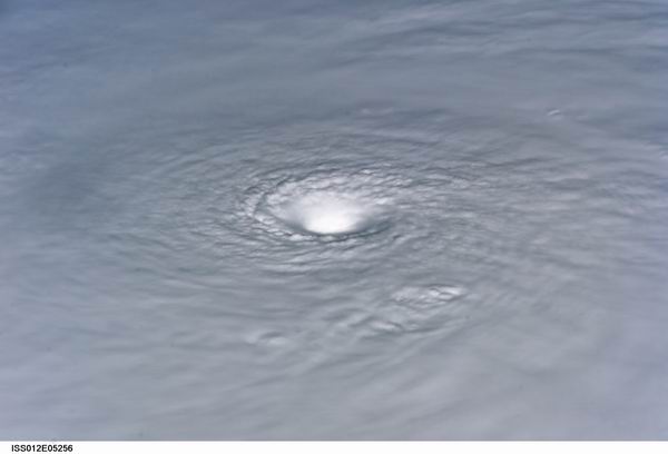
Take a look at the spin now!Could that be an eye forming on the last frame?It is right were the LLC is.
http://www.ssd.noaa.gov/goes/flt/t1/loop-vis.html
--------------------
Survived: 10 hurricanes in Rhode Island,Florida and the Yucatan of Mexico .
|
Lee-Delray
Weather Master

Reged: Thu
Posts: 429
|
|
..
.NOEL LINGERING ALONG THE CUBAN COAST...TROPICAL STORM WATCH
WTNT31 KNHC 312032
TCPAT1
BULLETIN
TROPICAL STORM NOEL ADVISORY NUMBER 17
NWS TPC/NATIONAL HURRICANE CENTER MIAMI FL AL162007
500 PM EDT WED OCT 31 2007
...NOEL LINGERING ALONG THE CUBAN COAST...TROPICAL STORM WATCH
ISSUED FOR THE SOUTHEAST FLORIDA COAST...
AT 5PM EDT...2100Z...A TROPICAL STORM WATCH IS IN EFFECT FROM NORTH
OF OCEAN REEF TO JUPITER INLET FLORIDA. A TROPICAL STORM WATCH
MEANS THAT TROPICAL STORM CONDITIONS ARE POSSIBLE WITHIN THE WATCH
AREA.
|
Lee-Delray
Weather Master
Reged: Thu
Posts: 429
|
|
From the 5:00 Discussion, now I understand why they held off; makes perfect sense.
WINDS ASSOCIATED WITH THE ENVIRONMENTAL PRESSURE GRADIENT HAVE
DECREASED BELOW GALE FORCE ALONG THE SOUTHEAST FLORIDA COAST.
RECONNAISSANCE DATA INDICATE THAT THE WIND FIELD OF NOEL HAS
EXPANDED IN THE NORTHWEST QUADRANT...AND THE OFFICIAL FORECAST NOW
BRINGS TROPICAL STORM WINDS TO NEAR THE SOUTHEAST FLORIDA COAST.
SINCE ANY SUBSEQUENT INCREASE IN WINDS AT THE COAST WOULD BE
ASSOCIATED WITH THE TROPICAL STORM...A TROPICAL STORM WATCH IS
BEING ISSUED AT THIS TIME. WHILE A WATCH IS USUALLY ASSOCIATED WITH
A LONGER LEAD TIME THAN A WARNING...IT ALSO CONVEYS THE
POSSIBILITY...AS OPPOSED TO THE EXPECTATION...OF TROPICAL STORM
CONDITIONS. BECAUSE THE TROPICAL STORM FORCE WIND RADII ARE
FORECAST TO REMAIN OFFSHORE...A WATCH IS MORE APPROPRIATE THAN A
WARNING. THE NEED FOR A WARNING WILL BE REASSESSED THIS EVENING.
|
doug
Weather Analyst
Reged: Mon
Posts: 1006
Loc: parrish,fl
|
|
To comment on the report of the progress of the SW'ly wind zone progressing across the central GOM indeed it has...that is available on the W. ATL WV LOOP.
Impressive progress today while the center has stayed stationary...
The said the center may be making a cyclonic loop, but in the last frames of the most recent visible image I noticed a significant jump ENE. Will have to watch for an hour or so to see if it is a movement or a loop.
--------------------
doug
|
Storm Hobbyist
Registered User
Reged: Tue
Posts: 5
Loc: Ft. Lauderdale, Florida
|
|
5PM:
WINDS ASSOCIATED WITH THE ENVIRONMENTAL PRESSURE GRADIENT HAVE
DECREASED BELOW GALE FORCE ALONG THE SOUTHEAST FLORIDA COAST.
RECONNAISSANCE DATA INDICATE THAT THE WIND FIELD OF NOEL HAS
EXPANDED IN THE NORTHWEST QUADRANT...AND THE OFFICIAL FORECAST NOW
BRINGS TROPICAL STORM WINDS TO NEAR THE SOUTHEAST FLORIDA COAST.
SINCE ANY SUBSEQUENT INCREASE IN WINDS AT THE COAST WOULD BE
ASSOCIATED WITH THE TROPICAL STORM...A TROPICAL STORM WATCH IS
BEING ISSUED AT THIS TIME. WHILE A WATCH IS USUALLY ASSOCIATED WITH
A LONGER LEAD TIME THAN A WARNING...IT ALSO CONVEYS THE
POSSIBILITY...AS OPPOSED TO THE EXPECTATION...OF TROPICAL STORM
CONDITIONS. BECAUSE THE TROPICAL STORM FORCE WIND RADII ARE
FORECAST TO REMAIN OFFSHORE...A WATCH IS MORE APPROPRIATE THAN A
WARNING. THE NEED FOR A WARNING WILL BE REASSESSED THIS EVENING.
Anyways, I'm still staying firm on the fact that Noel will not do what is thinking its going to do...
I mean,honestly, they have been wrong this WHOLE time... 
The turn to the north is inevitable, of course, but its all about when. The has been wrong about this "when" for awhile now.
|
Colleen A.
Moderator

Reged: Sat
Posts: 1432
Loc: Florida
|
|
I'm not sure that's an eye forming, Bob. I suppose it could be an indication that the storm is re-organizing itself and that perhaps the LLC is deepening a bit...if the pressure begins to fall on Noel, this might be the case.
On the other hand, I could be completely off base and have no clue! 
--------------------
You know you're a hurricane freak when you wake up in the morning and hit "REFRESH" on CFHC instead of the Snooze Button.
|
Colleen A.
Moderator
Reged: Sat
Posts: 1432
Loc: Florida
|
|
Easy...the has not been wrong the WHOLE time on this. We are dealing with a tropical system which went over land and re-emerged just a few hours ago into the Atlantic. This land interaction almost always has an effect on a tropical system; it can split it apart, disrupt it, create a new LLC or fall apart altogether. There are other issues you have to look at also. Timing with fronts, troughs, etc. can always effect a storm and hasten up a forecast or slow it down and the has no control whatsoever over that, so they cannot be blamed.
I know it may not seem like it right now, but in my years of following they have been more right than wrong and time will tell what happens with Noel.
--------------------
You know you're a hurricane freak when you wake up in the morning and hit "REFRESH" on CFHC instead of the Snooze Button.
|
weathernet
Storm Tracker
Reged: Sat
Posts: 296
Loc: Elsewhere
|
|
Alan - you made no reference yesterday or last night with regards to your "steering current maps" of a stationary motion today. The maps "are" pretty though. It is but one tool, among many however one really need to examine the real weather. Remember too, even and both show surface, mid level, and upper air, but not as an identical interpretation. I am the first to admit to being a map and model monger, however I feel to get a proper read of the weather, one must spend at least as much looking at the "real picture". This picture being the satellite views. Often time models depict something that may simply not be there, where at least the naked eye can make such observations.
I believe we are seeing a cyclonic loop, but not a NE motion. Is basically stationary, but will likely continue to drift NW. I do believe we will see deepening during the evening hours.
Edited by weathernet (Wed Oct 31 2007 05:59 PM)
|
LoisCane
Veteran Storm Chaser

Reged: Fri
Posts: 1236
Loc: South Florida
|
|
i believe we dont know for sure what we are seeing... hard to say for sure and don't think anyone knows
either way its very close to south florida and has moved further west than we thought
a lot could happen, norcross showed several scenarios
i think the watch was a prudent step, a little late but a good compromise
nice to think its a loop, could be weak steering currents and what i dont understand is if the front is as strong as the thought...why are the currents so weak?
i dont see a cyclonic loop.. i see a slow, steady drift west
http://www.ssd.noaa.gov/goes/flt/t1/loop-vis.html
--------------------
http://hurricaneharbor.blogspot.com/
Edited by LoisCane (Wed Oct 31 2007 06:58 PM)
|
Tak
Weather Watcher
Reged: Tue
Posts: 41
Loc: Altamonte Springs, FL
|
|
Looks to me like Noel is about to get a diet of dry air http://www.ssd.noaa.gov/goes/east/watl/loop-wv.html and about 30+ kts of wind shear http://cimss.ssec.wisc.edu/tropic/real-time/atlantic/winds/wg8shr.html
I dont think it can move west against this.
|
jessiej
Weather Watcher
Reged: Thu
Posts: 26
Loc: Pembroke Pines, Fl
|
|
Radar from Cuba
http://www.met.inf.cu/asp/genesis.asp?TB.../cmwMAXw01a.gif
--------------------
Katrina 2005
Wilma 2005
|
Ed Dunham
Former Meteorologist & CFHC Forum Moderator (Ed Passed Away on May 14, 2017)
Reged: Sun
Posts: 2565
Loc: Melbourne, FL
|
|
I've placed a short update on the Main Page. It may help to clarify some items in the latest Discussion. A stationary system should hint at just how weak the steering currents are at the moment.
Regarding : A couple of days ago in an update I stated that the future track was still tbd. Please remember that does not have this luxury when the forecast time pops up every 6 hours.
ED
|
Hurricane29
Weather Guru

Reged: Mon
Posts: 148
Loc: Miami Florida
|
|
8pm National Hurricane Center Advisory...
NOEL HAS BEEN DRIFTING NORTHWARD FOR THE LAST SEVERAL HOURS AND A
GENERAL SLOW NORTHWARD MOTION IS EXPECTED TO CONTINUE DURING THE
NEXT 24 HOURS.
DATA FROM THE NOAA RECONNAISSANCE PLANE INDICATE THAT MAXIMUM
SUSTAINED WINDS HAVE INCREASED TO NEAR 60 MPH...95 KM/HR...WITH
HIGHER GUSTS. SOME STRENGTHENING IS POSSIBLE DURING THE NEXT 24
HOURS.
Edited by Hurricane29 (Wed Oct 31 2007 09:50 PM)
|
Ed Dunham
Former Meteorologist & CFHC Forum Moderator (Ed Passed Away on May 14, 2017)
Reged: Sun
Posts: 2565
Loc: Melbourne, FL
|
|
Note that the above post was from the 8PM Intermediate Public Advisory. Just a general reminder to quote your source. Also note that it is okay to post an extract from any bulletin - but only if you are using it to support a particular point of view since bulletins are always available as drop-down items on the Main Page.
I'd hazard a guess that the primary center might be drifting northward to align itself with the secondary center - but its also possible that the trough to the west is finally exerting its influence on the entire system. A faster forward speed on the 03Z bulletin would provide good verification of this.
ED
|
LoisCane
Veteran Storm Chaser
Reged: Fri
Posts: 1236
Loc: South Florida
|
|
northward at NEAR 2 mph
what is that 1 and a half miles per hour forward speed
intensity is more impt here than direction at that forward speed
up to 60mph... we aren't getting that far from hurricane force and intensification is in the forecast
in weak steering currents over warm water there is a bigger point here than if noel is or isnt moving n at NEAR 2mph
and more so his western side has seemed to grown and ooze west at at least 2mph i think
--------------------
http://hurricaneharbor.blogspot.com/
|
 Threaded

 [Re:
[Re: 


