2:30 PM 21 July 2011 Update
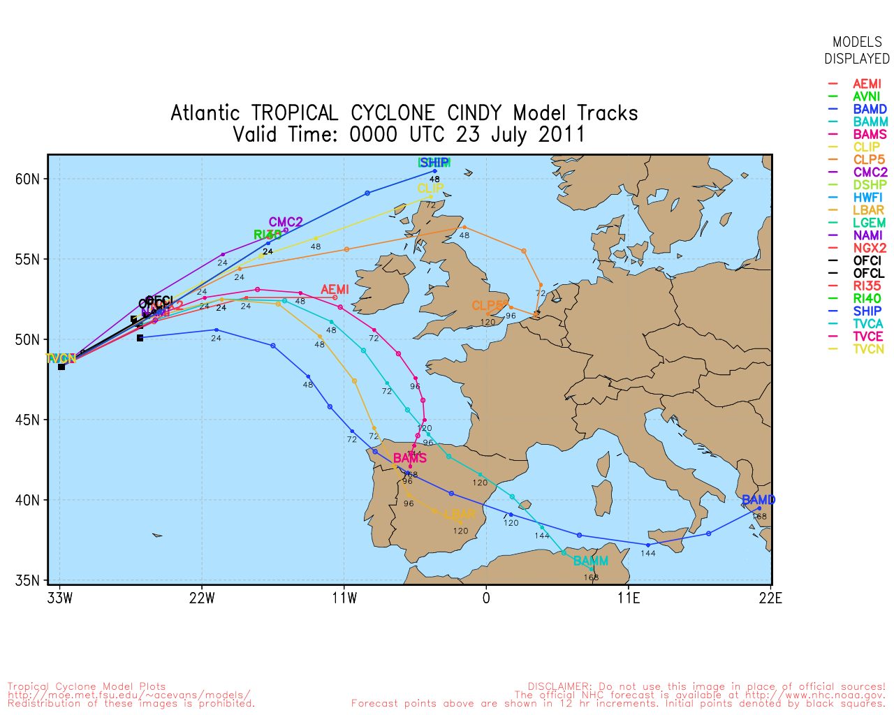
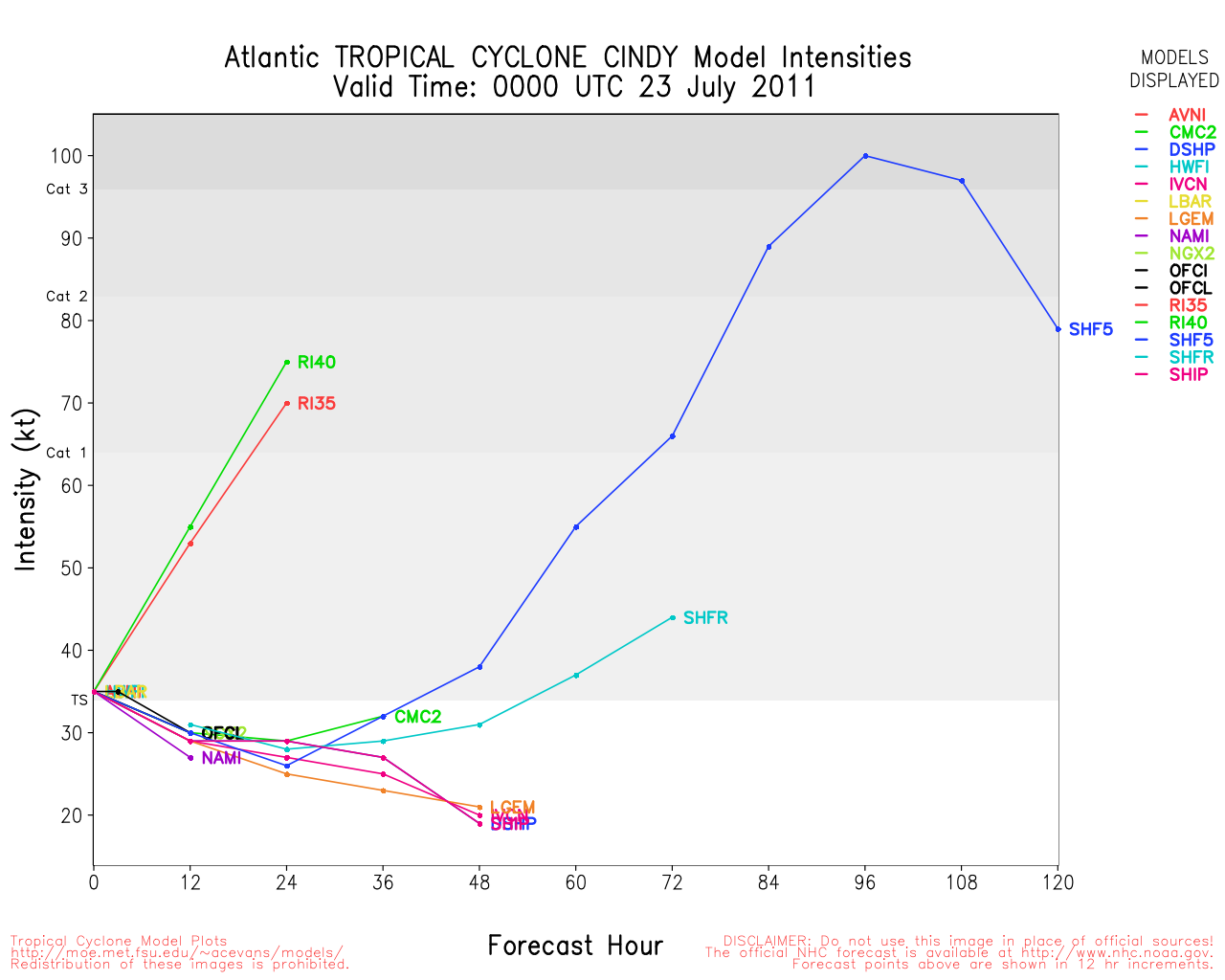
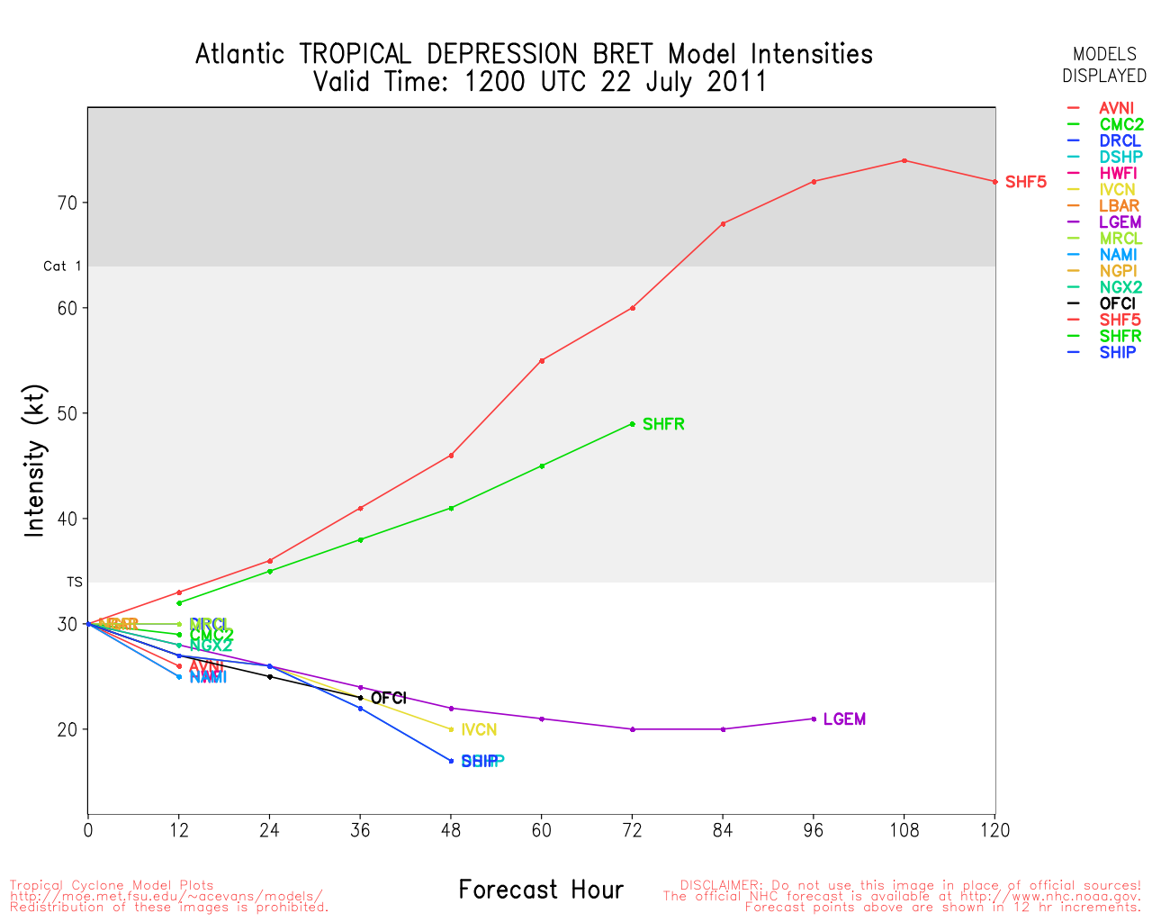
Cindy has strengthened today, but will likely stay under hurricane force before weakening.
The area in the Central Atlantic (no invest yet) also now has a 10% chance for development in the next 48 hours. Current models suggest it moving through the Caribbean or along the northern islands. Those in the Eastern Caribbean will want to watch this area over the next few days.
StormCarib Reports from the Caribbean Islands
Caribbean Weather Observations
Barbados Brohav Weather Fax
Full Caribbean Radar Composite
Caribbean Broadcast Corporation (TV/Radio from Antilles)
San Juan, PR NWS Page
Various Caribbean Radio Stations
DR1 Dominican Republic Hurricanes
4:45 PM Update
Tropical Storm Cindy has formed from invest 99L, this system is located east of Tropical Storm Bret, and is moving very quickly out to sea toward the northeast.
More on Cindy in the Storm Forum.
90L Event Related Links


SFWMD Model Plot (Animated Model Plot) SFWMD Hurricane Page
[https://flhurricane.com/floatanimator.php?year=2011&storm=4 Flhurricane Satellite Floater Animation of 90L
GOES Floater
Animated Model Plot of 90L
Clark Evans Track Model Plot of 90L
(Animated!) Model Plots in Google Earth - In Google Maps
Clark Evans Intensity Model Plot of 90L (Animated!)
Clark Evans Track Plot of 90L
Other Model Charts from Clark
Clark Evans Top 10 Analog Storms for 90L
More model runs on from RAL/Jonathan Vigh's page
NRL Info on 90L -- RAMMB Info
COD Atlantic Satellite View
Cindy Event Related Links


SFWMD Model Plot (Animated Model Plot) SFWMD Hurricane Page
[https://flhurricane.com/floatanimator.php?year=2011&storm=3 Flhurricane Satellite Floater Animation of Cindy
GOES Floater
Animated Model Plot of Cindy
Clark Evans Track Model Plot of Cindy
(Animated!) Model Plots in Google Earth - In Google Maps
Clark Evans Intensity Model Plot of Cindy (Animated!)
Clark Evans Track Plot of Cindy
Other Model Charts from Clark
Clark Evans Top 10 Analog Storms for Cindy
More model runs on from RAL/Jonathan Vigh's page
NRL Info on Cindy -- RAMMB Info
COD Atlantic Satellite View
Bret Event Related Links


SFWMD Model Plot (Animated Model Plot) SFWMD Hurricane Page
[https://flhurricane.com/floatanimator.php?year=2011&storm=2 Flhurricane Satellite Floater Animation of Bret
GOES Floater
Animated Model Plot of Bret
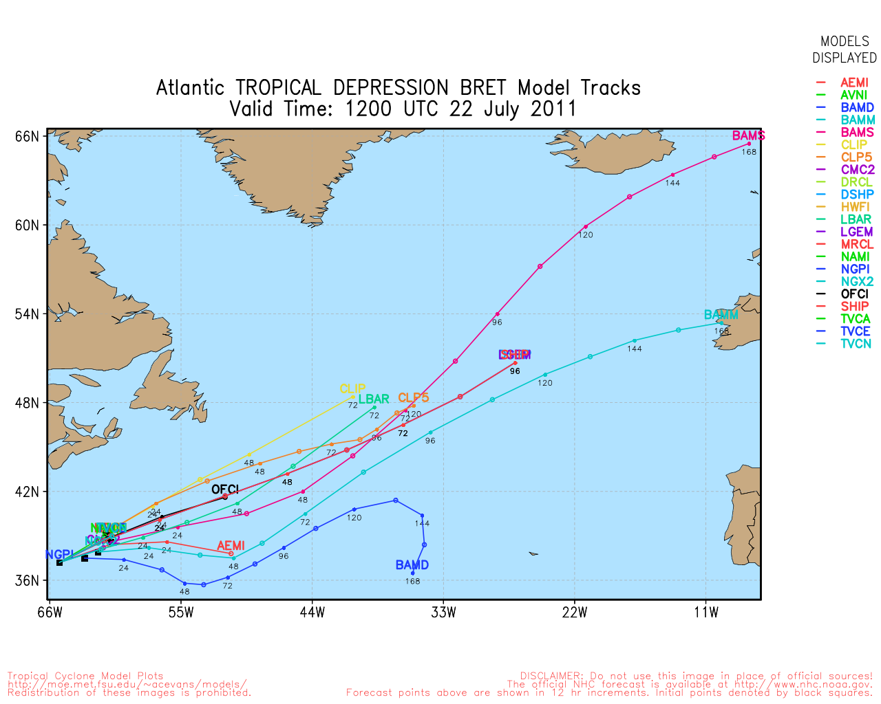
Clark Evans Track Model Plot of Bret
(Animated!) Model Plots in Google Earth - In Google Maps
Clark Evans Intensity Model Plot of Bret (Animated!)
Clark Evans Track Plot of Bret
Other Model Charts from Clark
Clark Evans Top 10 Analog Storms for Bret
More model runs on from RAL/Jonathan Vigh's page
NRL Info on Bret -- RAMMB Info
COD Atlantic Satellite View
8:30 AM Update
The wave east of Bret, 99L, is now up to a 60% chance for development and may become a tropical depression or storm later today. It will remain out to sea as well.
Original Update
Tropical Storm Bret continues to move northeast away from land, and continues to gradually weaken as it heads out to sea.
Another area, tracked as 99L, east of Bret, who also likely came from the same front that Bret did, has a 30% chance for development, it is already well out to sea and expected to remain this way.
The wave in the Central Atlantic (near 42W) continues to maintain itself, and has a slightly higher shot at becoming something that will need to be watched. It is likely to become an invest today for beginning model runs, and likely will be the one to watch over the next week or so if it continues to persist.
On this central Atlantic wave, There is nothing strongly suggesting it will move out to sea, which means it has the potential to enter the Caribbean and head generally westward through it (more likely) or move just north of it.slightly less likely, but still possible. Conditions ahead of it range from moderate to good, so there is nothing obvious to keep it from developing other than a small area of dry air ahead of it. If the wave develops it would likely be around the weekend. There is a forecast lounge for this wave already set up that gets into more speculation.
 Threaded


