Update - Saturday, August 3rd, 11AM
Aided by the warm waters of the Gulf Stream, the remnant circulation of Dorian regenerated into a Tropical Depression in the early hours of Saturday morning about 40 miles east of Melbourne, Florida. TD Dorian is now visible as a low-level swirl well to the east of Jacksonville that is moving to the northeast with most of the convection displaced to the south of the center. Strongest winds are almost at tropical storm force in the convection south through southeast of the center but a slow weakening is expected as TD Dorian continues to track off to the northeast. Dorian should become a post-tropical low later this evening and and merge with a trough on Sunday. Since no land areas are influenced by the stronger winds, a Tropical Storm Watch is not required.
ED
Original Post - Thursday, August 1st, 4PM
The remnants of Tropical Storm Dorian are once again being tracked as invest 91L, and recon is tentatively scheduled to venture out there tomorrow. It has a very small chance of redevelopment before it could get to Florida. Either way it will likely just bring some more rainfall.
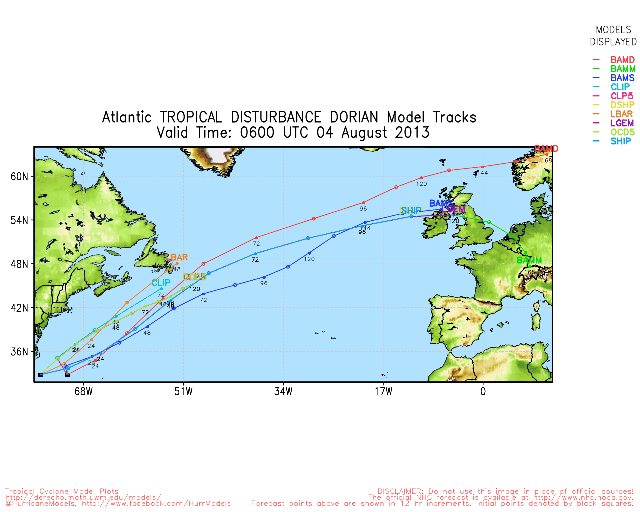
The model is the only one that brings the "center" onshore, but the majority keep it just offshore before it turns north and away.
East Florida Links
Southeast Composite Radar Loop
(Latest Static)
South to North:
Key West, FL Radar Radar Loop
(Latest Static)
Miami, FL Radar Radar Loop
(Latest Static)
Melbourne, FL Radar Radar Loop
(Latest Static)
Jacksonville, FL Radar Radar Loop
(Latest Static)
Caribbean/South East Coast Satellite Imagery
SFWMD Radar Loop of South Florida with storm Track
SFWMD Full Florida Radar Loop with Storm Track
Area Forecast Discussions:
FLorida Keys -
Miami/South Florida -
Melbourne/East Central Florida -
Jacksonville/Northeast Florida -
Tropical Depression Dorian Event Related Links


SFWMD Model Plot (Animated Model Plot) SFWMD Hurricane Page
[https://flhurricane.com/floatanimator.php?year=2013&storm=4 Flhurricane Satellite Floater Animation of Dorian
GOES Floater
Animated Model Plot of Dorian
Clark Evans Track Model Plot of Dorian
(Animated!) Model Plots in Google Earth - In Google Maps
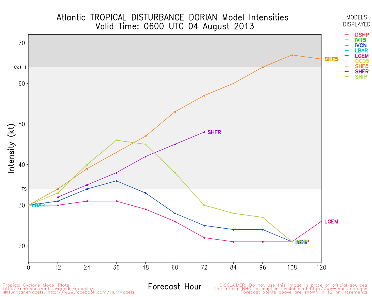
Clark Evans Intensity Model Plot of Dorian (Animated!)
Clark Evans Track Plot of Dorian
Other Model Charts from Clark
Clark Evans Top 10 Analog Storms for Dorian
More model runs on from RAL/Jonathan Vigh's page
NRL Info on Dorian -- RAMMB Info
COD Atlantic Satellite View
Edited by Ed Dunham (Sat Aug 03 2013 11:09 AM)
 Threaded


