Update - Tuesday, October 22, 2013, 8:15AM
Cloud tops over Lorenzo have warmed this morning and the cyclone has stalled. A weak but stubborn mid-level ridge is sandwiched between Lorenzo and a front to the north and the ridge currently has a stronger effect than the front on the movement of the system. Earlier yesterday some of the models suggested this slowdown while others depicted an anticyclonic loop. For the moment Lorenzo is a bit weaker and not as vertically integrated.
ED
Update - Monday, October 21, 2013, 11:45PM
Just a quick update to note that TD13 was upgraded to Tropical Storm Lorenzo at 21/21Z. At 22/03Z winds were still at 35 knots but pressure was down to 1008MB. Lorenzo still expected to move more to the east on Tuesday.
ED
Update - Monday, October 21, 2013, 11AM
Tropical Depression 13 has formed about 650 miles east southeast of Bermuda. The system is moving to the northeast at 7 knots with sustained winds of 30 knots and a central pressure of 1010MB. The cyclone has a good chance to become a minimal Tropical Storm later today or tonight. Movement will become more easterly on Tuesday with slow weakening later in the week as westerly windshear increases over the system. No land areas are threatened or expected to be threatened so no watches/warnings are needed.
ED
Original Post - Monday, October 21, 2013, 1:48AM
Invest 90L, located well to the east southeast of Bermuda, has been showing signs of improved structure and with satellite evidence of a weak low pressure center, the system has about a 50/50 chance of becoming a tropical cyclone later on Monday. Eventual movement more to the east is expected.
ED
Tropical Storm Lorenzo Event Related Links


SFWMD Model Plot (Animated Model Plot) SFWMD Hurricane Page
[https://flhurricane.com/floatanimator.php?year=2013&storm=13 Flhurricane Satellite Floater Animation of TS Lorenzo
GOES Floater
Animated Model Plot of TS Lorenzo
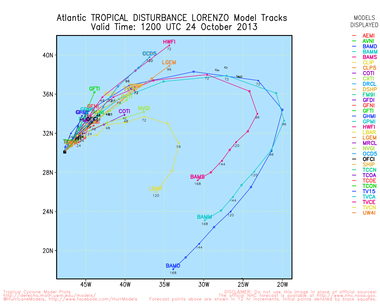
Clark Evans Track Model Plot of TS Lorenzo
(Animated!) Model Plots in Google Earth - In Google Maps
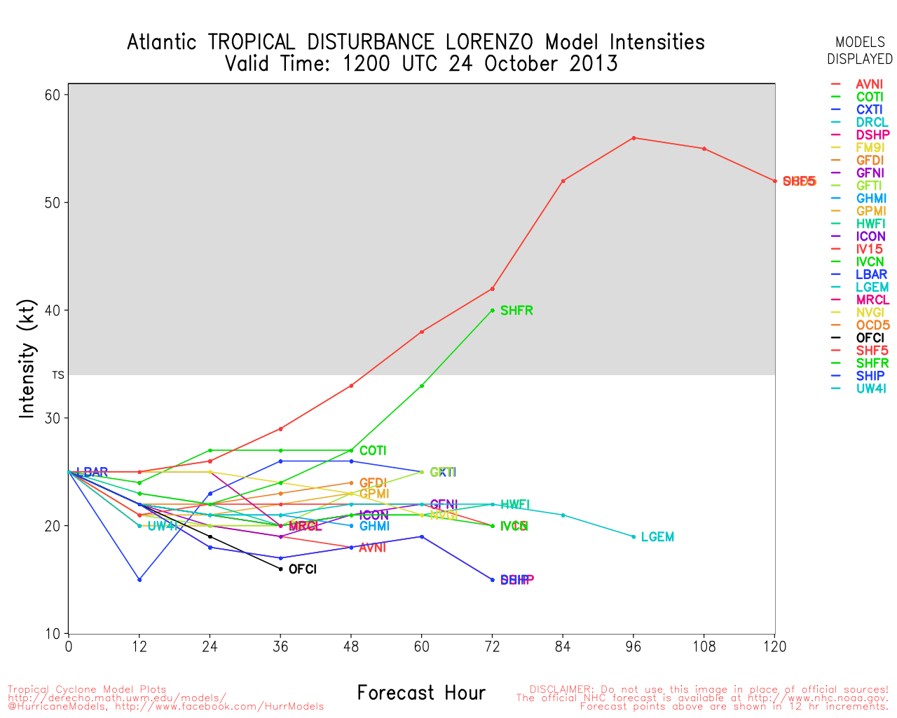
Clark Evans Intensity Model Plot of TS Lorenzo (Animated!)
Clark Evans Track Plot of TS Lorenzo
Other Model Charts from Clark
Clark Evans Top 10 Analog Storms for TS Lorenzo
More model runs on from RAL/Jonathan Vigh's page
NRL Info on TS Lorenzo -- RAMMB Info
COD Atlantic Satellite View
Edited by Ed Dunham (Tue Oct 22 2013 08:29 AM)
 Threaded


