MikeC
Admin
Reged: Sun
Posts: 4543
Loc: Orlando, FL
|
|
5:00 AM EDT Update 30 June 2014
The area east of Florida has lost much of the convection overnight so near term development (Today) seems less likely. If the circulation persists, later tomorrow or Wednesday are better possibilities. The continued southern movement along with shear is making it difficult for the convection to hang on.
Some rainfall from bands of this system will be seen today, particularly extreme coastal Brevard county south to Palm Beach County. Beach conditions may be poor in these areas, and locally heavy rainfall from these bands will probably last through mid-late this week, some of them may reach inland. Although not guaranteed, the center is expected to remain just offshore of Florida, however. This system remains something to watch over the next few days.

Let us know conditions related to this system in your area, in this Storm Forum post.
1:30 PM EDT Update 29 June 2014
The system off the southeast coast (91L - ~230 miles east of St. Augustine) is looking better structurally today, but still lacks circulation. The recon mission scheduled for today was cancelled, but there is another scheduled for tomorrow morning, if needed.

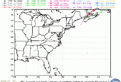
(Image from NWS Melbourne)
Along with the lack of circulation, there is dry air nearby, and general pressures are still relatively high.
So no tropical development today, it seems, but tomorrow and especially late Tuesday, if it develops, may be more likely.
Chances as of this afternoon are 60% for development in the next 48 hours, and 80% in the next 5 days. Even if it does not strengthen much, it will at the very least have impact on a lot of beaches for rip-currents and the like during the July 4th weekend.

Original Update
And area that has been over South Carolina the past few days has persisted and now is over open waters of the Atlantic, and has fairly good conditions around it for development.
It just was designated as invest 91L, so more to come soon.
The National Hurricane Center gives it a 30% chance for development in the next 48 hours, and 50% in the next 5 days, based on satellite appearance this morning, those chances may be a bit low.
The system is generally moving southeast away from land and has windspeeds around 25MPH, it's likely to remain offshore for a while.
Forecasting models have not really picked up on this system yet. But generally those along the east coast,of Florida, coastal Georgia, and the Carolinas will want to watch the progress of this system.
Aircraft recon is tentatively scheduled to fly out there tomorrow afternoon, if needed.

Event Links:
Daytona Beach Cam
Satellite Beach Cam
Melbourne Beach Cam
Orlando near Universal Cam
Port Canaveral Webcam
Long term florida radar recording (started 3:15PM 6/30/2014)
Invest 91L (Off South Carolina) Event Related Links

SFWMD Model Plot (Animated Model Plot) SFWMD Hurricane Page
[https://flhurricane.com/floatanimator.php?year=2014&storm=1 Flhurricane Satellite Floater Animation of 91L
GOES Floater
Animated Model Plot of 91L
Clark Evans Track Model Plot of 91L
(Animated!) Model Plots in Google Earth - In Google Maps
Clark Evans Intensity Model Plot of 91L (Animated!)
Clark Evans Track Plot of 91L
Other Model Charts from Clark
Clark Evans Top 10 Analog Storms for 91L
More model runs on from RAL/Jonathan Vigh's page
NRL Info on 91L -- RAMMB Info
COD Atlantic Satellite View
Southeast Composite Radar Loop
(Latest Static)
Mid-Atlantic/Carolina Links
Southeast Composite Radar Loop
(Latest Static)
Charleston, SC Radar Radar Loop
(Latest Static)
Wilmington, NC Radar Radar Loop
(Latest Static)
Morehead City, NC Radar Radar Loop
(Latest Static)
Norfolk/Wakefield, VA Radar Radar Loop
(Latest Static)
Area Forecast Discussions:
Charleston, SC -
Wilmington, NC -
Morehead City, NC -
Norfolk/Virginia Beach/Hampton Roads, VA
Power Outage Maps:
South Carolina Power Outage Map
North Carolina Power Outage Map
Virginia Power Outage Map
East Florida Links
Southeast Composite Radar Loop
(Latest Static)
South to North:
Key West, FL Radar Radar Loop
(Latest Static)
Miami, FL Radar Radar Loop
(Latest Static)
Melbourne, FL Radar Radar Loop
(Latest Static)
Jacksonville, FL Radar Radar Loop
(Latest Static)
Caribbean/South East Coast Satellite Imagery
SFWMD Radar Loop of South Florida with storm Track
SFWMD Full Florida Radar Loop with Storm Track
Area Forecast Discussions:
FLorida Keys -
Miami/South Florida -
Melbourne/East Central Florida -
Jacksonville/Northeast Florida -
|
danielw
Moderator

Reged: Wed
Posts: 3525
Loc: Hattiesburg,MS (31.3N 89.3W)
|
|
9:00 AM EDT Visible image

Interactive Global Geostationary Weather Satellite Images
|
MikeC
Admin
Reged: Sun
Posts: 4543
Loc: Orlando, FL
|
|
The recon mission scheduled for today was cancelled, but there is another scheduled for tomorrow morning, if needed.
The system has a good structure, but the circulation is very weak, and pressures are still relatively high. No development today, it seems,
|
MikeC
Admin
Reged: Sun
Posts: 4543
Loc: Orlando, FL
|
|
From NWS Melbourne
|
MikeC
Admin
Reged: Sun
Posts: 4543
Loc: Orlando, FL
|
|
The recon flight for tomorrow morning was rescheduled to 2pm.
|
Ed Dunham
Former Meteorologist & CFHC Forum Moderator (Ed Passed Away on May 14, 2017)
Reged: Sun
Posts: 2565
Loc: Melbourne, FL
|
|
Dry air from the north has been entrained into the system and it certainly has taken its toll on the convection this evening. The center, which stalled for about six hours earlier today, may have dissipated - I certainly can't locate anything at the 30/00Z position of 29.6N 77.6W. The center may be redeveloping further to the south. A new western rainband is forming and lightning can be seen to the east of Melbourne. Future development of this system (if any) is going to be a slow process. Its worth noting that the ridge has moved far enough to the east so that the influx of dry air has been shut down.
ED
|
MikeC
Admin
Reged: Sun
Posts: 4543
Loc: Orlando, FL
|
|
Recon is en route to the system now.
http://tropicalatlantic.com/recon/
contains up to date position data, and links to maps.
|
MikeC
Admin
Reged: Sun
Posts: 4543
Loc: Orlando, FL
|
|
Recon was having issue with windspeed detection, but pressures are only 1011, which is still fairly high. No immediate upgrade, but may occur later tonight or tomorrow.
Something is very off about the dewpoints being reported though. Most likely malfunctioning equipment.
It's possible that it may be upgraded to a depression at 5PM.
|
MikeC
Admin
Reged: Sun
Posts: 4543
Loc: Orlando, FL
|
|
added
Long term florida radar recording (started 3:15PM 6/30/2014)
|
MikeC
Admin
Reged: Sun
Posts: 4543
Loc: Orlando, FL
|
|
Highlighting the fact that the release a special Tropical weather outlook:
Special outlook issued to update discussion of the area of low
pressure east of Florida.
Updated: An Air Force Reserve unit reconnaissance aircraft is
investigating the area of low pressure centered about 110 miles east
of Melbourne, Florida. While the low is well defined, the
associated thunderstorm activity is just below the organizational
threshold required to initiate tropical cyclone advisories.
Environmental conditions continue to be favorable for development,
and only a slight increase in the organization and persistence of
the thunderstorm activity would result in the formation of a
tropical depression.
Data from the reconnaissance aircraft indicate that peak sustained
winds with the low are about 30-35 mph. The low is moving
southwestward at around 5 mph, but is expected to turn westward
tonight and northward by Wednesday when it will be near the east
coast of Florida. If this system becomes a tropical cyclone, a
tropical storm watch could be required for portions of the central
or northern Atlantic coast of Florida. A turn toward the northeast
near the southeastern U.S. coast is expected by Thursday.
* Formation chance through 48 hours...high...80 percent.
* Formation chance through 5 days...high...80 percent.
|
typhoon_tip
Meteorologist
Reged: Wed
Posts: 576
|
|
Concur with Ed. In fact ... I logged in to make a similar statement. Pending some form of confirmation by RECON, it does appear that the earlier perceived axis of rotation has decayed; furthermore, may be in the process of relocating S. Some "twist" does appear to be taking place in the mid-levels, and just in the very recent two hours there appears to be a subtle uptick in convection along 27th parallel.
Judging by other cloud elements in motion there still appears to be some shear impacting from the N. Be that as it may, a lot of guidance types attempt to deepen this system, taking it precariously close (though in what form remains to be seen) to the eastern seaboard from NE Florida to SE New England, depending on which guidance is used. Definitely something to keep and eye on ...
|
 Threaded


