Another wave with a 40% chance for development over the next 5 days is being watched in the east Atlantic. This wave, tracked as 94L, has quite a bit of dry air and poor conditions to traverse before entering more favorable areas. Most of the Atlantic east of the Caribbean is currently awash in generally dry conditions.
However it is approaching the start of the peak season, in mid August that runs through mid October. So it is important to watch this and any other tropical disturbances that may develop.
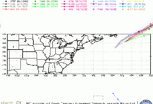
Invest 94L (East Atlantic Event Related Links

SFWMD Model Plot (Animated Model Plot) SFWMD Hurricane Page
[https://flhurricane.com/floatanimator.php?year=2014&storm=4 Flhurricane Satellite Floater Animation of 94L
GOES Floater
Animated Model Plot of 94L
Clark Evans Track Model Plot of 94L
(Animated!) Model Plots in Google Earth - In Google Maps
Clark Evans Intensity Model Plot of 94L (Animated!)
Clark Evans Track Plot of 94L
Other Model Charts from Clark
Clark Evans Top 10 Analog Storms for 94L
More model runs on from RAL/Jonathan Vigh's page
NRL Info on 94L -- RAMMB Info
COD Atlantic Satellite View
More to come later.
 Threaded


