4:00 AM CDT 2 September 2014 Update
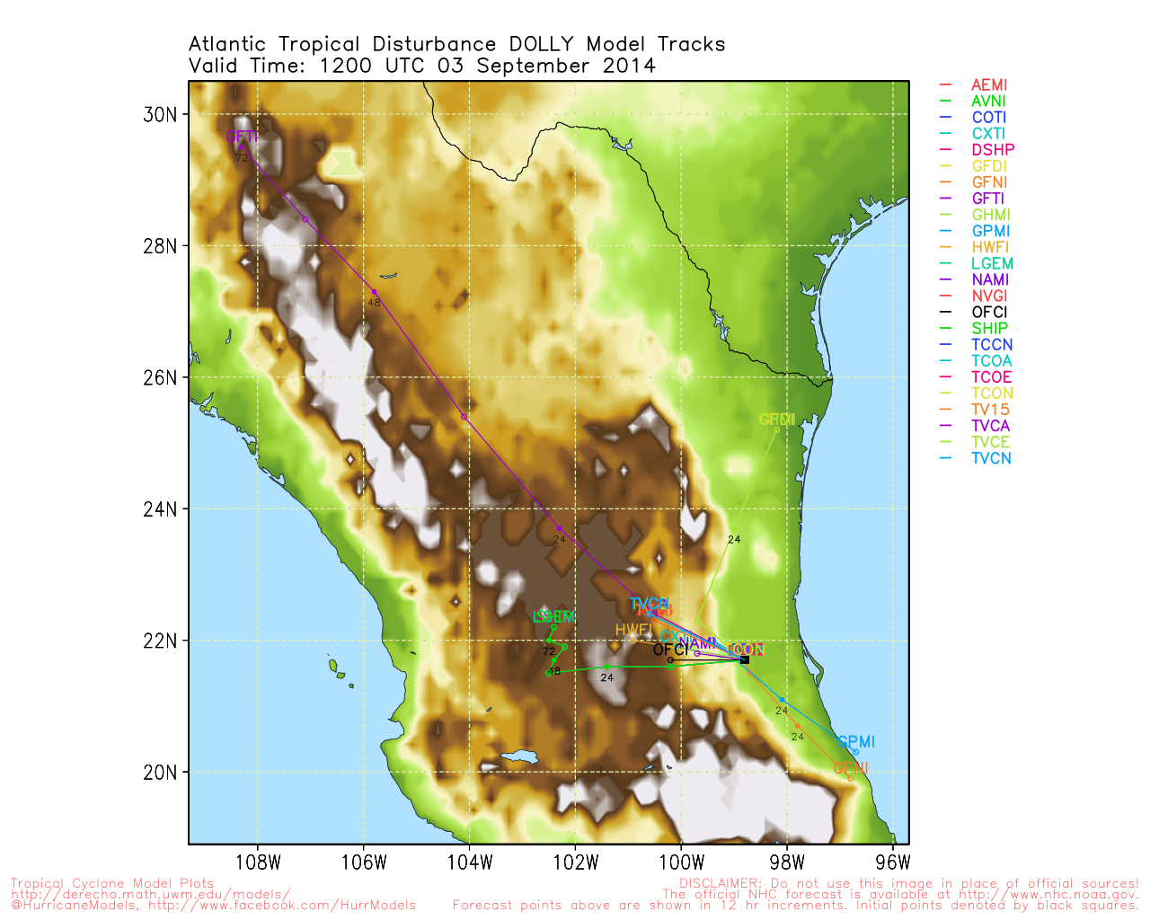
Tropical Storm Dolly (from Invest 99L) is challenging forecasts, and is now starting to put south Texas at some risk for impacts. As of this update, tropical storm force winds are occurring up to 115 miles from the center. In response, the government of Mexico has extended the tropical storm warning area northward to Barra El Mezquital.
Weather Conditions at Ciudad Victoria, Mexico
Weather Conditions at Tampico, Mexico
4:30 PM CDT 1 September 2014 Update
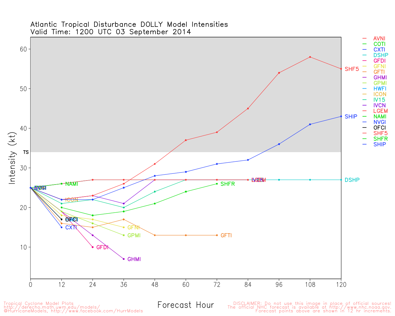
Invest 99L which made its way from the Caribbean across the Yucatan and into the extreme southwestern Gulf of Mexico has become the fifth tropical cyclone of the 2014 Atlantic Hurricane Season.
Tropical Depression Five presently consists of a well defined surface circulation with a curved band of hearty convection wrapping around to the south and east of the center, and maximum sustained winds of 30 MPH. Five is forecast to become Dolly and make landfall well south of The Texas/Mexico border around mid-week as a low-end tropical storm.
Original Update

The end of August comes with entering the climatological peak for activity in the Atlantic basin, and it appears it could be coming right on schedule with no less than five areas of disturbed weather in the Atlantic. Should any of these disturbances become better defined and/or they are issued Invest tags, we will set up individual Forecast Lounges, as warranted.
Closest to home, the broad low of old Invest 98L, which moved inland near Brownsville, Tx late yesterday, has subsumed a strong tropical surge that ran up behind it.
This merged feature is presently producing widespread tropical showers and some thunderstorms along the Gulf of Mexico from the Mexico/Texas border all the way to the west coast of Florida. Gusts of up to 50 MPH are occurring offshore, and as a westerly wind component already exists, despite the old center of 98L now being just inland, it may be wise to keep tabs on this throughout this holiday weekend, just in case. Sometimes inland centers can reform offshore, if given the chance. Either way, some on again/off again squally weather is a safe bet for much of the gulf coast today, and possibly into the rest of the weekend.
Below: Invest 98L 12:15PM CDT 8/29/2014

Texas Gulf Coast Links
[http://moe.met.fsu.edu/~mnissenbaum/radar.html Mark Nissenbaum's radar page}
East to West:
Houston/Galveston, TX Radar Radar Loop
(Latest Static)
Corpus Christi, TX Radar Radar Loop
(Latest Static)
Brownsville, TX Radar Radar Loop
(Latest Static)
Gulf of Mexico Satellite Imagery
Area Forecast Discussions:
Houston/Galveston, TX
- Corpus Christi, TX - Browsnville/South Padre Island, TX
StormCarib Reports from the Caribbean Islands
Caribbean Weather Observations
Barbados Brohav Weather Fax
Full Caribbean Radar Composite
Caribbean Broadcast Corporation (TV/Radio from Antilles)
San Juan, PR NWS Page
Various Caribbean Radio Stations
DR1 Dominican Republic Hurricanes
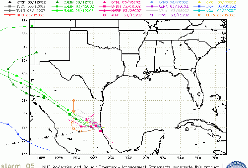
Dolly Event Related Links

SFWMD Model Plot (Animated Model Plot) SFWMD Hurricane Page
[https://flhurricane.com/floatanimator.php?year=2014&storm=5 Flhurricane Satellite Floater Animation of Dolly
GOES Floater
Animated Model Plot of Dolly
Clark Evans Track Model Plot of Dolly
(Animated!) Model Plots in Google Earth - In Google Maps
Clark Evans Intensity Model Plot of Dolly (Animated!)
Clark Evans Track Plot of Dolly
Other Model Charts from Clark
Clark Evans Top 10 Analog Storms for Dolly
More model runs on from RAL/Jonathan Vigh's page
NRL Info on Dolly -- RAMMB Info
COD Atlantic Satellite View
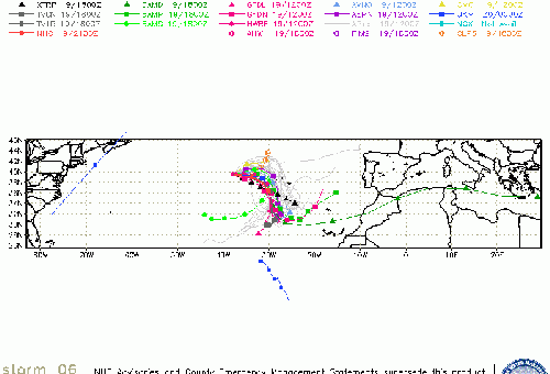
91L (East Atlantic) Event Related Links

SFWMD Model Plot (Animated Model Plot) SFWMD Hurricane Page
[https://flhurricane.com/floatanimator.php?year=2014&storm=6 Flhurricane Satellite Floater Animation of 91L
GOES Floater
Animated Model Plot of 91L
Clark Evans Track Model Plot of 91L
(Animated!) Model Plots in Google Earth - In Google Maps
Clark Evans Intensity Model Plot of 91L (Animated!)
Clark Evans Track Plot of 91L
Other Model Charts from Clark
Clark Evans Top 10 Analog Storms for 91L
More model runs on from RAL/Jonathan Vigh's page
NRL Info on 91L -- RAMMB Info
COD Atlantic Satellite View
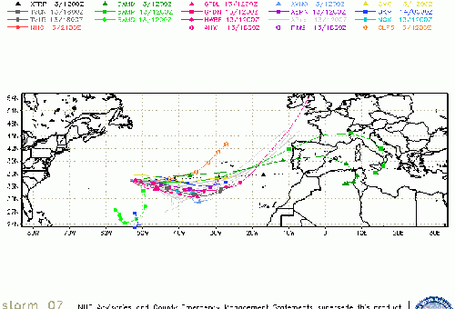
92L (Near Bahamas) Event Related Links

SFWMD Model Plot (Animated Model Plot) SFWMD Hurricane Page
[https://flhurricane.com/floatanimator.php?year=2014&storm=7 Flhurricane Satellite Floater Animation of 92L
GOES Floater
Animated Model Plot of 92L
Clark Evans Track Model Plot of 92L
(Animated!) Model Plots in Google Earth - In Google Maps
Clark Evans Intensity Model Plot of 92L (Animated!)
Clark Evans Track Plot of 92L
Other Model Charts from Clark
Clark Evans Top 10 Analog Storms for 92L
More model runs on from RAL/Jonathan Vigh's page
NRL Info on 92L -- RAMMB Info
COD Atlantic Satellite View
Edited by MikeC (Wed Sep 10 2014 05:05 PM)
 Threaded


