Today marks 10 years since the landfall of hurricane Jean, the last of the "big 4" to hit in 2004. It made landfall in the evening, only a few miles from where Hurricane made lade fall a few weeks before. Jeanne was notable for doing a large loop in the Bahamas and causing erosion and damage along the east beaches all the way up to Volusia county, The highest winds were felt in Indian river and southern Brevard county. Surge and beach erosion caused damage to structures into Volusia county, however.
One more hurricane, , would make landfall in Florida the following year before the nearly 9 year gap (and counting) we have now. Only a few tropical storms affected Florida since 2005.
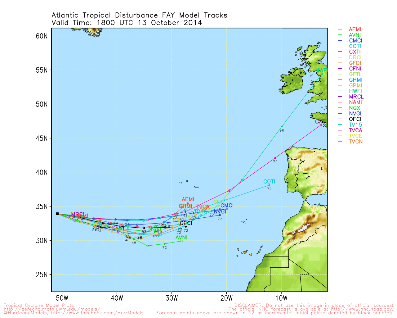
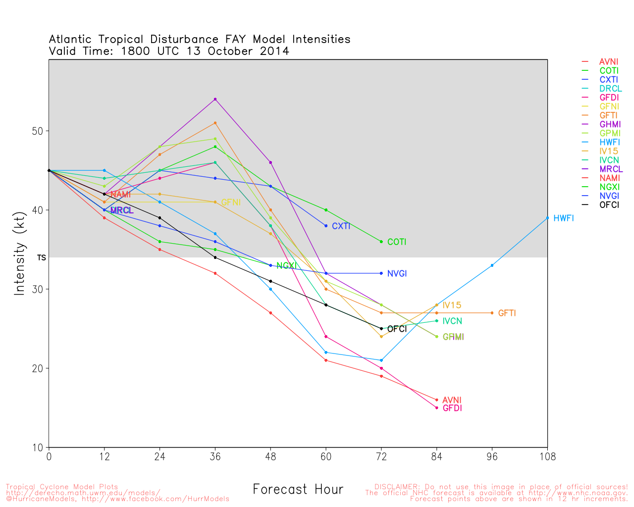
Although 96L is being tracked in the Central Atlantic, the generally hostile conditions across the Atlantic will likely keep this one from developing. "home grown" systems closer to us are the most likely place for formation at this time, and nothing is organized enough to be a threat short term. Stalled fronts have caused excessive rainfall this week in Florida, but nothing tropically significant was able to come of it.
East Florida Links
Southeast Composite Radar Loop
(Latest Static)
South to North:
Key West, FL Radar Radar Loop
(Latest Static)
Miami, FL Radar Radar Loop
(Latest Static)
Melbourne, FL Radar Radar Loop
(Latest Static)
Jacksonville, FL Radar Radar Loop
(Latest Static)
Caribbean/South East Coast Satellite Imagery
SFWMD Radar Loop of South Florida with storm Track
SFWMD Full Florida Radar Loop with Storm Track
Area Forecast Discussions:
FLorida Keys -
Miami/South Florida -
Melbourne/East Central Florida -
Jacksonville/Northeast Florida -
Subtropical Depression Seven Event Related Links

SFWMD Model Plot (Animated Model Plot) SFWMD Hurricane Page
[https://flhurricane.com/floatanimator.php?year=2014&storm=7 Flhurricane Satellite Floater Animation of SubTD7
GOES Floater
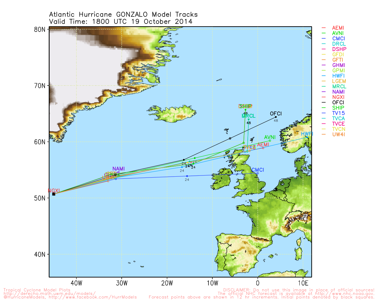
Animated Model Plot of SubTD7
Clark Evans Track Model Plot of SubTD7
(Animated!) Model Plots in Google Earth - In Google Maps
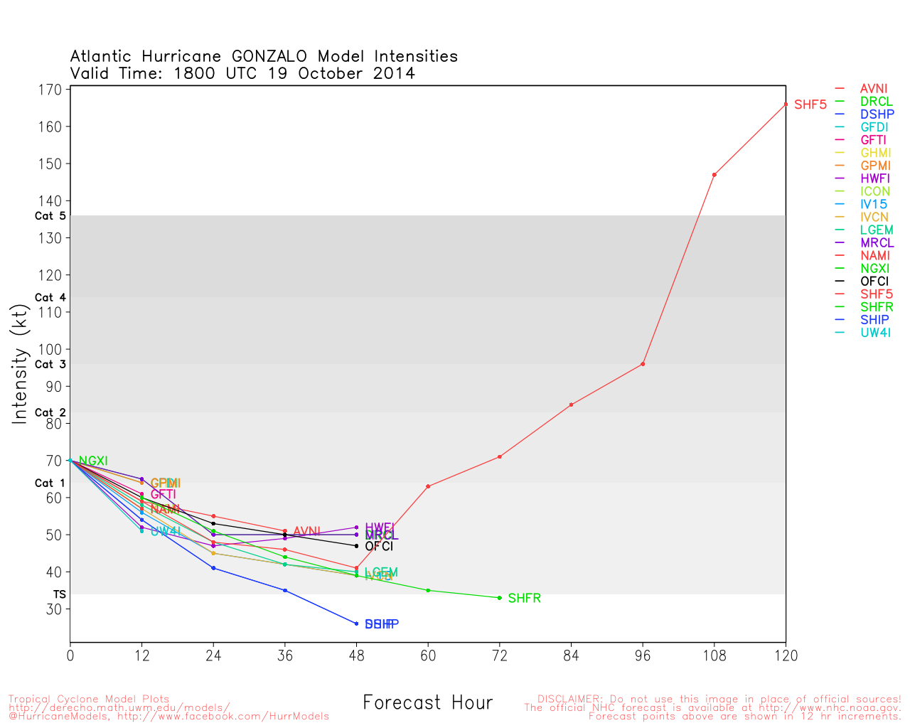
Clark Evans Intensity Model Plot of SubTD7 (Animated!)
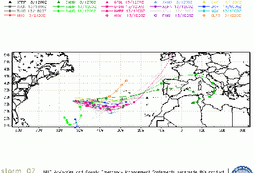
Clark Evans Track Plot of SubTD7
Other Model Charts from Clark
Clark Evans Top 10 Analog Storms for SubTD7
More model runs on from RAL/Jonathan Vigh's page
NRL Info on SubTD7 -- RAMMB Info
COD Atlantic Satellite View
90L Event Related Links

SFWMD Model Plot (Animated Model Plot) SFWMD Hurricane Page
[https://flhurricane.com/floatanimator.php?year=2014&storm=8 Flhurricane Satellite Floater Animation of 90L
GOES Floater
Animated Model Plot of 90L
Clark Evans Track Model Plot of 90L
(Animated!) Model Plots in Google Earth - In Google Maps
Clark Evans Intensity Model Plot of 90L (Animated!)
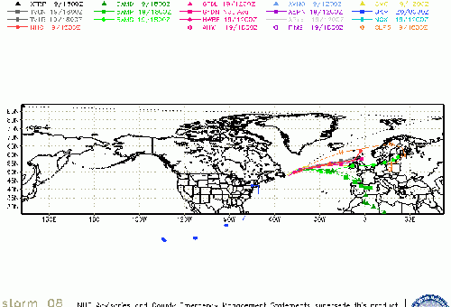
Clark Evans Track Plot of 90L
Other Model Charts from Clark
Clark Evans Top 10 Analog Storms for 90L
More model runs on from RAL/Jonathan Vigh's page
NRL Info on 90L -- RAMMB Info
COD Atlantic Satellite View
 Threaded


