2 PM EDT 30 August 2018 Update
Invest 90L in the far eastern Atlantic is now SIX and Tropical Storm Warnings have been issued for the southern Cabo Verde Islands. This is a vigorous system and interests in the islands should consider making hurricane preparations in the event the system begins really ramping up prior to exiting the area, as this is possible.
Elsewhere, a pair of waves southeast of Florida, one in the central Caribbean and another approaching the Antilles, are being monitored for potential development in the Gulf of Mexico next week.
-Ciel
8 AM EDT 29 August 2018 Update
There is a 50% Chance for development of a wave coming off Africa, however this particular system is very likely to recurve out to sea well before the Caribbean. For this mornings 8AM Tropical Weather Outlook.

Another area in around the Leeward islands in the extreme Northeastern Caribbean is being watched for potential development late this weekend into next week, but currently not on the official outlook. That one may at least bring some rain to Florida early next week.

The middle arrow area is the one to pay attention to closely into the weekend and next week for the Gulf and Florida, even though it does not look like much now.
We'll be watching and updating as things start to change in the Atlantic. See the forecast lounge for more discussions on models that are helping to signal what may happen.
Potential Six Event Related Links
SFWMD Model Plot (Animated Model Plot) SFWMD Hurricane Page
[https://flhurricane.com/floatanimator.php?year=2018&storm=6 Flhurricane Satellite Floater Animation of Six
GOES Floater
Animated Model Plot of Six
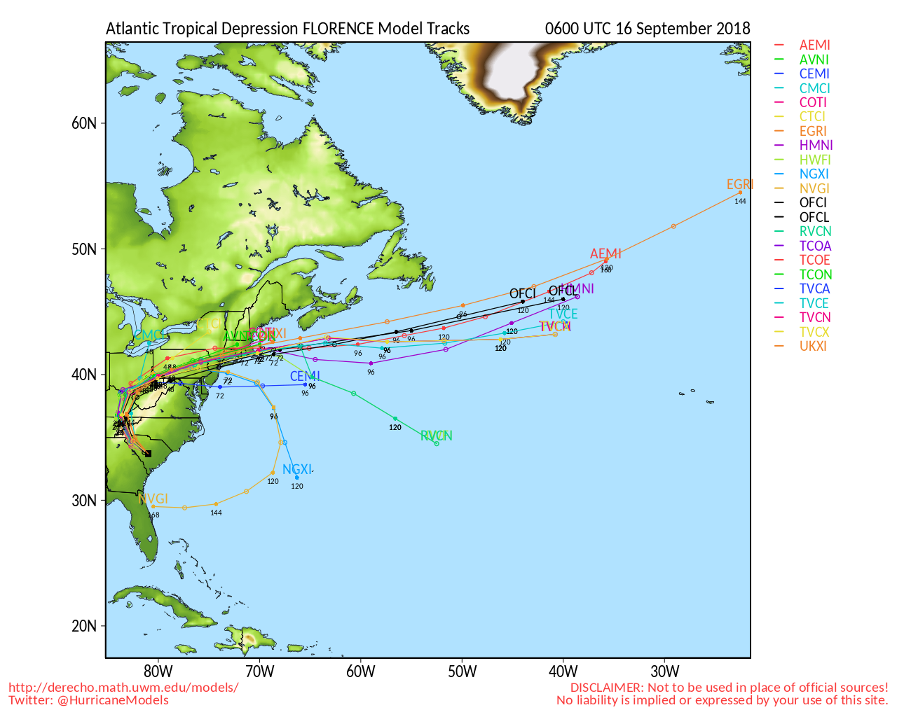
Clark Evans Track Model Plot of Six
(Animated!) Model Plots in Google Earth - In Google Maps
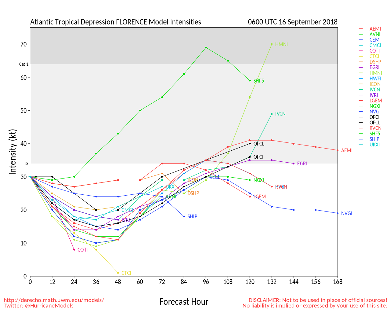
Clark Evans Intensity Model Plot of Six (Animated!)
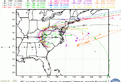
Clark Evans Track Plot of Six
Other Model Charts from Clark
Clark Evans Top 10 Analog Storms for Six
More model runs on from RAL/Jonathan Vigh's page
NRL Info on Six -- RAMMB Info
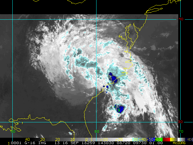
COD Atlantic Satellite View
Edited by cieldumort (Thu Aug 30 2018 02:07 PM)
 Threaded


